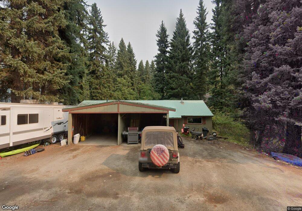
217 Forest St McCall, ID 83638
Estimated Value: $469,202 - $851,000
5
Beds
3
Baths
2,032
Sq Ft
$321/Sq Ft
Est. Value
About This Home
This home is located at 217 Forest St, McCall, ID 83638 and is currently estimated at $651,801, approximately $320 per square foot. 217 Forest St is a home located in Valley County with nearby schools including McCall-Donnelly High School, Mountain Life Education, and McCall Adventist Christian School.
Ownership History
Date
Name
Owned For
Owner Type
Purchase Details
Closed on
Aug 19, 2025
Sold by
Carolee Barrett Taylor Trust and Taylor Carolee
Bought by
Musgrove Ross and Musgrove Erin S
Current Estimated Value
Home Financials for this Owner
Home Financials are based on the most recent Mortgage that was taken out on this home.
Original Mortgage
$265,000
Outstanding Balance
$264,771
Interest Rate
6.72%
Mortgage Type
New Conventional
Estimated Equity
$387,031
Purchase Details
Closed on
Mar 20, 2012
Sold by
Taylor Carolee
Bought by
Taylor Carolee and Carolee Barrett Taylor Trust
Create a Home Valuation Report for This Property
The Home Valuation Report is an in-depth analysis detailing your home's value as well as a comparison with similar homes in the area
Home Values in the Area
Average Home Value in this Area
Purchase History
| Date | Buyer | Sale Price | Title Company |
|---|---|---|---|
| Musgrove Ross | -- | Flying S Title And Escrow Of I | |
| Taylor Carolee | -- | None Available |
Source: Public Records
Mortgage History
| Date | Status | Borrower | Loan Amount |
|---|---|---|---|
| Open | Musgrove Ross | $265,000 |
Source: Public Records
Tax History
| Year | Tax Paid | Tax Assessment Tax Assessment Total Assessment is a certain percentage of the fair market value that is determined by local assessors to be the total taxable value of land and additions on the property. | Land | Improvement |
|---|---|---|---|---|
| 2025 | $2,956 | $619,548 | $240,123 | $379,425 |
| 2023 | $2,956 | $597,917 | $252,761 | $345,156 |
| 2022 | $2,806 | $536,706 | $269,012 | $267,694 |
| 2021 | $2,831 | $350,345 | $63,279 | $287,066 |
| 2020 | $2,494 | $270,718 | $79,499 | $191,219 |
| 2019 | $2,415 | $238,814 | $66,218 | $172,596 |
| 2018 | $2,408 | $221,317 | $60,148 | $161,169 |
| 2017 | $2,472 | $213,409 | $60,148 | $153,261 |
| 2016 | $2,335 | $196,222 | $51,171 | $145,051 |
| 2015 | $2,390 | $193,339 | $0 | $0 |
| 2013 | -- | $181,895 | $0 | $0 |
Source: Public Records
Map
Nearby Homes
- 1000 Gamble Rd
- 1850 National Forest Development Road 318th
- 790 Idaho 55
- Lot 18 Compass Ln Unit 18
- Lot 12 N Loop Rd Unit 6
- Lot 3 Springer Ct Unit 3
- Lot 5 Springer Ct
- Lot 3 Springer Ct
- Lot 5 Springer Ct Unit 5
- 136 Whitetail Dr
- 101 E Lake St Unit C15
- 704 Brown Dr
- TBD N Mission St
- 508 River St
- 212 Broken Pine Ln
- 13321 Idaho 55
- Lot 1 Springer Ct
- 285 Rio Vista Blvd
- 137 Stibnite St E
- 212 Rio Vista Blvd
Your Personal Tour Guide
Ask me questions while you tour the home.