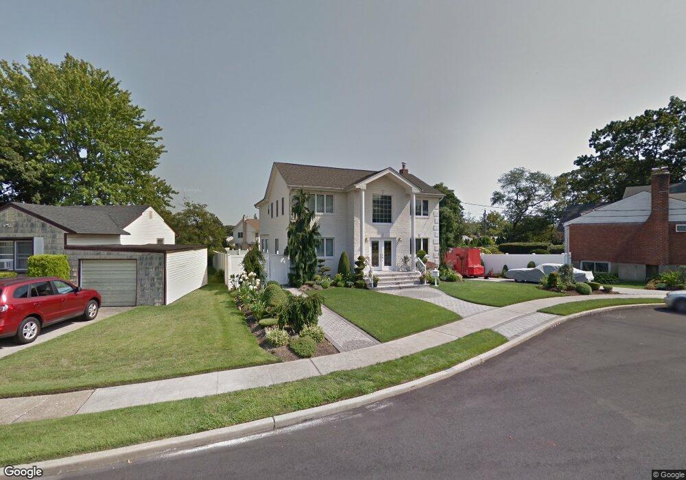
217 Guildford Ct West Hempstead, NY 11552
Estimated Value: $890,565 - $1,041,000
--
Bed
2
Baths
2,482
Sq Ft
$389/Sq Ft
Est. Value
About This Home
This home is located at 217 Guildford Ct, West Hempstead, NY 11552 and is currently estimated at $965,783, approximately $389 per square foot. 217 Guildford Ct is a home located in Nassau County with nearby schools including Hebrew Academy of Nassau County (HANC).
Ownership History
Date
Name
Owned For
Owner Type
Purchase Details
Closed on
Sep 7, 2022
Sold by
Vaccaro Vito
Bought by
Mannino Antonietta
Current Estimated Value
Purchase Details
Closed on
Dec 10, 2018
Sold by
Mannino Antonietta
Bought by
Mannino Antonietta and Vaccaro Vito
Home Financials for this Owner
Home Financials are based on the most recent Mortgage that was taken out on this home.
Original Mortgage
$515,000
Interest Rate
4.6%
Mortgage Type
New Conventional
Purchase Details
Closed on
Oct 5, 2001
Sold by
Leffer Robert M
Bought by
Iccari Antonietta
Purchase Details
Closed on
Jan 26, 1999
Create a Home Valuation Report for This Property
The Home Valuation Report is an in-depth analysis detailing your home's value as well as a comparison with similar homes in the area
Home Values in the Area
Average Home Value in this Area
Purchase History
| Date | Buyer | Sale Price | Title Company |
|---|---|---|---|
| Mannino Antonietta | -- | Your Title Experts | |
| Mannino Antonietta | -- | Chicago Title Ins Co | |
| Iccari Antonietta | $260,000 | Neil C Mascolo | |
| -- | -- | -- |
Source: Public Records
Mortgage History
| Date | Status | Borrower | Loan Amount |
|---|---|---|---|
| Previous Owner | Mannino Antonietta | $515,000 |
Source: Public Records
Tax History Compared to Growth
Tax History
| Year | Tax Paid | Tax Assessment Tax Assessment Total Assessment is a certain percentage of the fair market value that is determined by local assessors to be the total taxable value of land and additions on the property. | Land | Improvement |
|---|---|---|---|---|
| 2025 | $13,684 | $650 | $313 | $337 |
| 2024 | $6,427 | $710 | $342 | $368 |
| 2023 | $14,726 | $710 | $342 | $368 |
| 2022 | $14,726 | $710 | $342 | $368 |
| 2021 | $19,293 | $697 | $336 | $361 |
| 2020 | $15,419 | $1,038 | $620 | $418 |
| 2019 | $5,820 | $1,038 | $620 | $418 |
| 2018 | $5,518 | $1,038 | $0 | $0 |
| 2017 | $7,601 | $1,038 | $594 | $444 |
| 2016 | $12,881 | $1,084 | $507 | $577 |
| 2015 | $5,152 | $1,084 | $507 | $577 |
| 2014 | $5,152 | $1,084 | $507 | $577 |
| 2013 | $5,890 | $1,326 | $620 | $706 |
Source: Public Records
Map
Nearby Homes
- 198 Guildford Ct
- 231 Dogwood Ave
- 279 Semton Blvd
- 594 Fenworth Blvd
- 19 Richard St
- 303 Nassau Blvd
- 149 Rule St
- 576 Western Park Dr
- 474 Roy St
- 350 Paul Place
- 249 Grange St
- 126 Oakland Ave
- 56 Fendale St
- 537 Madison Ave
- 676 Sobo Ave
- 144 Rintin St
- 190 Commonwealth St
- 757 Marion St
- 590 Langley Ave
- 613 Adams Ave
- 211 Guildford Ct
- 584 David St
- 581 Roy St
- 229 Guildford Ct
- 580 David St
- 577 Roy St
- 210 Guildford Ct
- 216 Guildford Ct
- 216 Guildford Ct
- 588 David St
- 204 Guildford Ct
- 235 Guildford Ct
- 576 David St
- 222 Guildford Ct
- 224 Guildford Ct
- 594 David St
- 571 Roy St
- 219 Dogwood Ave
- 239 Guildford Ct
- 228 Guildford Ct