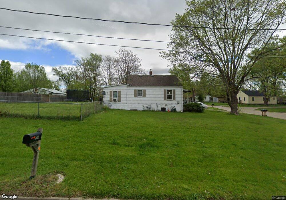
217 Herold Ave Des Moines, IA 50315
Watrous Heights NeighborhoodEstimated Value: $137,783 - $159,000
2
Beds
1
Bath
676
Sq Ft
$218/Sq Ft
Est. Value
About This Home
This home is located at 217 Herold Ave, Des Moines, IA 50315 and is currently estimated at $147,196, approximately $217 per square foot. 217 Herold Ave is a home located in Polk County with nearby schools including South Union Elementary School, Brody Middle School, and Lincoln High School.
Ownership History
Date
Name
Owned For
Owner Type
Purchase Details
Closed on
Sep 21, 2000
Sold by
Andreini Gilbert J and Andreini Jerrine J
Bought by
Jer Ela Properties
Current Estimated Value
Purchase Details
Closed on
Apr 26, 2000
Sold by
The Chase Manhattan Bank
Bought by
Andreini Gilbert J
Purchase Details
Closed on
May 27, 1997
Sold by
Burkett Carrie C
Bought by
Lovell Lawrence K
Home Financials for this Owner
Home Financials are based on the most recent Mortgage that was taken out on this home.
Original Mortgage
$34,400
Interest Rate
8.01%
Create a Home Valuation Report for This Property
The Home Valuation Report is an in-depth analysis detailing your home's value as well as a comparison with similar homes in the area
Home Values in the Area
Average Home Value in this Area
Purchase History
| Date | Buyer | Sale Price | Title Company |
|---|---|---|---|
| Jer Ela Properties | -- | -- | |
| Andreini Gilbert J | $25,500 | -- | |
| Lovell Lawrence K | $42,000 | -- |
Source: Public Records
Mortgage History
| Date | Status | Borrower | Loan Amount |
|---|---|---|---|
| Previous Owner | Lovell Lawrence K | $34,400 |
Source: Public Records
Tax History Compared to Growth
Tax History
| Year | Tax Paid | Tax Assessment Tax Assessment Total Assessment is a certain percentage of the fair market value that is determined by local assessors to be the total taxable value of land and additions on the property. | Land | Improvement |
|---|---|---|---|---|
| 2025 | $2,118 | $121,400 | $34,900 | $86,500 |
| 2024 | $2,118 | $107,700 | $30,600 | $77,100 |
| 2023 | $2,050 | $107,700 | $30,600 | $77,100 |
| 2022 | $2,034 | $87,000 | $25,100 | $61,900 |
| 2021 | $1,914 | $87,000 | $25,100 | $61,900 |
| 2020 | $2,236 | $76,700 | $22,100 | $54,600 |
| 2019 | $1,858 | $76,700 | $22,100 | $54,600 |
| 2018 | $1,838 | $69,100 | $19,400 | $49,700 |
| 2017 | $1,726 | $69,100 | $19,400 | $49,700 |
| 2016 | $1,682 | $63,800 | $17,700 | $46,100 |
| 2015 | $1,682 | $63,800 | $17,700 | $46,100 |
| 2014 | $1,732 | $65,200 | $17,600 | $47,600 |
Source: Public Records
Map
Nearby Homes
- 304 Herold Ave
- 212 Titus Ave
- 515 Emma Ave
- 612 Emma Ave
- 518 Maxwelton Dr
- 299 Hackley Ave
- 520 Hackley Ave
- 108 E Philip St
- 126 E Maxwelton Dr
- 209 E Philip St
- 311 E Emma Ave
- . Herold Ave
- 936 Mckinley Ave Unit 14
- 930 Emma Ave
- 4316 SE 4th St
- 3822 SW 2nd St
- 5501 S Union St
- 409 Wilmers Ave
- 118 E Watrous Ave
- 303 Porter Ave
- 4607 SW 3rd St
- 4605 SW 3rd St
- 211 Herold Ave
- 4612 SW 3rd St
- 214 Herold Ave
- 218 Herold Ave
- 4608 SW 3rd St
- 212 Herold Ave
- 4616 SW 2nd St
- 300 Herold Ave
- 4604 SW 2nd St
- 4604 SW 3rd St
- 4517 SW 3rd St
- 4600 SW 3rd St
- 4513 SW 3rd St
- 4516 SW 3rd St
- 4704 SW 2nd St
- 4607 SW 2nd St
- 4516 SW 2nd St
- 215 Mckinley Ave