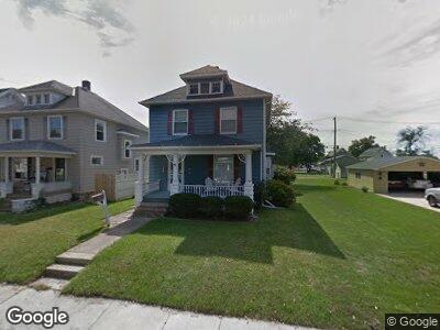
217 Hudson St Tiffin, OH 44883
Estimated Value: $105,000 - $136,000
3
Beds
1
Bath
1,360
Sq Ft
$85/Sq Ft
Est. Value
About This Home
This home is located at 217 Hudson St, Tiffin, OH 44883 and is currently estimated at $115,719, approximately $85 per square foot. 217 Hudson St is a home located in Seneca County with nearby schools including Columbian High School, Calvert Catholic Schools, and Calvert High School.
Ownership History
Date
Name
Owned For
Owner Type
Purchase Details
Closed on
Dec 21, 2016
Sold by
Phoenix Investments Ltd
Bought by
Mccaulla Properties Llc
Current Estimated Value
Purchase Details
Closed on
Apr 16, 2015
Sold by
Harple C William and Harple Denise M
Bought by
Phoenix Investments Ltd
Purchase Details
Closed on
Mar 4, 2015
Sold by
Harple Thomas A
Bought by
Harple C Williams
Purchase Details
Closed on
Jul 10, 2000
Sold by
Perna Frank A and Perna Malinda S
Bought by
Harple Thomas A
Create a Home Valuation Report for This Property
The Home Valuation Report is an in-depth analysis detailing your home's value as well as a comparison with similar homes in the area
Home Values in the Area
Average Home Value in this Area
Purchase History
| Date | Buyer | Sale Price | Title Company |
|---|---|---|---|
| Mccaulla Properties Llc | $45,400 | Legacy Title | |
| Phoenix Investments Ltd | -- | Attorney | |
| Harple C Williams | $55,000 | Attorney | |
| Harple Thomas A | $85,500 | -- |
Source: Public Records
Mortgage History
| Date | Status | Borrower | Loan Amount |
|---|---|---|---|
| Previous Owner | Harple Thomas A | $75,000 |
Source: Public Records
Tax History Compared to Growth
Tax History
| Year | Tax Paid | Tax Assessment Tax Assessment Total Assessment is a certain percentage of the fair market value that is determined by local assessors to be the total taxable value of land and additions on the property. | Land | Improvement |
|---|---|---|---|---|
| 2024 | $1,057 | $30,530 | $4,200 | $26,330 |
| 2023 | $1,057 | $30,530 | $4,200 | $26,330 |
| 2022 | $818 | $19,610 | $3,370 | $16,240 |
| 2021 | $824 | $19,610 | $3,370 | $16,240 |
| 2020 | $839 | $19,608 | $3,371 | $16,237 |
| 2019 | $843 | $19,047 | $3,360 | $15,687 |
| 2018 | $845 | $19,047 | $3,360 | $15,687 |
| 2017 | $922 | $19,047 | $3,360 | $15,687 |
| 2016 | $999 | $22,835 | $3,294 | $19,541 |
| 2015 | $1,868 | $22,870 | $3,294 | $19,576 |
| 2014 | $1,820 | $22,870 | $3,294 | $19,576 |
| 2013 | $2,038 | $23,324 | $3,360 | $19,964 |
Source: Public Records
Map
Nearby Homes
- 215 Hudson St
- 211 Hall St
- 52 Hall St
- 50 Clay St
- 27 Boehler St
- 2695 Ohio 18
- 0 Miami St Unit 20242094
- 0 Miami St Unit 20242078
- 0 Miami St Unit Parcel 2 6116475
- 0 Miami St Unit Parcel 3 6116497
- 83 Kensington Ave
- 23 E Perry St
- 81 Melissa St
- 0 Township Road 198a Unit 20242098
- 0 Township Road 198a Unit Parcel 4
- 406 Water St
- 64 Saint Clair St
- 140 E Davis St
- 61 Douglas St
- 314 S Sandusky St