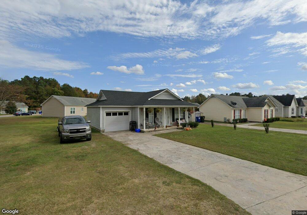
217 Katie Dr Rocky Mount, NC 27803
Estimated Value: $166,000 - $185,000
3
Beds
2
Baths
1,028
Sq Ft
$169/Sq Ft
Est. Value
About This Home
This home is located at 217 Katie Dr, Rocky Mount, NC 27803 and is currently estimated at $173,897, approximately $169 per square foot. 217 Katie Dr is a home with nearby schools including G.W. Bulluck Elementary School, West Edgecombe Middle School, and Southwest Edgecombe High School.
Ownership History
Date
Name
Owned For
Owner Type
Purchase Details
Closed on
Oct 3, 2025
Sold by
Gill Jason B
Bought by
Gill Jason B and Harvey Wanetta
Current Estimated Value
Home Financials for this Owner
Home Financials are based on the most recent Mortgage that was taken out on this home.
Original Mortgage
$124,875
Interest Rate
6.74%
Mortgage Type
New Conventional
Purchase Details
Closed on
Aug 20, 2025
Sold by
Sanders Monica
Bought by
Gill Jason B
Home Financials for this Owner
Home Financials are based on the most recent Mortgage that was taken out on this home.
Original Mortgage
$124,875
Interest Rate
6.74%
Mortgage Type
New Conventional
Purchase Details
Closed on
Jul 30, 2007
Sold by
Banko New York Co
Bought by
Sanders Monica
Home Financials for this Owner
Home Financials are based on the most recent Mortgage that was taken out on this home.
Original Mortgage
$52,200
Interest Rate
6.56%
Mortgage Type
New Conventional
Purchase Details
Closed on
Mar 8, 2007
Sold by
Smith Williw Earl and Smith Margaret
Bought by
Bank Of New York Trust Co
Purchase Details
Closed on
Nov 15, 2005
Sold by
Mills Erader and Mills Yvonne P
Bought by
Smith Willie and Smith Margaret
Home Financials for this Owner
Home Financials are based on the most recent Mortgage that was taken out on this home.
Original Mortgage
$84,481
Interest Rate
9.19%
Mortgage Type
Adjustable Rate Mortgage/ARM
Create a Home Valuation Report for This Property
The Home Valuation Report is an in-depth analysis detailing your home's value as well as a comparison with similar homes in the area
Home Values in the Area
Average Home Value in this Area
Purchase History
| Date | Buyer | Sale Price | Title Company |
|---|---|---|---|
| Gill Jason B | -- | None Listed On Document | |
| Gill Jason B | $166,500 | None Listed On Document | |
| Sanders Monica | $58,000 | None Available | |
| Bank Of New York Trust Co | $60,000 | None Available | |
| Smith Willie | $99,500 | None Available |
Source: Public Records
Mortgage History
| Date | Status | Borrower | Loan Amount |
|---|---|---|---|
| Previous Owner | Gill Jason B | $124,875 | |
| Previous Owner | Sanders Monica | $52,200 | |
| Previous Owner | Smith Willie | $84,481 | |
| Previous Owner | Smith Willie | $14,900 |
Source: Public Records
Tax History Compared to Growth
Tax History
| Year | Tax Paid | Tax Assessment Tax Assessment Total Assessment is a certain percentage of the fair market value that is determined by local assessors to be the total taxable value of land and additions on the property. | Land | Improvement |
|---|---|---|---|---|
| 2024 | $2,292 | $0 | $0 | $0 |
| 2023 | $1,339 | $0 | $0 | $0 |
| 2022 | $1,170 | $0 | $0 | $0 |
| 2021 | $1,170 | $0 | $0 | $0 |
| 2020 | $1,082 | $0 | $0 | $0 |
| 2019 | $1,082 | $0 | $0 | $0 |
| 2018 | $1,082 | $0 | $0 | $0 |
| 2017 | $108,205 | $0 | $0 | $0 |
| 2016 | $1,656 | $0 | $0 | $0 |
| 2015 | $165,602 | $0 | $0 | $0 |
| 2014 | $159,909 | $0 | $0 | $0 |
Source: Public Records
Map
Nearby Homes
- 216 Katie Dr
- 9007 Brookfield Dr
- 9015 Brookfield Dr
- E Main St
- 709 Queen St
- 4040 S Hathaway Blvd
- 404 Hilltop Dr
- 406 Hilltop Dr
- 8833 Town Creek Rd
- 604 Speight Dr
- 625 Speight Dr
- 117 Holly Dr
- 804 Mill Branch Rd
- 605 Judge St
- 2808 S Wesleyan Blvd
- 00 Town Creek
- 75 Harper Farm Ln
- 8804 Mill Branch Rd
- 5014 Davis Rd
- 4001 Arlington St