Estimated Value: $137,000 - $196,000
2
Beds
1
Bath
720
Sq Ft
$239/Sq Ft
Est. Value
About This Home
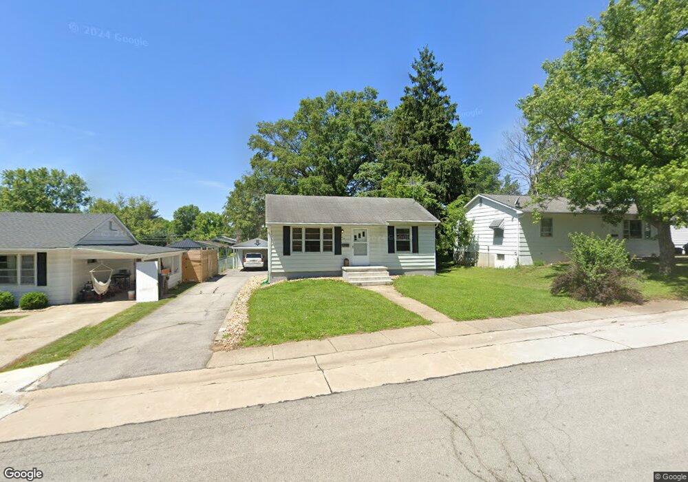
This home is located at 217 Kuhne Blvd, Troy, MO 63379 and is currently estimated at $172,048, approximately $238 per square foot. 217 Kuhne Blvd is a home located in Lincoln County with nearby schools including Main Street Elementary School, Troy Middle School, and Troy Buchanan High School.
Ownership History
Date
Name
Owned For
Owner Type
Purchase Details
Closed on
May 20, 2021
Sold by
Brush Bailey J
Bought by
Bhogapurapu Hari Jagadeesh Kumar and Bhogapurapu Elizabeth Ann
Current Estimated Value
Purchase Details
Closed on
Aug 16, 2019
Sold by
Dolde Mary A and Dolde Ronald J
Bought by
Brush Bailey J
Home Financials for this Owner
Home Financials are based on the most recent Mortgage that was taken out on this home.
Original Mortgage
$34,500
Interest Rate
3.2%
Mortgage Type
Commercial
Purchase Details
Closed on
Jan 14, 2013
Sold by
Bailey Raymond E
Bought by
Dolde Mary A and Bailey Raymond R
Create a Home Valuation Report for This Property
The Home Valuation Report is an in-depth analysis detailing your home's value as well as a comparison with similar homes in the area
Home Values in the Area
Average Home Value in this Area
Purchase History
| Date | Buyer | Sale Price | Title Company |
|---|---|---|---|
| Bhogapurapu Hari Jagadeesh Kumar | -- | Title Partners Agency Llc | |
| Brush Bailey J | -- | None Available | |
| Dolde Mary A | -- | None Available |
Source: Public Records
Mortgage History
| Date | Status | Borrower | Loan Amount |
|---|---|---|---|
| Previous Owner | Brush Bailey J | $34,500 |
Source: Public Records
Tax History
| Year | Tax Paid | Tax Assessment Tax Assessment Total Assessment is a certain percentage of the fair market value that is determined by local assessors to be the total taxable value of land and additions on the property. | Land | Improvement |
|---|---|---|---|---|
| 2025 | $842 | $13,406 | $1,520 | $11,886 |
| 2024 | $794 | $12,396 | $1,045 | $11,351 |
| 2023 | $789 | $12,396 | $1,045 | $11,351 |
| 2022 | $753 | $11,776 | $1,045 | $10,731 |
| 2021 | $757 | $61,980 | $0 | $0 |
| 2020 | $667 | $54,540 | $0 | $0 |
| 2019 | $668 | $54,540 | $0 | $0 |
| 2018 | $692 | $10,612 | $0 | $0 |
| 2017 | $694 | $10,612 | $0 | $0 |
| 2016 | $635 | $9,451 | $0 | $0 |
| 2015 | $637 | $9,451 | $0 | $0 |
| 2014 | $645 | $9,559 | $0 | $0 |
| 2013 | -- | $9,559 | $0 | $0 |
Source: Public Records
Map
Nearby Homes
- 218 John St
- 340 Kemper St
- 971 Boone St
- 904 2nd St
- 1091 Boone St
- 151 Colonial Ln
- 701 Cap Au Gris St
- N Lincoln Dr ( 52+ - Acres)
- 0 Penn Unit 16017625
- 896 E Cherry St
- 0 Merlin Dr Unit xx 21006708
- 0 Turnbull Trail (1-3+ - Acres)
- 0 Turnbull Trail (4-7+ - Acres)
- 2489 Oak Forest Dr
- 105 Hickory Dr
- 158 Hickory Dr
- 0 Mac Unit MIS26002263
- 996 Huntington Dr
- 473 N Lincoln Dr
- 0 S 3rd St Unit MAR23052580