Estimated Value: $346,000 - $499,000
3
Beds
2
Baths
1,619
Sq Ft
$262/Sq Ft
Est. Value
About This Home
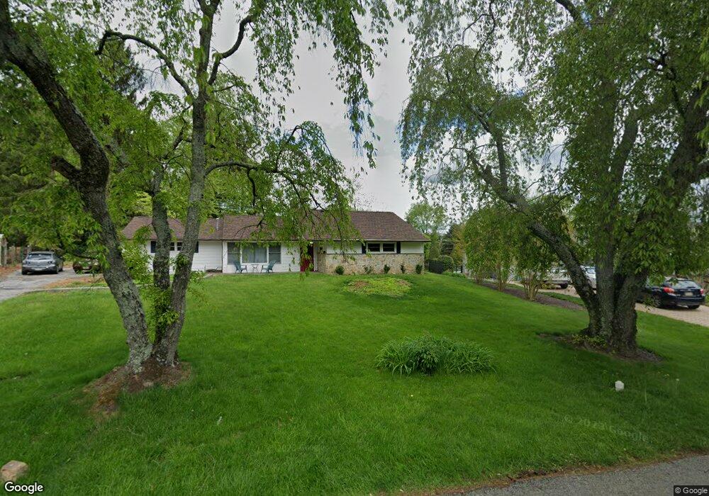
This home is located at 217 Locust Ln, Exton, PA 19341 and is currently estimated at $424,696, approximately $262 per square foot. 217 Locust Ln is a home located in Chester County with nearby schools including Exton Elementary School, J.R. Fugett Middle School, and West Chester East High School.
Ownership History
Date
Name
Owned For
Owner Type
Purchase Details
Closed on
Nov 23, 2021
Sold by
Norton Paul and Norton Leslie C
Bought by
Norton Ryan A
Current Estimated Value
Home Financials for this Owner
Home Financials are based on the most recent Mortgage that was taken out on this home.
Original Mortgage
$262,000
Outstanding Balance
$240,574
Interest Rate
3.14%
Mortgage Type
Seller Take Back
Estimated Equity
$184,122
Purchase Details
Closed on
Aug 13, 2020
Sold by
Pierce Ellen D
Bought by
Norton Paul and Norton Leslie C
Purchase Details
Closed on
Jan 13, 2010
Sold by
Morley George M
Bought by
Pierce Ellen D
Create a Home Valuation Report for This Property
The Home Valuation Report is an in-depth analysis detailing your home's value as well as a comparison with similar homes in the area
Home Values in the Area
Average Home Value in this Area
Purchase History
| Date | Buyer | Sale Price | Title Company |
|---|---|---|---|
| Norton Ryan A | -- | Industrial Valley Abstract C | |
| Norton Paul | $202,500 | Philadelphia Abstract Co | |
| Pierce Ellen D | -- | None Available |
Source: Public Records
Mortgage History
| Date | Status | Borrower | Loan Amount |
|---|---|---|---|
| Open | Norton Ryan A | $262,000 |
Source: Public Records
Tax History
| Year | Tax Paid | Tax Assessment Tax Assessment Total Assessment is a certain percentage of the fair market value that is determined by local assessors to be the total taxable value of land and additions on the property. | Land | Improvement |
|---|---|---|---|---|
| 2025 | $3,643 | $125,670 | $43,730 | $81,940 |
| 2024 | $3,643 | $125,670 | $43,730 | $81,940 |
| 2023 | $3,481 | $125,670 | $43,730 | $81,940 |
| 2022 | $3,434 | $125,670 | $43,730 | $81,940 |
| 2021 | $3,384 | $125,670 | $43,730 | $81,940 |
| 2020 | $3,361 | $125,670 | $43,730 | $81,940 |
| 2019 | $3,313 | $125,670 | $43,730 | $81,940 |
| 2018 | $3,239 | $125,670 | $43,730 | $81,940 |
| 2017 | $3,165 | $125,670 | $43,730 | $81,940 |
| 2016 | $2,666 | $125,670 | $43,730 | $81,940 |
| 2015 | $2,666 | $125,670 | $43,730 | $81,940 |
| 2014 | $2,666 | $125,670 | $43,730 | $81,940 |
Source: Public Records
Map
Nearby Homes
- 300 Bell Ct
- 167 Brazier Ln
- 226 Red Leaf Ln
- 233 Coffman Dr
- 218 Hendricks Ave
- 217 Namar Ave
- 720 Brainerd Rd
- 212 Cambridge Chase Unit 13
- 596 Coach Hill Ct Unit C
- 603 Coach Hill Ct Unit B
- 1406 Timber Mill Ln
- 1 Timber Mill Ln Unit SARTO
- 5 Timber Mill Ln Unit BISCOTTO
- 3 Timber Mill Ln Unit SILENZIO
- 2 Timber Mill Ln Unit SERENO
- 560 Astor Square Unit 6
- 542 Astor Square Unit 24J
- 143 Birchwood Dr
- 430 Carmarthen Ct
- 304 Huntington Ct Unit 62
- 219 Locust Ln
- 215 Locust Ln
- 221 Locust Ln
- 213 Locust Ln
- 216 Locust Ln
- 516 E Swedesford Rd
- 518 E Swedesford Rd
- 600 E Swedesford Rd
- 514 E Swedesford Rd
- 512 E Swedesford Rd
- 223 Locust Ln
- 521 Heather Rd
- 516 Brookview Rd
- 211 Locust Ln
- 225 Locust Ln
- 519 Heather Rd
- 514 Brookview Rd
- 520 Heather Rd
- 222 Locust Ln
- 209 Locust Ln
Your Personal Tour Guide
Ask me questions while you tour the home.