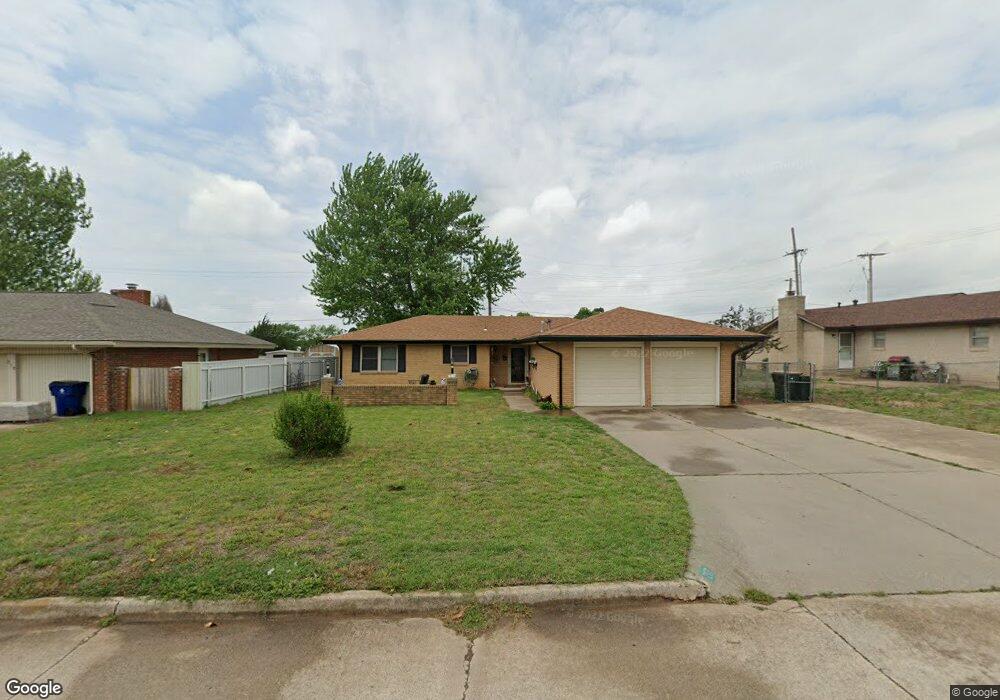
217 N 31st St Duncan, OK 73533
Estimated Value: $138,000 - $155,000
3
Beds
2
Baths
1,196
Sq Ft
$121/Sq Ft
Est. Value
About This Home
This home is located at 217 N 31st St, Duncan, OK 73533 and is currently estimated at $144,943, approximately $121 per square foot. 217 N 31st St is a home located in Stephens County with nearby schools including Mark Twain Elementary School, Duncan Middle School, and Duncan High School.
Ownership History
Date
Name
Owned For
Owner Type
Purchase Details
Closed on
May 29, 2013
Sold by
Jewell Harold C and Jewell Harold Cy
Bought by
Jewell Harold C and Jewell Juanita
Current Estimated Value
Purchase Details
Closed on
Sep 8, 2008
Sold by
Johnson Angelia L and Johnson Lynn Dale
Bought by
Salazar Israel
Home Financials for this Owner
Home Financials are based on the most recent Mortgage that was taken out on this home.
Original Mortgage
$87,840
Interest Rate
6.46%
Mortgage Type
FHA
Purchase Details
Closed on
May 22, 1998
Sold by
Robertson James A
Create a Home Valuation Report for This Property
The Home Valuation Report is an in-depth analysis detailing your home's value as well as a comparison with similar homes in the area
Home Values in the Area
Average Home Value in this Area
Purchase History
| Date | Buyer | Sale Price | Title Company |
|---|---|---|---|
| Jewell Harold C | -- | None Available | |
| Salazar Israel | $89,000 | None Available | |
| -- | $49,000 | -- |
Source: Public Records
Mortgage History
| Date | Status | Borrower | Loan Amount |
|---|---|---|---|
| Previous Owner | Salazar Israel | $87,840 |
Source: Public Records
Tax History Compared to Growth
Tax History
| Year | Tax Paid | Tax Assessment Tax Assessment Total Assessment is a certain percentage of the fair market value that is determined by local assessors to be the total taxable value of land and additions on the property. | Land | Improvement |
|---|---|---|---|---|
| 2025 | $716 | $9,682 | $925 | $8,757 |
| 2024 | $716 | $9,400 | $925 | $8,475 |
| 2023 | $716 | $9,401 | $925 | $8,476 |
| 2022 | $668 | $9,127 | $925 | $8,202 |
| 2021 | $647 | $8,603 | $925 | $7,678 |
| 2020 | $645 | $8,467 | $925 | $7,542 |
| 2019 | $625 | $8,220 | $925 | $7,295 |
| 2018 | $703 | $8,894 | $925 | $7,969 |
| 2017 | $659 | $8,930 | $925 | $8,005 |
| 2016 | $630 | $8,417 | $925 | $7,492 |
| 2015 | $679 | $8,417 | $925 | $7,492 |
| 2014 | $679 | $8,636 | $935 | $7,701 |
Source: Public Records
Map
Nearby Homes
- 210 210 N 31st St
- 0 W Beech Ave
- 206 N 28th St
- 1244 Carriage Dr
- 106 Emery Rd
- 1359 Smith Rd
- 1385 Smith Rd
- 507 N Alice Dr
- 201 N 23rd St
- 209 N 22nd St
- 2210 Western Dr
- 210 N 22nd St
- 2108 Ave
- 2110 W Main St
- 2011 2011 W Oak Ave
- 2150 Drexal Place
- 2230 W Spruce St
- 2006 W Oak Ave
- 2206 2206 W Spruce
- 3421 Salter St