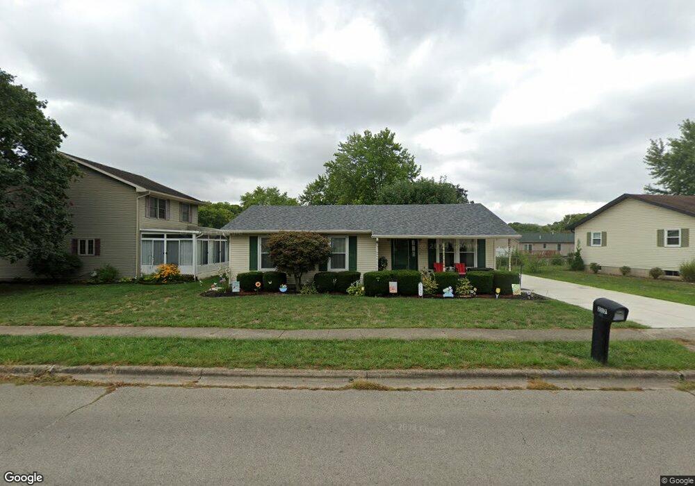
217 Pontious Ln Circleville, OH 43113
Estimated Value: $223,000 - $255,000
3
Beds
2
Baths
1,172
Sq Ft
$205/Sq Ft
Est. Value
About This Home
This home is located at 217 Pontious Ln, Circleville, OH 43113 and is currently estimated at $240,295, approximately $205 per square foot. 217 Pontious Ln is a home located in Pickaway County with nearby schools including Circleville High School, Crossroads Christian Academy, and New Hope Christian Academy.
Ownership History
Date
Name
Owned For
Owner Type
Purchase Details
Closed on
Nov 22, 2010
Sold by
Wolford Janet L and Wolford Norma Jean
Bought by
Belles Lawrence F and Belles Janet S
Current Estimated Value
Home Financials for this Owner
Home Financials are based on the most recent Mortgage that was taken out on this home.
Original Mortgage
$121,894
Outstanding Balance
$79,541
Interest Rate
4.44%
Mortgage Type
VA
Estimated Equity
$160,754
Purchase Details
Closed on
Dec 12, 1997
Sold by
Shumaker William C
Bought by
Cozart Joseph S
Purchase Details
Closed on
Oct 30, 1995
Sold by
Damron Jerry T
Bought by
Debord Douglas A and Debord Carrie
Home Financials for this Owner
Home Financials are based on the most recent Mortgage that was taken out on this home.
Original Mortgage
$85,890
Interest Rate
7.65%
Mortgage Type
FHA
Purchase Details
Closed on
Nov 1, 1988
Create a Home Valuation Report for This Property
The Home Valuation Report is an in-depth analysis detailing your home's value as well as a comparison with similar homes in the area
Home Values in the Area
Average Home Value in this Area
Purchase History
| Date | Buyer | Sale Price | Title Company |
|---|---|---|---|
| Belles Lawrence F | $118,000 | Transcounty | |
| Cozart Joseph S | $93,147 | -- | |
| Debord Douglas A | $87,000 | -- | |
| -- | $9,000 | -- |
Source: Public Records
Mortgage History
| Date | Status | Borrower | Loan Amount |
|---|---|---|---|
| Open | Belles Lawrence F | $121,894 | |
| Previous Owner | Debord Douglas A | $85,890 |
Source: Public Records
Tax History
| Year | Tax Paid | Tax Assessment Tax Assessment Total Assessment is a certain percentage of the fair market value that is determined by local assessors to be the total taxable value of land and additions on the property. | Land | Improvement |
|---|---|---|---|---|
| 2025 | $4,511 | $59,560 | $7,470 | $52,090 |
| 2024 | $4,511 | $59,560 | $7,470 | $52,090 |
| 2023 | $1,767 | $59,560 | $7,470 | $52,090 |
| 2022 | $1,696 | $47,180 | $6,250 | $40,930 |
| 2021 | $1,707 | $47,180 | $6,250 | $40,930 |
| 2020 | $1,707 | $47,180 | $6,250 | $40,930 |
| 2019 | $1,417 | $39,020 | $6,250 | $32,770 |
| 2018 | $1,477 | $39,020 | $6,250 | $32,770 |
| 2017 | $1,466 | $39,020 | $6,250 | $32,770 |
| 2016 | $1,377 | $36,760 | $7,440 | $29,320 |
| 2015 | $1,378 | $36,760 | $7,440 | $29,320 |
| 2014 | $1,373 | $36,760 | $7,440 | $29,320 |
| 2013 | $1,541 | $39,700 | $7,440 | $32,260 |
Source: Public Records
Map
Nearby Homes
- 152 Griner Ave
- 231 Westwood Dr
- 180 Nicholas Dr
- 461 Watt St
- 430 Ruth Ave
- 416 Stella Ave
- 5658 US Highway 22 and 3
- 405 Watt St
- 551 E Main St
- 446 E Franklin St
- 531 E Franklin St
- 378 E Franklin St
- 550 Springhollow Rd
- 561 Springhollow Rd
- 339 Meadow Ln
- 125 N Pickaway St
- 575 Renick Ave
- 420 Faye Ave
- 461 N Court St
- 528 N Court St
Your Personal Tour Guide
Ask me questions while you tour the home.