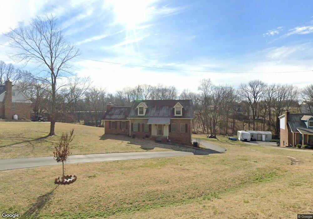
217 Quail Ridge Dr Cottontown, TN 37048
Estimated Value: $350,822 - $454,000
--
Bed
2
Baths
1,822
Sq Ft
$226/Sq Ft
Est. Value
About This Home
This home is located at 217 Quail Ridge Dr, Cottontown, TN 37048 and is currently estimated at $411,206, approximately $225 per square foot. 217 Quail Ridge Dr is a home located in Robertson County with nearby schools including Robert F. Woodall Elementary School, White House Heritage Elementary School, and White House Heritage High School.
Ownership History
Date
Name
Owned For
Owner Type
Purchase Details
Closed on
Aug 2, 2005
Sold by
Sullivan Betsey R
Bought by
Miller Mildred C
Current Estimated Value
Purchase Details
Closed on
Jul 31, 2005
Sold by
Miller Robert N
Bought by
Sullivan Betsey R
Purchase Details
Closed on
Dec 22, 1993
Sold by
Etal Glasgow Raymond K Jr
Bought by
Steven Sullivan Rex
Purchase Details
Closed on
Mar 25, 1988
Bought by
Glasgow Raymond K
Purchase Details
Closed on
Feb 3, 1987
Bought by
Cochrane David D
Create a Home Valuation Report for This Property
The Home Valuation Report is an in-depth analysis detailing your home's value as well as a comparison with similar homes in the area
Home Values in the Area
Average Home Value in this Area
Purchase History
| Date | Buyer | Sale Price | Title Company |
|---|---|---|---|
| Miller Mildred C | -- | -- | |
| Sullivan Betsey R | -- | -- | |
| Steven Sullivan Rex | $110,000 | -- | |
| Glasgow Raymond K | $91,400 | -- | |
| Cochrane David D | -- | -- |
Source: Public Records
Tax History Compared to Growth
Tax History
| Year | Tax Paid | Tax Assessment Tax Assessment Total Assessment is a certain percentage of the fair market value that is determined by local assessors to be the total taxable value of land and additions on the property. | Land | Improvement |
|---|---|---|---|---|
| 2024 | $1,386 | $77,000 | $23,750 | $53,250 |
| 2023 | $1,386 | $77,000 | $23,750 | $53,250 |
| 2022 | $1,236 | $48,000 | $6,475 | $41,525 |
| 2021 | $1,236 | $48,000 | $6,475 | $41,525 |
| 2020 | $1,236 | $48,000 | $6,475 | $41,525 |
| 2019 | $1,236 | $48,000 | $6,475 | $41,525 |
| 2018 | $1,236 | $48,000 | $6,475 | $41,525 |
| 2017 | $1,024 | $33,200 | $5,525 | $27,675 |
| 2016 | $1,024 | $33,200 | $5,525 | $27,675 |
| 2015 | $983 | $33,200 | $5,525 | $27,675 |
| 2014 | $983 | $33,200 | $5,525 | $27,675 |
Source: Public Records
Map
Nearby Homes
- 1130 Adam Dr
- 1500 Hidden Meadow Dr
- 1214 Hollis Terrace
- 111 Renee Ct
- 1552 Hidden Meadow Dr
- 102 Arrowood Dr
- 8149 Netterfield Dr
- 8137 Netterfield Dr
- 8131 Netterfield Dr
- 0 Martin Ln
- 8117 Netterfield Dr
- 4167 S Downs Cir
- 4025 Burton Dr
- 4037 Burton Dr
- 2306 Brokeshire Dr
- 4087 Burton Dr
- 4187 Burton Dr
- 4199 Burton Dr
- 4209 Burton Dr
- 4171 Burton Dr
- 221 Quail Ridge Dr
- 213 Quail Ridge Dr
- 3839 Highway 31 W
- 3839 U S 31w
- 211 Quail Ridge Dr
- 237 Quail Ridge Dr
- 225 Quail Ridge Dr
- 1160 Adam Dr
- 229 Quail Ridge Dr
- 233 Quail Ridge Dr
- 205 Quail Ridge Dr
- 1165 Adam Dr
- 3823 Highway 31 W
- 101 Baldridge Dr
- 1150 Adam Dr
- 241 Quail Ridge Dr
- 113 Baldridge Dr
- 201 Quail Ridge Dr
- 121 Baldridge Dr
- 1161 Adam Dr