NOT LISTED FOR SALE

217 Smull St Old Forge, PA 18518

Estimated Value: $95,181 - $312,000

0.2 Acre
$1,101,475 Price per Acre
8,712 Sq Ft Lot

Last Sold November 26, 2014

Last sale price $23,250

Est. 848% increase in value since last sale

Current estimated payment $1,497/month

561 Days on Market

About This Lot

As of November 2014

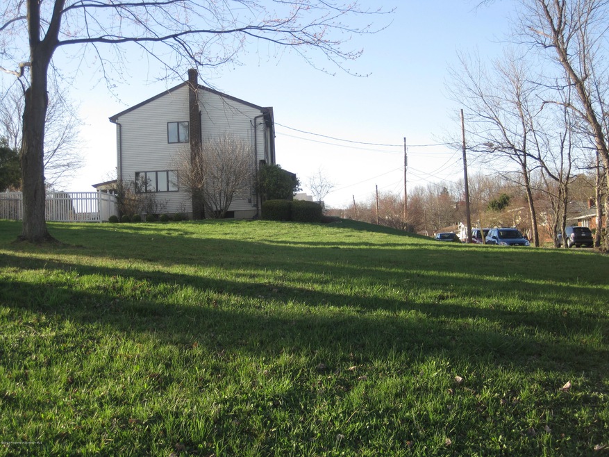
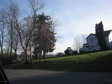
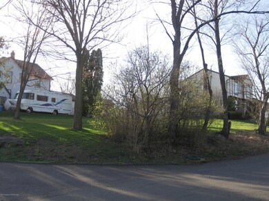
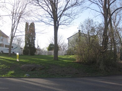
Nice level lot in quiet neighbor. Build your home on one of the few lots in OF not in a development., Tax Information: Available

Last Agent to Sell the Property

Ellen Rudis

Classic Properties Kingston License #AB066828 Listed on: 04/17/2013

Last Buyer's Agent

Ellen Rudis

Classic Properties Kingston License #AB066828 Listed on: 04/17/2013

Property Details

Property Type

  • Land

Est. Annual Taxes

  • $402

Lot Details

  • 8,712 Sq Ft Lot
  • Lot Dimensions are 74x118
  • Property fronts a state road
  • Corner Lot
  • Level Lot

Utilities

  • Phone Available

Community Details

  • Ski Accessible

Listing and Financial Details

  • Assessor Parcel Number 17613020019

Property Details

Property Type

Land

Est. Annual Taxes

$402

Lot Details

0

Listing Details

  • Directions: Moosic Rd., to Smull. Property on Left on the corner of Smull and Smith.
  • Lot Size Acres: 0.2
  • Prop. Type: Land
  • Reso Property Sub Type: Unimproved Land
  • Horses: No
  • ResoLotFeatures: Corner Lot, Level
  • Road Frontage Type: State Road
  • Road Surface Type: Paved
  • Reso Association Amenities: Ski Accessible, Trash
  • AuctionYN: No
  • SchoolTaxAmount: 246.49
  • Special Features: None
  • Property Sub Type: LotsLands

Exterior Features

  • Waterfront: No
  • Exclusions: No
  • Builder Name: Any Builder
  • RoadFrontageLength: 74.00

Utilities

  • Utilities: Electricity Available, Phone Available
  • Water Source: Public

Schools

  • Junior High Dist: Old Forge

Lot Info

  • Development Status: Raw Land
  • Land Lease: No
  • Lot Dimensions: 74X118
  • Additional Parcels: No
  • Parcel #: 17613020019
  • Zoning Description: Residential

Tax Info

  • Tax Year: 2014
  • Tax Annual Amount: 401.83
  • Tax Book Number: 0362/0670

Ownership History

Date Name Owned For Owner Type

Purchase Details

Closed on
Nov 13, 2000
Bought by
Kelley Michael J
Current Estimated Value
$220,295
Source: Public Records

Range of Values:

Collateral Analytics

Collateral Analytics Collateral Analytics AVMs (Automated Valuation Model) employ a number of statistical approaches combined with neighborhood-specific comparable selection guarantees the most up-to-date and precise valuations.

Not Available

Collateral Analytics does not have data for the current month. Please view the chart for historical values.

ICE

ICE Mortgage Technology ICE Mortgage Technology’s AVM (Automated Valuation Model) is a state-of-the-art online residential property valuation tool that provides a quick and accurate estimate of the value of almost any home in the U.S.

Not Available

ICE Mortgage Technology does not have data for the current month. Please view the chart for historical values.

First American

First American First American Data & Analytics’ next-generation AVM combines unrivaled data assets with a blended ensemble of valuation models to produce highly accurate, reliable valuations you can trust.

Not Available

First American does not have data for the current month. Please view the chart for historical values.

Quantarium

Quantarium Quantarium’s valuation service, repeatedly proven the industry’s most accurate and comprehensive, is supercharged with a self-learning and auto-tuning AI engine that continually becomes smarter and more accurate as it processes daily inputs from the industry’s leading RE data lake.

Not Available

Quantarium does not have data for the current month. Please view the chart for historical values.

Average Value
Not Available
List Price
Sold Price
Create a Home Valuation Report for This Property
The Home Valuation Report is an in-depth analysis detailing your home's value as well as a comparison with similar homes in the area

Home Values in the Area

Source: Public Records

Average Home Value in this Area


Source: Public Records

Purchase History

Date Buyer Sale Price Title Company
Kelley Michael J $64,600 --
Source: Public Records

Mortgage History

Date Status Borrower Loan Amount
Open Kelley Michael J $50,000
Closed Kelley Michael J $75,000
Closed Kelley Michael $33,000
Source: Public Records

Property History

Date Event Price Change Sq Ft Price
11/26/2014 11/26/14 Sold $23,250 -53.5% --
10/30/2014 10/30/14 Pending -- -- --
04/17/2013 04/17/13 For Sale $50,000 -- --
Source: Greater Scranton Board of REALTORS®

Tax History Compared to Growth

Source: Public Records

Tax History

Year Tax Paid Tax Assessment Tax Assessment Total Assessment is a certain percentage of the fair market value that is determined by local assessors to be the total taxable value of land and additions on the property. Land Improvement
2025 $3,242 $12,500 $5,300 $7,200
2024 $2,891 $12,500 $5,300 $7,200
2023 $2,891 $12,500 $5,300 $7,200
2022 $2,794 $12,500 $5,300 $7,200
2021 $2,718 $12,500 $5,300 $7,200
2020 $2,686 $12,500 $5,300 $7,200
2019 $2,574 $12,500 $5,300 $7,200
2018 $2,549 $12,500 $5,300 $7,200
2017 $2,549 $12,500 $5,300 $7,200
2016 $1,478 $12,500 $5,300 $7,200
2015 -- $12,500 $5,300 $7,200
2014 -- $12,500 $5,300 $7,200
Source: Public Records

Agents Affiliated with this Home

  • Section Image
See All Agents

Map

Source: Greater Scranton Board of REALTORS®

MLS Number: GSB131651

Greater Scranton Board of REALTORS®

APN: 1761302001901