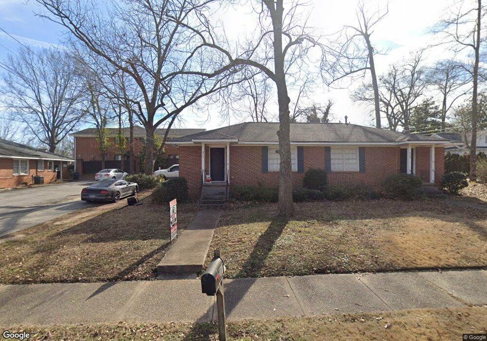
217 Springdale St Athens, GA 30606
Milledge Avenue Historic District NeighborhoodEstimated Value: $284,000 - $568,000
--
Bed
2
Baths
1,458
Sq Ft
$321/Sq Ft
Est. Value
About This Home
This home is located at 217 Springdale St, Athens, GA 30606 and is currently estimated at $467,741, approximately $320 per square foot. 217 Springdale St is a home located in Clarke County with nearby schools including Barrow Elementary School, Clarke Middle School, and Clarke Central High School.
Ownership History
Date
Name
Owned For
Owner Type
Purchase Details
Closed on
Feb 1, 2016
Sold by
Johnson Fred Irvin
Bought by
Bond C Herbert and Bond Dorrie R
Current Estimated Value
Home Financials for this Owner
Home Financials are based on the most recent Mortgage that was taken out on this home.
Original Mortgage
$286,000
Interest Rate
4.04%
Mortgage Type
New Conventional
Purchase Details
Closed on
Mar 11, 2009
Sold by
Synovus Co
Bought by
Johnson Allen W
Purchase Details
Closed on
Apr 15, 2002
Sold by
Johnson Edna V & Trust Co Bk Of Ne
Bought by
Johnson Edna V & Trust Co Bk Of Ne
Purchase Details
Closed on
Feb 8, 2002
Sold by
Johnson Edna V & Trust Co Bk O
Bought by
Johnson Edna V & Synovous Trust Company
Create a Home Valuation Report for This Property
The Home Valuation Report is an in-depth analysis detailing your home's value as well as a comparison with similar homes in the area
Home Values in the Area
Average Home Value in this Area
Purchase History
| Date | Buyer | Sale Price | Title Company |
|---|---|---|---|
| Bond C Herbert | $400,000 | -- | |
| Johnson Allen W | $125,000 | -- | |
| Johnson Edna V & Trust Co Bk Of Ne | -- | -- | |
| Johnson Edna V & Synovous Trust Company | -- | -- |
Source: Public Records
Mortgage History
| Date | Status | Borrower | Loan Amount |
|---|---|---|---|
| Closed | Bond C Herbert | $286,000 |
Source: Public Records
Tax History Compared to Growth
Tax History
| Year | Tax Paid | Tax Assessment Tax Assessment Total Assessment is a certain percentage of the fair market value that is determined by local assessors to be the total taxable value of land and additions on the property. | Land | Improvement |
|---|---|---|---|---|
| 2025 | $5,898 | $189,952 | $64,800 | $125,152 |
| 2024 | $5,898 | $177,327 | $59,940 | $117,387 |
| 2023 | $5,541 | $160,387 | $59,940 | $100,447 |
| 2022 | $4,311 | $135,155 | $56,700 | $78,455 |
| 2021 | $3,582 | $106,290 | $56,700 | $49,590 |
| 2020 | $3,582 | $106,290 | $56,700 | $49,590 |
| 2019 | $3,609 | $106,290 | $56,700 | $49,590 |
| 2018 | $2,938 | $86,544 | $56,700 | $29,844 |
| 2017 | $2,832 | $83,402 | $56,700 | $26,702 |
| 2016 | $2,137 | $62,960 | $56,700 | $6,260 |
| 2015 | $1,865 | $54,860 | $48,600 | $6,260 |
| 2014 | $1,703 | $50,000 | $43,740 | $6,260 |
Source: Public Records
Map
Nearby Homes
- 265 Springdale St
- 255 Bloomfield St
- 338 Springdale St
- 997 S Milledge Ave Unit 2
- 997 S Milledge Ave Unit 3
- 997 S Milledge Ave Unit 1
- 997 S Milledge Ave Unit 4
- 50 Springdale St
- 577 W Cloverhurst Ave
- 1055 Baxter St Unit 504
- 495 Woodlawn Ave
- 494 Baxter St Unit 32
- 597 Dearing St
- 365 S Church St Unit 1A, 1B, 1C
- 500 Dearing St Unit 6
- 206 Fortson Dr
- 169 Fortson Cir
- 490 Mcwhorter Dr
- 1226 W Broad St
- 224 Fortson Dr
- 237 Spingdale St
- 237 Springdale St
- 750 S Milledge Ave
- 238 Springdale St
- 239 Springdale St
- 0 Springdale St Unit 8826625
- 0 Springdale St Unit 8468233
- 0 Springdale St Unit 7542170
- 0 Springdale St Unit 3224095
- 0 Springdale St Unit 3190836
- 0 Springdale St Unit 3094481
- 0 Springdale St
- 248 Springdale St
- 688 S Milledge Ave
- 145 Mount Vernon Place
- 735 S Milledge Ave
- 243 Springdale St
- 721 S Milledge Ave
- 250 Springdale St
- 770 S Milledge Ave