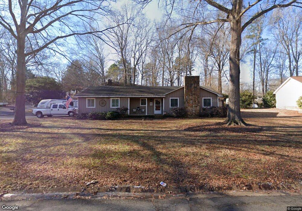
217 Swamp Fox Dr Fort Mill, SC 29715
Springfield NeighborhoodEstimated Value: $310,000 - $400,000
3
Beds
2
Baths
1,610
Sq Ft
$224/Sq Ft
Est. Value
About This Home
This home is located at 217 Swamp Fox Dr, Fort Mill, SC 29715 and is currently estimated at $361,069, approximately $224 per square foot. 217 Swamp Fox Dr is a home located in York County with nearby schools including Fort Mill Elementary School, Fort Mill Middle School, and Nation Ford High School.
Ownership History
Date
Name
Owned For
Owner Type
Purchase Details
Closed on
Jul 16, 2020
Sold by
Gilleland John and Gilleland Tia
Bought by
Gilleland John and Gilleland Tia
Current Estimated Value
Purchase Details
Closed on
Apr 21, 2017
Sold by
Gilleland John and Gilleland Tia
Bought by
Gilleland John and Gilleland Tia
Home Financials for this Owner
Home Financials are based on the most recent Mortgage that was taken out on this home.
Original Mortgage
$140,519
Outstanding Balance
$116,720
Interest Rate
4.23%
Mortgage Type
FHA
Estimated Equity
$244,349
Purchase Details
Closed on
Apr 15, 2010
Sold by
Simmons Barry Bryant
Bought by
Gilleland John and Morse Tia
Home Financials for this Owner
Home Financials are based on the most recent Mortgage that was taken out on this home.
Original Mortgage
$155,138
Interest Rate
4.94%
Mortgage Type
FHA
Create a Home Valuation Report for This Property
The Home Valuation Report is an in-depth analysis detailing your home's value as well as a comparison with similar homes in the area
Home Values in the Area
Average Home Value in this Area
Purchase History
| Date | Buyer | Sale Price | Title Company |
|---|---|---|---|
| Gilleland John | -- | Timios Inc | |
| Gilleland John | -- | None Available | |
| Gilleland John | $158,000 | -- |
Source: Public Records
Mortgage History
| Date | Status | Borrower | Loan Amount |
|---|---|---|---|
| Open | Gilleland John | $140,519 | |
| Closed | Gilleland John | $155,138 |
Source: Public Records
Tax History
| Year | Tax Paid | Tax Assessment Tax Assessment Total Assessment is a certain percentage of the fair market value that is determined by local assessors to be the total taxable value of land and additions on the property. | Land | Improvement |
|---|---|---|---|---|
| 2025 | $1,184 | $6,745 | $1,406 | $5,339 |
| 2024 | $1,035 | $5,865 | $1,896 | $3,969 |
| 2023 | $1,004 | $5,865 | $1,896 | $3,969 |
| 2022 | $995 | $5,865 | $1,896 | $3,969 |
| 2021 | -- | $5,865 | $1,896 | $3,969 |
| 2020 | $1,068 | $5,865 | $0 | $0 |
| 2019 | $1,066 | $5,100 | $0 | $0 |
| 2018 | $1,126 | $5,100 | $0 | $0 |
| 2017 | $1,063 | $5,100 | $0 | $0 |
| 2016 | $1,049 | $5,100 | $0 | $0 |
| 2014 | $739 | $5,100 | $1,600 | $3,500 |
| 2013 | $739 | $5,180 | $1,600 | $3,580 |
Source: Public Records
Map
Nearby Homes
- 105 Redcoat Dr
- 001 Roanoke Dr
- 000 Roanoke Dr
- 002 Roanoke Dr
- 1710 Merritt Rd Unit 3
- 1565 Kennel Rd
- 1185 Regions Blvd
- 1435 Kilburn Ln
- 1459 Kilburn Ln
- 1297 Edbrooke Ln
- 2112 Tatton Hall Rd
- 3954 Kestrel Ln
- 3995 Kestrel Ln
- 1123 Regions Blvd
- 2289 Tatton Hall Rd
- Tract B Stream Ln
- 10822 Pettus Farm Rd
- 1018 Johnna Ln
- 10891 Pettus Rd
- 3149 Beacon Heights Rd
- 215 Swamp Fox Dr
- 301 Brookside Dr
- 210 Swamp Fox Dr
- 301 Swamp Fox Dr
- 213 Swamp Fox Dr
- 203 Pelham Ln
- 201 Pelham Ln
- 205 Pelham Ln
- 298 Swamp Fox Dr
- 303 Brookside Dr
- 302 Brookside Dr
- 211 Swamp Fox Dr
- 207 Pelham Ln
- 211 Brookside Dr
- 303 Swamp Fox Dr
- 300 Swamp Fox Dr
- 121 Pelham Ln
- 208 Swamp Fox Dr
- 209 Pelham Ln
- 305 Brookside Dr