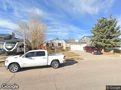
217 Tomahawk Dr Evanston, WY 82930
Estimated Value: $296,000 - $514,000
--
Bed
1
Bath
1,254
Sq Ft
$289/Sq Ft
Est. Value
About This Home
This home is located at 217 Tomahawk Dr, Evanston, WY 82930 and is currently estimated at $362,835, approximately $289 per square foot. 217 Tomahawk Dr is a home located in Uinta County with nearby schools including Evanston High School and Evanston Child Development Center.
Ownership History
Date
Name
Owned For
Owner Type
Purchase Details
Closed on
Feb 27, 2009
Sold by
Eastman Scott A and Eastman Renee A
Bought by
Mccoy Mark D and Mccoy Lauren A
Current Estimated Value
Home Financials for this Owner
Home Financials are based on the most recent Mortgage that was taken out on this home.
Original Mortgage
$186,459
Outstanding Balance
$122,723
Interest Rate
4.92%
Mortgage Type
FHA
Create a Home Valuation Report for This Property
The Home Valuation Report is an in-depth analysis detailing your home's value as well as a comparison with similar homes in the area
Home Values in the Area
Average Home Value in this Area
Purchase History
| Date | Buyer | Sale Price | Title Company |
|---|---|---|---|
| Mccoy Mark D | -- | None Available |
Source: Public Records
Mortgage History
| Date | Status | Borrower | Loan Amount |
|---|---|---|---|
| Open | Mccoy Mark D | $186,459 | |
| Previous Owner | Eastman Scott A | $325,000 | |
| Previous Owner | Eastman Scott A | $100,000 |
Source: Public Records
Tax History Compared to Growth
Tax History
| Year | Tax Paid | Tax Assessment Tax Assessment Total Assessment is a certain percentage of the fair market value that is determined by local assessors to be the total taxable value of land and additions on the property. | Land | Improvement |
|---|---|---|---|---|
| 2024 | $1,402 | $20,627 | $3,805 | $16,822 |
| 2023 | $1,413 | $20,886 | $3,024 | $17,862 |
| 2022 | $1,423 | $20,906 | $2,971 | $17,935 |
| 2021 | $1,135 | $16,649 | $2,336 | $14,313 |
| 2020 | $974 | $14,291 | $1,299 | $12,992 |
| 2019 | $959 | $14,097 | $1,299 | $12,798 |
| 2018 | $0 | $13,388 | $1,185 | $12,203 |
| 2017 | $923 | $13,582 | $1,313 | $12,269 |
| 2016 | $911 | $13,399 | $1,313 | $12,086 |
| 2015 | -- | $13,411 | $1,313 | $12,098 |
| 2014 | -- | $13,930 | $0 | $0 |
Source: Public Records
Map
Nearby Homes
- 225 Tomahawk Dr
- 319 Wright Way
- 324 Ottley Ln
- 325 Davis Dr
- 3925 Yellow Creek Rd
- 3893 Yellow Creek Rd
- 3861 Yellow Creek Rd
- 3827 Yellow Creek Rd
- 2884 lot #1207 Yellow Creek Rd
- 405 Burns Ave Unit 3,4,5
- 123 Red Hawk Ave
- 405, 411, & 419 Burns Ave
- 449 Billies Cir
- 325 Hathaway Ave
- 816 Sundance Ave
- 336 Emerson Ave
- 0 Prospector Dr
- 307 Hansen Ave
- 301 Emerson Ave
- 2884 lot #1119 Yellowcreek Rd
- 217 Tomahawk Dr
- 213 Tomahawk Dr
- 213 Tomahawk Dr Unit Arrowhead Drive
- 208 Lupine Dr
- 216 Lupine Dr
- 224 Tomahawk Dr
- 209 Tomahawk Dr
- 204 Lupine Dr
- 204 Lupine Dr Unit Arrowhead
- 229 Tomahawk Dr Unit Lodgepole
- 205 Tomahawk Dr
- 191 Lodgepole Dr
- 220 Lupine Dr
- 200 Lupine Dr
- 200 Lupine Dr Unit Arrowhead
- 194 Lodgepole Dr
- 188 Lupine Dr
- 201 Tomahawk Dr
- 233 Tomahawk Dr
- 207 Lupine Dr