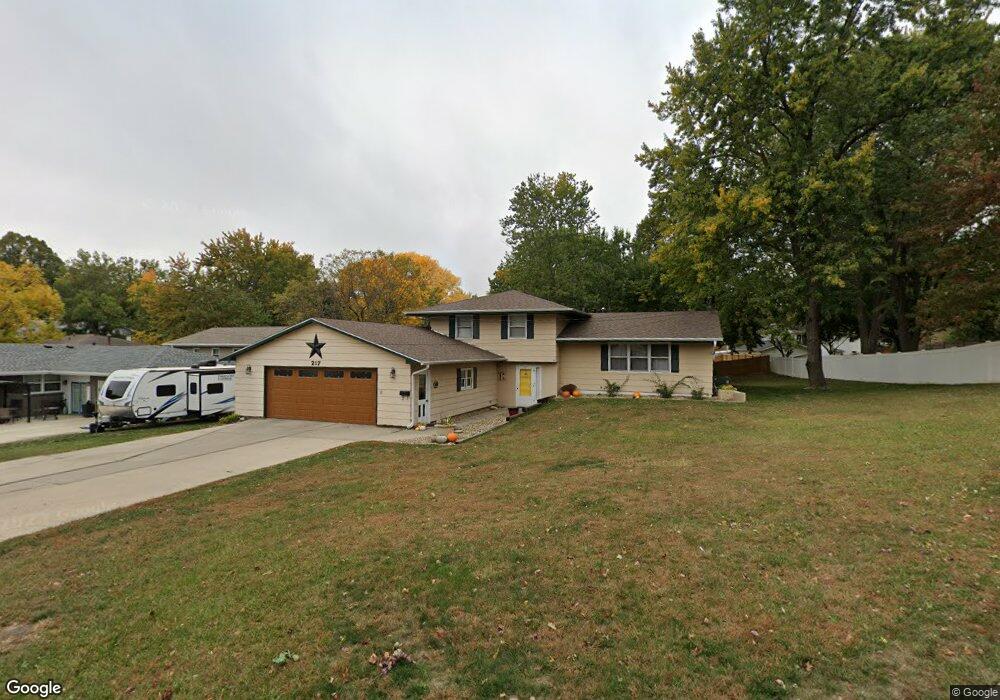
217 W 13th St S Newton, IA 50208
Estimated Value: $230,000 - $267,000
3
Beds
3
Baths
1,248
Sq Ft
$201/Sq Ft
Est. Value
About This Home
This home is located at 217 W 13th St S, Newton, IA 50208 and is currently estimated at $250,424, approximately $200 per square foot. 217 W 13th St S is a home located in Jasper County with nearby schools including Thomas Jefferson Elementary School, Woodrow Wilson Elementary School, and Berg Middle School.
Ownership History
Date
Name
Owned For
Owner Type
Purchase Details
Closed on
Jun 28, 2013
Sold by
Gilmore Brant T and Eggers Lori L
Bought by
Cupples Billy G
Current Estimated Value
Home Financials for this Owner
Home Financials are based on the most recent Mortgage that was taken out on this home.
Original Mortgage
$147,959
Outstanding Balance
$105,746
Interest Rate
3.52%
Mortgage Type
New Conventional
Estimated Equity
$144,678
Create a Home Valuation Report for This Property
The Home Valuation Report is an in-depth analysis detailing your home's value as well as a comparison with similar homes in the area
Home Values in the Area
Average Home Value in this Area
Purchase History
| Date | Buyer | Sale Price | Title Company |
|---|---|---|---|
| Cupples Billy G | $145,000 | United Land Title Co |
Source: Public Records
Mortgage History
| Date | Status | Borrower | Loan Amount |
|---|---|---|---|
| Open | Cupples Billy G | $147,959 |
Source: Public Records
Tax History Compared to Growth
Tax History
| Year | Tax Paid | Tax Assessment Tax Assessment Total Assessment is a certain percentage of the fair market value that is determined by local assessors to be the total taxable value of land and additions on the property. | Land | Improvement |
|---|---|---|---|---|
| 2025 | $3,824 | $233,220 | $52,490 | $180,730 |
| 2024 | $3,824 | $212,110 | $52,490 | $159,620 |
| 2023 | $3,798 | $212,110 | $52,490 | $159,620 |
| 2022 | $3,768 | $191,720 | $52,490 | $139,230 |
| 2021 | $3,742 | $178,360 | $52,490 | $125,870 |
| 2020 | $3,742 | $168,120 | $33,320 | $134,800 |
| 2019 | $3,278 | $144,260 | $0 | $0 |
| 2018 | $3,278 | $144,260 | $0 | $0 |
| 2017 | $3,282 | $144,260 | $0 | $0 |
| 2016 | $3,282 | $144,260 | $0 | $0 |
| 2015 | $3,196 | $144,260 | $0 | $0 |
| 2014 | $3,076 | $137,930 | $0 | $0 |
Source: Public Records
Map
Nearby Homes
- 210 W 13th St S
- 1221 Monroe Dr
- 237 W 12th St S
- 8 Chancery Ct
- 1100 1st Ave W
- 1000 1st Ave W
- 1431 Cardinal Ridge Dr
- 304 W 11th St N
- 308 W 8th St S
- 625 S 3rd Ave W
- 623 S 4th Ave W
- 726 W 9th St S
- 6911-10 Highway F 48 W
- 303 W 5th St S
- 702 W 6th St S
- 723 W 6th St S
- 429 1st Ave W
- 913 W 18th St S
- 1121 Woodland Dr
- 549 W 10th St N
- 216 W 13th St S
- 215 W 13th St S
- 1300 S 3rd Ave W
- 1304 S 3rd Ave W
- 300 W 13th St S
- 1301 Monroe Dr Unit A
- 1301 Monroe Dr
- 228 W 14th St S
- 224 W 14th St S
- 1305 Monroe Dr
- 1316 S 3rd Ave W
- 233 W 12th St S
- 1301 S 3rd Ave W
- 221 W 12th St S
- 1217 Monroe Dr
- 1311 Monroe Dr
- 301 W 12th St S
- 205 W 12th St S
- 1315 S 3rd Ave W
- 203 W 12th St S