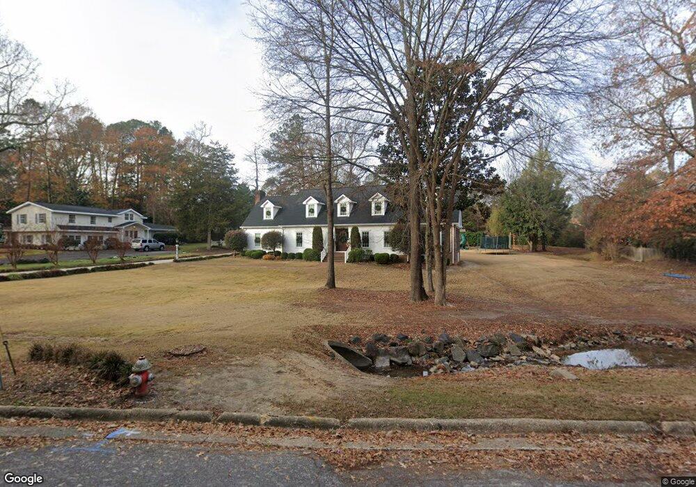
217 W Meadowbrook Dr Smithfield, NC 27577
Estimated Value: $493,000 - $546,000
4
Beds
3
Baths
3,326
Sq Ft
$155/Sq Ft
Est. Value
About This Home
This home is located at 217 W Meadowbrook Dr, Smithfield, NC 27577 and is currently estimated at $514,066, approximately $154 per square foot. 217 W Meadowbrook Dr is a home located in Johnston County with nearby schools including South Smithfield Elementary School, Smithfield Middle School, and Smithfield-Selma High School.
Ownership History
Date
Name
Owned For
Owner Type
Purchase Details
Closed on
Apr 26, 2010
Sold by
Hurt Thomas G and Hurt Laura S
Bought by
Hopkins Anthony Wayne and Hopkins Amanda Kennerly
Current Estimated Value
Home Financials for this Owner
Home Financials are based on the most recent Mortgage that was taken out on this home.
Original Mortgage
$208,000
Outstanding Balance
$139,004
Interest Rate
4.99%
Mortgage Type
New Conventional
Estimated Equity
$375,062
Create a Home Valuation Report for This Property
The Home Valuation Report is an in-depth analysis detailing your home's value as well as a comparison with similar homes in the area
Home Values in the Area
Average Home Value in this Area
Purchase History
| Date | Buyer | Sale Price | Title Company |
|---|---|---|---|
| Hopkins Anthony Wayne | $260,000 | None Available |
Source: Public Records
Mortgage History
| Date | Status | Borrower | Loan Amount |
|---|---|---|---|
| Open | Hopkins Anthony Wayne | $208,000 |
Source: Public Records
Tax History Compared to Growth
Tax History
| Year | Tax Paid | Tax Assessment Tax Assessment Total Assessment is a certain percentage of the fair market value that is determined by local assessors to be the total taxable value of land and additions on the property. | Land | Improvement |
|---|---|---|---|---|
| 2025 | $4,760 | $490,690 | $105,000 | $385,690 |
| 2024 | $4,056 | $327,070 | $81,130 | $245,940 |
| 2023 | $4,169 | $327,070 | $81,130 | $245,940 |
| 2022 | $4,252 | $327,070 | $81,130 | $245,940 |
| 2021 | $4,252 | $327,070 | $81,130 | $245,940 |
| 2020 | $4,350 | $327,070 | $81,130 | $245,940 |
| 2019 | $4,350 | $327,070 | $81,130 | $245,940 |
| 2018 | $3,708 | $274,676 | $71,590 | $203,086 |
| 2017 | $1,936 | $143,390 | $71,590 | $71,800 |
| 2016 | $3,368 | $249,510 | $71,590 | $177,920 |
| 2015 | $3,368 | $249,510 | $71,590 | $177,920 |
| 2014 | $3,368 | $249,510 | $71,590 | $177,920 |
Source: Public Records
Map
Nearby Homes
- 110 W Parker St
- 811 Baker St
- 103 E Meadowbrook Dr
- 710 S 2nd St
- 717 S 2nd St
- 911 S Crescent Dr
- 1108 S Walnut Dr
- 1112 S Crescent Dr
- 1115 Chestnut Dr
- 407 E Woodall St
- 429 S 5th St
- 1211 S 1st St
- 508 Crump St
- 507 E Woodall St
- 510 Crump St
- 1009 2nd Ave
- 512 Crump St
- 518 Crump St
- 409 W Holding St
- 214 W Stevens St
- 706 Sunset Dr
- 221 W Meadowbrook Dr
- 709 S Crescent Dr
- 707 S Crescent Dr
- 711 S Crescent Dr
- 214 W Meadowbrook Dr
- 710 Sunset Dr
- 223 W Meadowbrook Dr
- 703 S Crescent Dr
- 211 W Meadowbrook Dr
- 715 S Crescent Dr
- 710 S Crescent Dr
- 708 S Crescent Dr
- 716 Sunset Dr
- 202 W Meadowbrook Dr
- 712 S Crescent Dr
- 701 S Crescent Dr
- 614 S Vermont St
- 225 W Meadowbrook Dr
- 610 S Vermont St