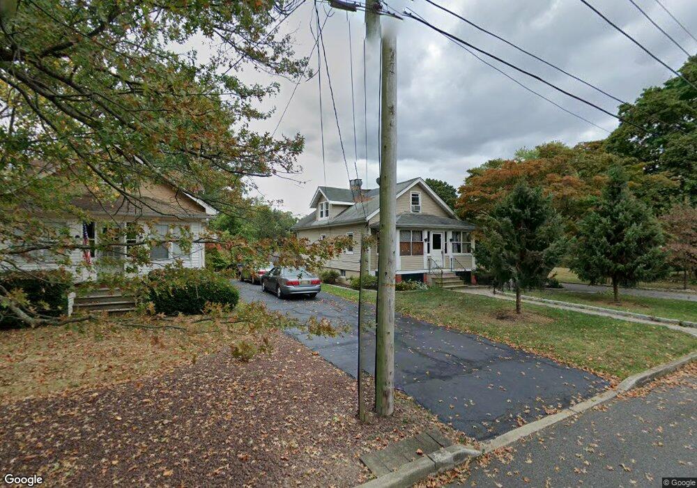
217 Wilson Ave Hightstown, NJ 08520
Estimated Value: $360,000 - $435,000
--
Bed
--
Bath
1,047
Sq Ft
$384/Sq Ft
Est. Value
About This Home
This home is located at 217 Wilson Ave, Hightstown, NJ 08520 and is currently estimated at $401,988, approximately $383 per square foot. 217 Wilson Ave is a home located in Mercer County with nearby schools including Melvin H. Kreps Middle School, Hightstown High School, and SciCore Academy.
Ownership History
Date
Name
Owned For
Owner Type
Purchase Details
Closed on
Feb 13, 2007
Current Estimated Value
Purchase Details
Closed on
Jun 2, 2006
Sold by
Snook John
Bought by
Hooven James
Home Financials for this Owner
Home Financials are based on the most recent Mortgage that was taken out on this home.
Original Mortgage
$209,000
Interest Rate
6.29%
Mortgage Type
Purchase Money Mortgage
Create a Home Valuation Report for This Property
The Home Valuation Report is an in-depth analysis detailing your home's value as well as a comparison with similar homes in the area
Home Values in the Area
Average Home Value in this Area
Purchase History
| Date | Buyer | Sale Price | Title Company |
|---|---|---|---|
| -- | $335,000 | -- | |
| Hooven James | $220,000 | -- |
Source: Public Records
Mortgage History
| Date | Status | Borrower | Loan Amount |
|---|---|---|---|
| Previous Owner | Hooven James | $209,000 |
Source: Public Records
Tax History Compared to Growth
Tax History
| Year | Tax Paid | Tax Assessment Tax Assessment Total Assessment is a certain percentage of the fair market value that is determined by local assessors to be the total taxable value of land and additions on the property. | Land | Improvement |
|---|---|---|---|---|
| 2025 | $9,791 | $199,700 | $98,000 | $101,700 |
| 2024 | $9,691 | $199,700 | $98,000 | $101,700 |
| 2023 | $9,691 | $199,700 | $98,000 | $101,700 |
| 2022 | $9,356 | $199,700 | $98,000 | $101,700 |
| 2021 | $9,018 | $199,700 | $98,000 | $101,700 |
| 2020 | $8,813 | $199,700 | $98,000 | $101,700 |
| 2019 | $8,567 | $199,700 | $98,000 | $101,700 |
| 2018 | $8,318 | $199,700 | $98,000 | $101,700 |
| 2017 | $8,232 | $199,700 | $98,000 | $101,700 |
| 2016 | $8,160 | $199,700 | $98,000 | $101,700 |
| 2015 | $8,108 | $199,700 | $98,000 | $101,700 |
| 2014 | $8,160 | $199,700 | $98,000 | $101,700 |
Source: Public Records
Map
Nearby Homes
- 128 Monmouth St
- 4 Sandstone Rd
- 5 Mill Run W
- 309 Lincoln Ave
- 23 Barton Dr
- 23 Powell Ct
- 158 Mill Run E
- 164 Mill Run E Unit 141
- 141 Lincoln Ave
- 344 Monmouth St
- 145 Lincoln Ave
- 4 Brakeman Ct
- 124 Mill Run E Unit 85
- 126 Mill Run E
- 126 Mill Run E Unit 84
- 104 1st Ave
- 336 Stockton St
- 43 Norton Ave
- 0 Route 130
- 365 Stockton St
- 215 Wilson Ave
- 221 Wilson Ave
- 220 Chamberlin Ave
- 218 Chamberlin Ave
- 216 Chamberlin Ave
- 222 Chamberlin Ave
- 214 Chamberlin Ave
- 220A Wilson Ave
- 222 Wilson Ave
- 223 Wilson Ave
- 112 Chamberlin Ave
- 220 Wilson Ave
- 210 Chamberlin Ave
- 226 Wilson Ave
- 218 Wilson Ave
- 178 Chamberlin Ave
- 171 Mechanic St
- 175 Mechanic St
- 216 Wilson Ave
- 169 Mechanic St