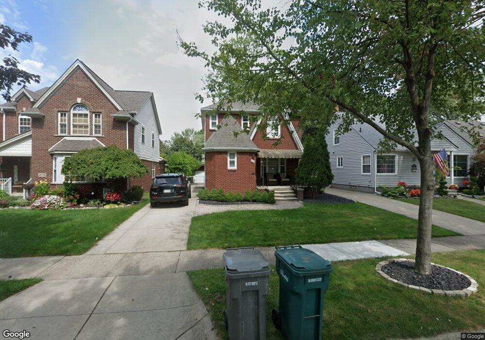
21700 Olmstead St Unit Bldg-Unit Dearborn, MI 48124
Ford Homes Historic District NeighborhoodEstimated Value: $252,032 - $335,000
3
Beds
2
Baths
1,242
Sq Ft
$239/Sq Ft
Est. Value
About This Home
This home is located at 21700 Olmstead St Unit Bldg-Unit, Dearborn, MI 48124 and is currently estimated at $296,508, approximately $238 per square foot. 21700 Olmstead St Unit Bldg-Unit is a home located in Wayne County with nearby schools including Duvall Elementary School, Smith Middle School, and Edsel Ford High School.
Ownership History
Date
Name
Owned For
Owner Type
Purchase Details
Closed on
Nov 6, 2020
Sold by
Jaafar Nehme and Jaafar Rim
Bought by
Nazzal Mona
Current Estimated Value
Purchase Details
Closed on
May 24, 2019
Sold by
Jaafar Nehme
Bought by
Rim Jaafar Nehme and Rim Jaafar
Purchase Details
Closed on
Jun 26, 2018
Sold by
Miglietti Andrew
Bought by
Jaafar Nehme
Purchase Details
Closed on
Jun 21, 2011
Sold by
Lacroix Vincent A and Lacroix Kelly A
Bought by
Miglietti Andrew
Create a Home Valuation Report for This Property
The Home Valuation Report is an in-depth analysis detailing your home's value as well as a comparison with similar homes in the area
Home Values in the Area
Average Home Value in this Area
Purchase History
We collect this data history from publicly available records. To have your information removed, we recommend requesting removal directly through your county’s website.
| Date | Buyer | Sale Price | Title Company |
|---|---|---|---|
| Nazzal Mona | $230,000 | V1 Title Agency | |
| Rim Jaafar Nehme | -- | Venture Title | |
| Jaafar Nehme | $175,000 | Title One Inc | |
| Miglietti Andrew | $105,000 | Title One Inc |
Source: Public Records
Tax History
| Year | Tax Paid | Tax Assessment Tax Assessment Total Assessment is a certain percentage of the fair market value that is determined by local assessors to be the total taxable value of land and additions on the property. | Land | Improvement |
|---|---|---|---|---|
| 2025 | $4,120 | $96,900 | $0 | $0 |
| 2024 | $4,029 | $110,600 | $0 | $0 |
| 2023 | $3,813 | $115,000 | $0 | $0 |
| 2022 | $4,291 | $87,200 | $0 | $0 |
| 2021 | $4,986 | $80,800 | $0 | $0 |
| 2019 | $4,254 | $67,400 | $0 | $0 |
| 2018 | $3,188 | $65,600 | $0 | $0 |
| 2017 | $914 | $63,000 | $0 | $0 |
| 2016 | $2,982 | $61,900 | $0 | $0 |
| 2015 | $5,636 | $65,950 | $0 | $0 |
| 2013 | $5,460 | $54,600 | $0 | $0 |
| 2011 | -- | $60,000 | $0 | $0 |
Source: Public Records
Map
Nearby Homes
- 21721 Nowlin St
- 21725 Nowlin St
- 22043 Edison St
- 2119 Monroe St
- 21047 Outer Dr
- 22131 Nowlin St
- 21230 Audette St
- 22101 Francis St
- 22121 Francis St
- 21532 S Military St
- 21270 Outer Dr
- 22223 Military St
- 22258 Francis St
- 3045 Dudley St
- 21506 Tenny St
- 22424 Nowlin St
- 3245 Gertrude St
- 22732 Cleveland St
- 3360 Alice St
- 22165 Park St
- 21555 Olmstead St
- 21701 Olmstead St
- 21551 Olmstead St
- 21711 Olmstead St
- 21541 Olmstead St
- 21568 Nowlin St Unit Bldg-Unit
- 21568 Nowlin St
- 21719 Olmstead St
- 21552 Nowlin St
- 21533 Olmstead St
- 21706 Nowlin St
- 21544 Nowlin St
- 21714 Nowlin St
- 21725 Olmstead St
- 21525 Olmstead St
- 21534 Nowlin St
- 21556 Olmstead St
- 21564 Olmstead St
- Olmstead St
- 21700 Olmstead St
Your Personal Tour Guide
Ask me questions while you tour the home.