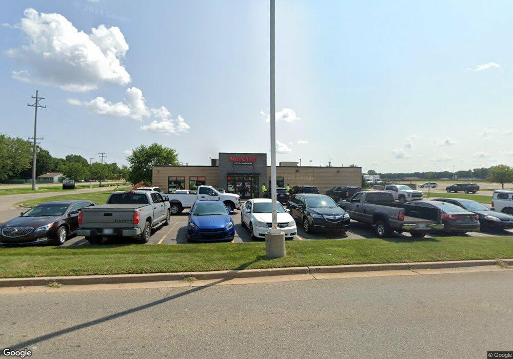
2171 Columbia Ave W Battle Creek, MI 49015
Westlake Prairieview NeighborhoodEstimated Value: $637,865
--
Bed
1
Bath
4,838
Sq Ft
$132/Sq Ft
Est. Value
About This Home
This home is located at 2171 Columbia Ave W, Battle Creek, MI 49015 and is currently estimated at $637,865, approximately $131 per square foot. 2171 Columbia Ave W is a home located in Calhoun County with nearby schools including Lakeview Middle School, Lakeview High School, and Arbor Academy.
Ownership History
Date
Name
Owned For
Owner Type
Purchase Details
Closed on
Oct 17, 2014
Sold by
Stamp By Design Llc
Bought by
Sol Ventures Llc
Current Estimated Value
Home Financials for this Owner
Home Financials are based on the most recent Mortgage that was taken out on this home.
Original Mortgage
$222,000
Outstanding Balance
$170,757
Interest Rate
4.19%
Mortgage Type
Commercial
Estimated Equity
$467,108
Purchase Details
Closed on
Jan 18, 2010
Sold by
Murray Ruth H
Bought by
Green Steven and Green Laurie
Purchase Details
Closed on
Sep 6, 2002
Bought by
Stamp By Design L L C
Create a Home Valuation Report for This Property
The Home Valuation Report is an in-depth analysis detailing your home's value as well as a comparison with similar homes in the area
Home Values in the Area
Average Home Value in this Area
Purchase History
| Date | Buyer | Sale Price | Title Company |
|---|---|---|---|
| Sol Ventures Llc | $277,500 | Ppr Title Agency | |
| Green Steven | $26,000 | None Available | |
| Stamp By Design L L C | $210,000 | -- |
Source: Public Records
Mortgage History
| Date | Status | Borrower | Loan Amount |
|---|---|---|---|
| Open | Sol Ventures Llc | $222,000 | |
| Closed | Green Steven | $0 |
Source: Public Records
Tax History Compared to Growth
Tax History
| Year | Tax Paid | Tax Assessment Tax Assessment Total Assessment is a certain percentage of the fair market value that is determined by local assessors to be the total taxable value of land and additions on the property. | Land | Improvement |
|---|---|---|---|---|
| 2025 | -- | $300,500 | $0 | $0 |
| 2024 | $10,913 | $290,921 | $0 | $0 |
| 2023 | $13,854 | $226,438 | $0 | $0 |
| 2022 | $9,864 | $211,136 | $0 | $0 |
| 2021 | $13,595 | $206,279 | $0 | $0 |
| 2020 | $13,755 | $224,270 | $0 | $0 |
| 2019 | $13,028 | $226,641 | $0 | $0 |
| 2018 | $13,028 | $208,394 | $108,338 | $100,056 |
| 2017 | $13,067 | $195,389 | $0 | $0 |
| 2016 | $13,186 | $219,463 | $0 | $0 |
| 2015 | $9,275 | $150,075 | $0 | $0 |
| 2014 | $9,275 | $152,896 | $0 | $0 |
Source: Public Records
Map
Nearby Homes
- 437 S 28th St
- 423 S 28th St
- 137 Apperson Rd
- 112 26th St S
- 24 31st St S
- 163 Cherrywood Ln
- 88 24th St S
- 230 23rd St S
- 1177 Chalmers Dr
- 0 W Columbia Ave Unit V/L 24062866
- 145 Terry Ct
- 190 Jacaranda Dr
- 1243 Territorial Rd W
- 0 Terry Ct
- 1225 Territorial Rd W
- 245 20th St S
- VL Windamere Blvd
- 96 Woodrow Ave S
- 120 Woodrow Ave S
- 318 Lakeshore Dr
- 2150 W Columbia Ave
- 2151 Columbia Ave W
- 184 31st St S
- 2106 W Columbia Ave
- 186 31st St S
- 178 31st St S
- 172 31st St S
- 185 31st St S
- 15386 Helmer Rd S
- 124 31st St S
- 175 31st St S
- 142 30th St S
- 118 31st St S
- 126 30th St S
- 112 S 31st St
- 112 31st St S
- 133 31st St S
- 130 30th St S
- 129 31st St S
- 124 30th St S
