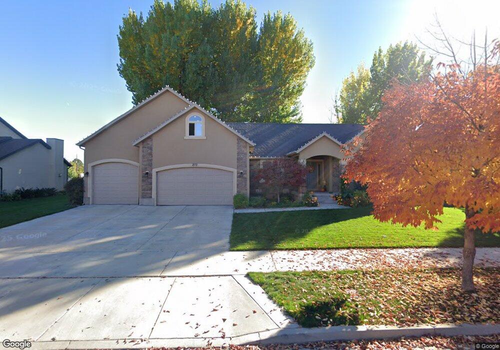
2171 W 470 S Unit 40 Provo, UT 84601
Franklin NeighborhoodEstimated Value: $629,000 - $723,000
3
Beds
3
Baths
2,469
Sq Ft
$267/Sq Ft
Est. Value
About This Home
This home is located at 2171 W 470 S Unit 40, Provo, UT 84601 and is currently estimated at $659,162, approximately $266 per square foot. 2171 W 470 S Unit 40 is a home located in Utah County with nearby schools including Dixon Middle School, Provo High School, and Freedom Preparatory Academy.
Ownership History
Date
Name
Owned For
Owner Type
Purchase Details
Closed on
Apr 20, 2021
Sold by
Cook Carolene F and Carolene F Cook Family Revocab
Bought by
Cook Carolene F and Carolene Cook 2021 Family Trus
Current Estimated Value
Purchase Details
Closed on
Jul 6, 2020
Sold by
Cook Carolene F
Bought by
Cook Carolene F and Carolene F Cook Revocable Trus
Home Financials for this Owner
Home Financials are based on the most recent Mortgage that was taken out on this home.
Original Mortgage
$211,350
Interest Rate
3.1%
Mortgage Type
New Conventional
Purchase Details
Closed on
Jun 28, 2016
Sold by
Cook Carolene F
Bought by
Cook Paul H and Cook Carolene F
Home Financials for this Owner
Home Financials are based on the most recent Mortgage that was taken out on this home.
Original Mortgage
$227,500
Interest Rate
3.66%
Mortgage Type
New Conventional
Purchase Details
Closed on
Jul 22, 2009
Sold by
Higgins Patrick J
Bought by
Higgins Patrick J and Higgins Karen
Home Financials for this Owner
Home Financials are based on the most recent Mortgage that was taken out on this home.
Original Mortgage
$321,600
Interest Rate
5.59%
Mortgage Type
New Conventional
Purchase Details
Closed on
May 31, 2006
Sold by
Kelson Wade R
Bought by
Higgins Patrick J and Higgins Karen
Home Financials for this Owner
Home Financials are based on the most recent Mortgage that was taken out on this home.
Original Mortgage
$67,000
Interest Rate
6.55%
Mortgage Type
Stand Alone Second
Purchase Details
Closed on
Apr 12, 2006
Sold by
Desert Point Builders Inc
Bought by
Kelson Wade R
Home Financials for this Owner
Home Financials are based on the most recent Mortgage that was taken out on this home.
Original Mortgage
$67,000
Interest Rate
6.55%
Mortgage Type
Stand Alone Second
Purchase Details
Closed on
Jun 27, 2005
Sold by
Sandalwood Llc
Bought by
Desert Point Builders Inc
Create a Home Valuation Report for This Property
The Home Valuation Report is an in-depth analysis detailing your home's value as well as a comparison with similar homes in the area
Home Values in the Area
Average Home Value in this Area
Purchase History
| Date | Buyer | Sale Price | Title Company |
|---|---|---|---|
| Cook Carolene F | -- | None Available | |
| Cook Carolene F | -- | Capstone T&E Inc | |
| Cook Carolene F | -- | Capstone T&E Inc | |
| Cook Paul H | -- | Accommodation | |
| Higgins Patrick J | -- | Title West Title Company | |
| Higgins Patrick J | -- | Title West Title Company | |
| Higgins Patrick J | -- | Integrated Title Insurance | |
| Kelson Wade R | -- | Integrated Title Insurance | |
| Desert Point Builders Inc | -- | Cottonwood Title Insurance |
Source: Public Records
Mortgage History
| Date | Status | Borrower | Loan Amount |
|---|---|---|---|
| Previous Owner | Cook Carolene F | $211,350 | |
| Previous Owner | Cook Paul H | $227,500 | |
| Previous Owner | Higgins Patrick J | $321,600 | |
| Previous Owner | Higgins Patrick J | $67,000 | |
| Previous Owner | Higgins Patrick J | $268,000 | |
| Previous Owner | Kelson Wade R | $240,000 |
Source: Public Records
Tax History Compared to Growth
Tax History
| Year | Tax Paid | Tax Assessment Tax Assessment Total Assessment is a certain percentage of the fair market value that is determined by local assessors to be the total taxable value of land and additions on the property. | Land | Improvement |
|---|---|---|---|---|
| 2025 | $3,003 | $323,235 | $228,700 | $359,000 |
| 2024 | $3,003 | $295,570 | $0 | $0 |
| 2023 | $2,902 | $281,600 | $0 | $0 |
| 2022 | $2,937 | $287,375 | $0 | $0 |
| 2021 | $2,331 | $397,800 | $129,000 | $268,800 |
| 2020 | $2,243 | $358,800 | $112,200 | $246,600 |
| 2019 | $2,144 | $356,700 | $112,200 | $244,500 |
| 2018 | $1,905 | $321,400 | $101,300 | $220,100 |
| 2017 | $1,772 | $164,340 | $0 | $0 |
| 2016 | $1,779 | $153,780 | $0 | $0 |
| 2015 | $1,692 | $147,840 | $0 | $0 |
| 2014 | $1,601 | $145,805 | $0 | $0 |
Source: Public Records
Map
Nearby Homes
- 312 S 1920 W
- 386 S 2390 W
- 273 S 1860 W
- 1828 W 170 S
- 147 S 1680 W
- 201 N Geneva Rd Unit 3
- 249 West Ln Unit 10
- 227 West Ln
- 154 N 2560 W
- 1075 Lakeview Pkwy
- 1125 Lakeview Pkwy
- 1744 W 150 N
- 478 S 1330 W
- 2744 W 50 N
- 255 N 1600 W Unit 148
- 255 N 1600 W Unit 52
- 255 N 1600 W Unit 84
- 255 N 1600 W Unit 108
- 392 N 2150 W
- 1303 W 600 S
- 2171 W 470 S
- 2199 W 470 S
- 2153 W 470 S Unit 41
- 2153 W 470 S
- 2188 W 470 S
- 2188 W 470 S Unit 11
- 2188 S 470
- 2166 W 470 S
- 2166 W 470 S Unit 10
- 2139 W 470 S
- 2213 W 470 S
- 2213 W 470 S Unit 38
- 2148 W 470 S
- 2148 W 470 S Unit 9
- 452 S 2210 W
- 452 S 2210 W Unit 37
- 435 S 2210 W
- 435 S 2210 W Unit Lot 12
- 2137 W 410 S
- 2167 W 410 S