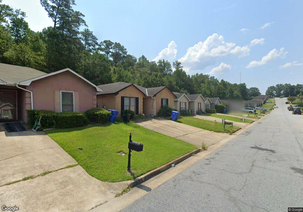
2172 Hunter Ct Columbus, GA 31907
Eastern Columbus NeighborhoodEstimated Value: $103,000 - $125,128
3
Beds
3
Baths
1,092
Sq Ft
$107/Sq Ft
Est. Value
About This Home
This home is located at 2172 Hunter Ct, Columbus, GA 31907 and is currently estimated at $117,032, approximately $107 per square foot. 2172 Hunter Ct is a home located in Muscogee County with nearby schools including Taylor Ranch Elementary School, Forrest Road Elementary School, and Fort Middle School.
Ownership History
Date
Name
Owned For
Owner Type
Purchase Details
Closed on
Dec 16, 2022
Sold by
Monroe Jerry W
Bought by
Monroe Jerry W and Monroe Angela
Current Estimated Value
Purchase Details
Closed on
Aug 28, 2014
Sold by
Bank Of America
Bought by
Monroe Jerry W
Purchase Details
Closed on
Jun 3, 2014
Sold by
Jones Martin
Bought by
Bank Of America
Purchase Details
Closed on
Sep 24, 2010
Sold by
M N M Properties Llc
Bought by
Monroe Jerry W and Monroe Angela M
Purchase Details
Closed on
Mar 26, 2010
Sold by
Johnson Merisha F
Bought by
Jones Martin
Home Financials for this Owner
Home Financials are based on the most recent Mortgage that was taken out on this home.
Original Mortgage
$95,144
Interest Rate
5.5%
Mortgage Type
FHA
Create a Home Valuation Report for This Property
The Home Valuation Report is an in-depth analysis detailing your home's value as well as a comparison with similar homes in the area
Home Values in the Area
Average Home Value in this Area
Purchase History
| Date | Buyer | Sale Price | Title Company |
|---|---|---|---|
| Monroe Jerry W | -- | -- | |
| Monroe Jerry W | $31,250 | -- | |
| Bank Of America | -- | -- | |
| Monroe Jerry W | -- | None Available | |
| Jones Martin | $96,900 | None Available |
Source: Public Records
Mortgage History
| Date | Status | Borrower | Loan Amount |
|---|---|---|---|
| Previous Owner | Jones Martin | $95,144 |
Source: Public Records
Tax History Compared to Growth
Tax History
| Year | Tax Paid | Tax Assessment Tax Assessment Total Assessment is a certain percentage of the fair market value that is determined by local assessors to be the total taxable value of land and additions on the property. | Land | Improvement |
|---|---|---|---|---|
| 2025 | $113 | $43,392 | $8,476 | $34,916 |
| 2024 | $113 | $28,900 | $8,476 | $20,424 |
| 2023 | $1,138 | $28,900 | $8,476 | $20,424 |
| 2022 | $1,052 | $33,188 | $8,476 | $24,712 |
| 2021 | $1,052 | $25,768 | $8,476 | $17,292 |
| 2020 | $987 | $24,172 | $8,476 | $15,696 |
| 2019 | $990 | $24,172 | $8,476 | $15,696 |
| 2018 | $990 | $24,172 | $8,476 | $15,696 |
| 2017 | $993 | $24,172 | $8,476 | $15,696 |
| 2016 | $1,092 | $26,462 | $4,800 | $21,662 |
| 2015 | $207 | $12,500 | $4,800 | $7,700 |
| 2014 | $422 | $39,155 | $4,800 | $34,355 |
| 2013 | -- | $39,155 | $4,800 | $34,355 |
Source: Public Records
Map
Nearby Homes
- 2216 Hunter Ct
- 6782 Mitchell Rd
- 2737 Schatulga Rd
- 2735 Schatulga Rd
- 6916 Bradshaw Dr
- 1925 Woodhollow Dr
- 2708 Courtland Ave
- 6620 Cove Cir
- 6370 Lemongrass Dr
- 6366 Lemongrass Dr
- 6362 Lemongrass Dr
- 6636 Foxboro Dr
- 1607 Mazor Dr
- 2942 Poppy Seed Loop
- 5642 Boby Dr
- 5644 Peggy Dr
- 6213 Fitzgerald Dr
- 6303 Morning Dew Dr
- 6302 Morning Dew Dr
- 6307 Morning Dew Dr
- 2168 Hunter Ct
- 2176 Hunter Ct
- 2164 Hunter Ct
- 2180 Hunter Ct
- 2160 Hunter Ct
- 2184 Hunter Ct
- 2156 Hunter Ct
- 2188 Hunter Ct
- 2152 Hunter Ct
- 2192 Hunter Ct
- 2175 Hunter Ct
- 2179 Hunter Ct
- 2171 Hunter Ct
- 2183 Hunter Ct
- 2167 Hunter Ct
- 2196 Hunter Ct
- 2148 Hunter Ct
- 2163 Hunter Ct
- 2187 Hunter Ct
- 2333 Schatulga Rd