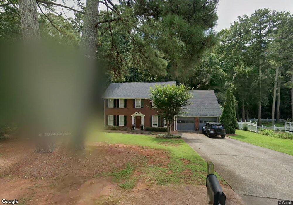
2172 Tully Wren NE Unit 1 Marietta, GA 30066
Sandy Plains NeighborhoodEstimated Value: $499,000 - $594,000
4
Beds
3
Baths
2,428
Sq Ft
$226/Sq Ft
Est. Value
About This Home
This home is located at 2172 Tully Wren NE Unit 1, Marietta, GA 30066 and is currently estimated at $547,631, approximately $225 per square foot. 2172 Tully Wren NE Unit 1 is a home located in Cobb County with nearby schools including Rocky Mount Elementary School, Simpson Middle School, and Lassiter High School.
Ownership History
Date
Name
Owned For
Owner Type
Purchase Details
Closed on
Sep 30, 2004
Sold by
Deye Patricia J
Bought by
Holsclaw Andrea
Current Estimated Value
Home Financials for this Owner
Home Financials are based on the most recent Mortgage that was taken out on this home.
Original Mortgage
$160,000
Outstanding Balance
$71,071
Interest Rate
4.25%
Mortgage Type
New Conventional
Estimated Equity
$476,560
Create a Home Valuation Report for This Property
The Home Valuation Report is an in-depth analysis detailing your home's value as well as a comparison with similar homes in the area
Home Values in the Area
Average Home Value in this Area
Purchase History
| Date | Buyer | Sale Price | Title Company |
|---|---|---|---|
| Holsclaw Andrea | $200,000 | -- |
Source: Public Records
Mortgage History
| Date | Status | Borrower | Loan Amount |
|---|---|---|---|
| Open | Holsclaw Andrea | $160,000 |
Source: Public Records
Tax History Compared to Growth
Tax History
| Year | Tax Paid | Tax Assessment Tax Assessment Total Assessment is a certain percentage of the fair market value that is determined by local assessors to be the total taxable value of land and additions on the property. | Land | Improvement |
|---|---|---|---|---|
| 2024 | $4,591 | $183,116 | $40,000 | $143,116 |
| 2023 | $4,048 | $183,116 | $40,000 | $143,116 |
| 2022 | $3,925 | $151,132 | $36,000 | $115,132 |
| 2021 | $3,483 | $130,904 | $33,600 | $97,304 |
| 2020 | $3,483 | $130,904 | $33,600 | $97,304 |
| 2019 | $3,483 | $130,904 | $33,600 | $97,304 |
| 2018 | $3,297 | $122,436 | $28,000 | $94,436 |
| 2017 | $3,148 | $122,436 | $28,000 | $94,436 |
| 2016 | $2,199 | $85,376 | $24,000 | $61,376 |
| 2015 | $2,255 | $85,376 | $24,000 | $61,376 |
| 2014 | $2,246 | $84,420 | $0 | $0 |
Source: Public Records
Map
Nearby Homes
- 3599 Downing St Unit 1
- 3756 Shallow Ct
- 3835 Rockhaven Ct
- 3812 Havenrock Dr
- 3819 Havenrock Dr
- 3816 Havenrock Dr
- 3435 Bryant Ln
- 3287 Allegheny Dr
- 2477 Bobbie Dr
- 0 Bluff Stone Trace Unit 7480667
- 3330 Ranch Rd
- 1833 Lake Ebenezer Trail NE
- 3465 Staci Ct NE
- 2315 Rocky Mountain Rd NE
- 4047 Idlewilde Meadows Dr NE
- 4145 Brasher Dr NE
- 2403 Wistful Way
- 2415 Wistful Way
- 2162 Tully Wren NE
- 2182 Tully Wren NE Unit 1
- 2152 Tully Wren NE Unit 1
- 2192 Tully Wren NE
- 2177 Tully Wren NE Unit 1
- 2187 Tully Wren NE
- 2241 Blenheim Ct
- 2142 Tully Wren NE
- 3613 Downing St
- 2157 Tully Wren NE
- 2142R Tully Wren NE
- 2202 Tully Wren NE
- 2247 Blenheim Ct
- 3611 Downing St
- 2147 Tully Wren NE
- 2190 Wenlok Trail NE
- 2092 Tully Wren NE
- 3609 Downing St
- 2180 Wenlok Trail NE
- 2212 Tully Wren NE