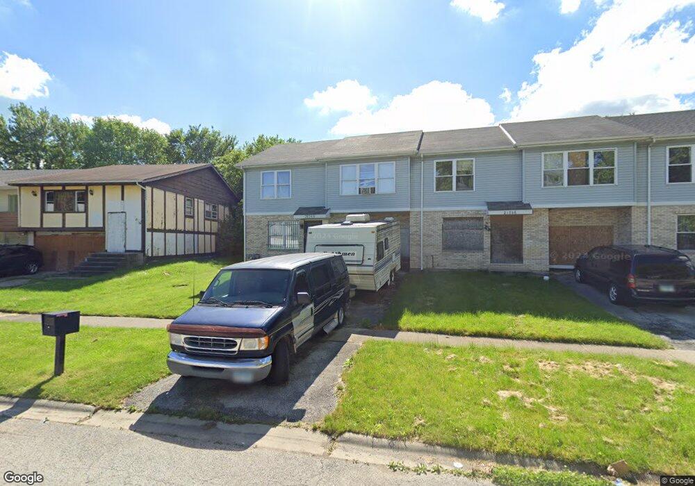
21748 Carol Ave Unit 9 Sauk Village, IL 60411
Estimated Value: $120,402 - $259,000
3
Beds
2
Baths
1,436
Sq Ft
$113/Sq Ft
Est. Value
About This Home
This home is located at 21748 Carol Ave Unit 9, Sauk Village, IL 60411 and is currently estimated at $162,601, approximately $113 per square foot. 21748 Carol Ave Unit 9 is a home located in Cook County with nearby schools including Wagoner Elementary School, Strassburg Elementary School, and Rickover Jr High School.
Ownership History
Date
Name
Owned For
Owner Type
Purchase Details
Closed on
Nov 10, 2015
Sold by
Secretary Of Housing & Urban Development
Bought by
Bishop Annette B
Current Estimated Value
Purchase Details
Closed on
Aug 5, 2014
Sold by
Bank Of America Na
Bought by
The Secretary Of Housing & Urban Develop
Purchase Details
Closed on
Jun 10, 2014
Sold by
The Secretary Of Housing & Urban Develop
Bought by
Bank Of America Na
Purchase Details
Closed on
Feb 11, 2013
Sold by
Jones Myron K
Bought by
Secretary Of Hud
Purchase Details
Closed on
Oct 10, 2006
Sold by
Coyne Chris and Servant Steven
Bought by
Sauk Trail Group Llc
Purchase Details
Closed on
Apr 21, 2006
Sold by
Sauk Trail Group Llc
Bought by
Jones Myron K
Home Financials for this Owner
Home Financials are based on the most recent Mortgage that was taken out on this home.
Original Mortgage
$114,460
Interest Rate
6.54%
Mortgage Type
FHA
Create a Home Valuation Report for This Property
The Home Valuation Report is an in-depth analysis detailing your home's value as well as a comparison with similar homes in the area
Home Values in the Area
Average Home Value in this Area
Purchase History
| Date | Buyer | Sale Price | Title Company |
|---|---|---|---|
| Bishop Annette B | -- | Stewart Title | |
| The Secretary Of Housing & Urban Develop | -- | None Available | |
| Bank Of America Na | -- | None Available | |
| Secretary Of Hud | -- | None Available | |
| Sauk Trail Group Llc | -- | Prairie Title Inc | |
| Jones Myron K | $118,000 | Prairie Title |
Source: Public Records
Mortgage History
| Date | Status | Borrower | Loan Amount |
|---|---|---|---|
| Previous Owner | Jones Myron K | $114,460 |
Source: Public Records
Tax History Compared to Growth
Tax History
| Year | Tax Paid | Tax Assessment Tax Assessment Total Assessment is a certain percentage of the fair market value that is determined by local assessors to be the total taxable value of land and additions on the property. | Land | Improvement |
|---|---|---|---|---|
| 2024 | $1,950 | $8,343 | $1,712 | $6,631 |
| 2023 | $1,302 | $8,343 | $1,712 | $6,631 |
| 2022 | $1,302 | $5,949 | $1,467 | $4,482 |
| 2021 | $496 | $5,949 | $1,467 | $4,482 |
| 2020 | $636 | $5,949 | $1,467 | $4,482 |
| 2019 | $1,967 | $9,573 | $1,344 | $8,229 |
| 2018 | $4,323 | $9,573 | $1,344 | $8,229 |
| 2017 | $4,600 | $9,573 | $1,344 | $8,229 |
| 2016 | $4,449 | $8,778 | $1,222 | $7,556 |
| 2015 | $4,243 | $8,778 | $1,222 | $7,556 |
| 2014 | $4,243 | $8,778 | $1,222 | $7,556 |
| 2013 | $3,875 | $8,777 | $1,222 | $7,555 |
Source: Public Records
Map
Nearby Homes
- 21746 Carol Ave Unit 8
- 21736 Carol Ave
- 21668 Peterson Ave
- 21630 Peterson Ave
- 1913 218th Place
- 21634 Gailine Ave
- 21618 Gailine Ave Unit 2
- 21811 Clyde Ave
- 21636 Clyde Ave
- 21607 Gailine Ave
- 21510 Peterson Ave
- 1950 219th Place
- 21946 Merrill Ave
- 1908 215th Place
- 21643 Merrill Ave
- 2065 219th Place
- 2210 220th St
- 2112 217th Place
- 2135 219th St
- 21836 Orion Ave
- 21746 Carol Ave Unit 1
- 21758 Carol Ave
- 21758 Carol Ave Unit 1
- 21760 Carol Ave
- 21744 Carol Ave
- 21762 Carol Ave
- 21757 Peterson Ave
- 21761 Peterson Ave
- 21738 Carol Ave Unit 6
- 21755 Peterson Ave
- 21764 Carol Ave
- 21763 Peterson Ave
- 21753 Peterson Ave
- 21765 Peterson Ave
- 21736 Carol Ave Unit NONE
- 21751 Peterson Ave
- 21768 Carol Ave
- 21767 Peterson Ave
- 21771 Peterson Ave
- 21747 Peterson Ave