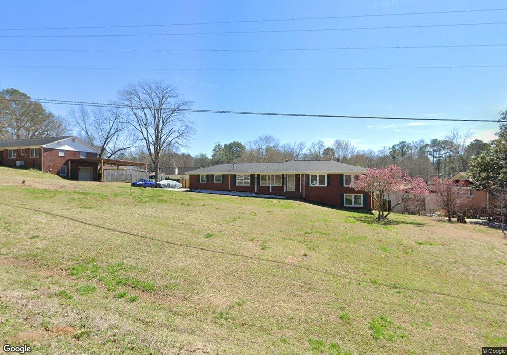
2175 Mcduffie Rd Austell, GA 30106
Estimated Value: $305,303 - $349,000
4
Beds
3
Baths
1,529
Sq Ft
$210/Sq Ft
Est. Value
About This Home
This home is located at 2175 Mcduffie Rd, Austell, GA 30106 and is currently estimated at $320,826, approximately $209 per square foot. 2175 Mcduffie Rd is a home located in Cobb County with nearby schools including Clarkdale Elementary School, Garrett Middle School, and South Cobb High School.
Ownership History
Date
Name
Owned For
Owner Type
Purchase Details
Closed on
Dec 30, 2010
Sold by
Bray Frances G A
Bought by
Miller Kelly
Current Estimated Value
Home Financials for this Owner
Home Financials are based on the most recent Mortgage that was taken out on this home.
Original Mortgage
$112,084
Outstanding Balance
$74,165
Interest Rate
4.25%
Mortgage Type
FHA
Estimated Equity
$246,661
Create a Home Valuation Report for This Property
The Home Valuation Report is an in-depth analysis detailing your home's value as well as a comparison with similar homes in the area
Home Values in the Area
Average Home Value in this Area
Purchase History
| Date | Buyer | Sale Price | Title Company |
|---|---|---|---|
| Miller Kelly | $115,200 | -- |
Source: Public Records
Mortgage History
| Date | Status | Borrower | Loan Amount |
|---|---|---|---|
| Open | Miller Kelly | $112,084 |
Source: Public Records
Tax History
| Year | Tax Paid | Tax Assessment Tax Assessment Total Assessment is a certain percentage of the fair market value that is determined by local assessors to be the total taxable value of land and additions on the property. | Land | Improvement |
|---|---|---|---|---|
| 2025 | $2,674 | $120,212 | $24,000 | $96,212 |
| 2024 | $2,676 | $120,212 | $24,000 | $96,212 |
| 2023 | $1,794 | $104,560 | $14,000 | $90,560 |
Source: Public Records
Map
Nearby Homes
- 2110 Plum Ln
- 4420 Pink Rose Ct
- 4630 Hemlock Dr
- 2349 Shire Ct
- 2034 Drennon Ave
- 2373 Buckley Ct
- 2085 Lenoa Ln
- 2083 Lenoa Ln
- 2081 Lenoa Ln
- 2013 Chesley Dr
- 4287 Keats Ct
- 4809 Hemlock Dr
- 4349 Kousa Rd Unit 4
- 1951 Bay Beauty Ln Unit 10
- 1809 Elmwood Dr
- 4688 Bennett St
- 1808 Elmwood Dr
- 2125 Clay Rd SW
- 4390 Chelou Dr
- 0 Clay Rd
- 2187 Mcduffie Rd
- 2161 Mcduffie Rd Unit 4
- 2130 Plum Ln
- 2140 Plum Ln
- 2120 Plum Ln Unit 5
- 2203 Mcduffie Rd Unit 4
- 2145 Mcduffie Rd
- 2150 Plum Ln
- 2215 Mcduffie Rd
- 2133 Mcduffie Rd Unit 4
- 2131 Plum Ln Unit 5
- 4500 Sparrowhawk Place
- 2141 Plum Ln
- 2121 Plum Ln Unit 5
- 2160 Plum Ln
- 2100 Plum Ln
- 2151 Plum Ln Unit 5
- 2111 Plum Ln Unit 5
- 4490 Sparrowhawk Place SW
- 2150 Mcduffie Rd
Your Personal Tour Guide
Ask me questions while you tour the home.