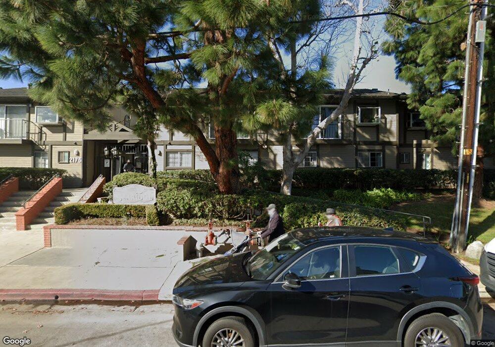
2175 Pacific Ave Unit D6 Costa Mesa, CA 92627
Westside Costa Mesa NeighborhoodEstimated Value: $754,446 - $827,000
2
Beds
2
Baths
1,117
Sq Ft
$717/Sq Ft
Est. Value
About This Home
This home is located at 2175 Pacific Ave Unit D6, Costa Mesa, CA 92627 and is currently estimated at $800,862, approximately $716 per square foot. 2175 Pacific Ave Unit D6 is a home located in Orange County with nearby schools including Victoria Elementary School, Charles W. Tewinkle Middle School, and Estancia High School.
Ownership History
Date
Name
Owned For
Owner Type
Purchase Details
Closed on
Feb 11, 2019
Sold by
Strauss Stephanie M and Strauss Stephanie Monika
Bought by
Strauss Stephanie M and The Stephanie Strauss Trust
Current Estimated Value
Purchase Details
Closed on
Mar 27, 2009
Sold by
Berger Julie A
Bought by
Strauss Stephanie Monika
Home Financials for this Owner
Home Financials are based on the most recent Mortgage that was taken out on this home.
Original Mortgage
$250,000
Outstanding Balance
$158,887
Interest Rate
5.04%
Mortgage Type
Purchase Money Mortgage
Estimated Equity
$641,975
Purchase Details
Closed on
May 12, 2006
Sold by
Miller Michael and Miller Kit Ling Sui
Bought by
Berger Julie A
Home Financials for this Owner
Home Financials are based on the most recent Mortgage that was taken out on this home.
Original Mortgage
$114,700
Interest Rate
6.52%
Mortgage Type
Credit Line Revolving
Purchase Details
Closed on
Feb 28, 2005
Sold by
Miller Michael Steven and Miller Kit Ling Sul
Bought by
Miller Michael and Miller Kit Ling Sui
Home Financials for this Owner
Home Financials are based on the most recent Mortgage that was taken out on this home.
Original Mortgage
$421,425
Interest Rate
5.5%
Mortgage Type
FHA
Purchase Details
Closed on
Feb 11, 2004
Sold by
Miller Michael Steven
Bought by
Miller Michael Steven and Miller Kit Ling Sul
Home Financials for this Owner
Home Financials are based on the most recent Mortgage that was taken out on this home.
Original Mortgage
$397,000
Interest Rate
8%
Mortgage Type
New Conventional
Purchase Details
Closed on
Sep 26, 2002
Sold by
Rosenthal Stanley
Bought by
Miller Michael Steven
Home Financials for this Owner
Home Financials are based on the most recent Mortgage that was taken out on this home.
Original Mortgage
$279,000
Interest Rate
7.87%
Create a Home Valuation Report for This Property
The Home Valuation Report is an in-depth analysis detailing your home's value as well as a comparison with similar homes in the area
Home Values in the Area
Average Home Value in this Area
Purchase History
| Date | Buyer | Sale Price | Title Company |
|---|---|---|---|
| Strauss Stephanie M | -- | None Available | |
| Strauss Stephanie Monika | $390,000 | Usa National Title Company | |
| Berger Julie A | -- | Ticor Title Co Fullerton | |
| Miller Michael | -- | Fidelity National Title Co | |
| Miller Michael Steven | -- | Landsafe Title | |
| Miller Michael Steven | $310,000 | Landsafe Title | |
| Rosenthal Stanley | -- | Landsafe Title |
Source: Public Records
Mortgage History
| Date | Status | Borrower | Loan Amount |
|---|---|---|---|
| Open | Strauss Stephanie Monika | $250,000 | |
| Previous Owner | Berger Julie A | $114,700 | |
| Previous Owner | Miller Michael | $421,425 | |
| Previous Owner | Miller Michael Steven | $397,000 | |
| Previous Owner | Miller Michael Steven | $279,000 |
Source: Public Records
Tax History
| Year | Tax Paid | Tax Assessment Tax Assessment Total Assessment is a certain percentage of the fair market value that is determined by local assessors to be the total taxable value of land and additions on the property. | Land | Improvement |
|---|---|---|---|---|
| 2025 | $5,691 | $502,219 | $375,377 | $126,842 |
| 2024 | $5,691 | $492,372 | $368,017 | $124,355 |
| 2023 | $5,540 | $482,718 | $360,801 | $121,917 |
| 2022 | $5,392 | $473,253 | $353,726 | $119,527 |
| 2021 | $5,260 | $463,974 | $346,790 | $117,184 |
| 2020 | $5,209 | $459,217 | $343,234 | $115,983 |
| 2019 | $5,108 | $450,213 | $336,504 | $113,709 |
| 2018 | $5,009 | $441,386 | $329,906 | $111,480 |
| 2017 | $4,922 | $432,732 | $323,437 | $109,295 |
| 2016 | $4,813 | $424,248 | $317,096 | $107,152 |
| 2015 | $4,764 | $417,876 | $312,333 | $105,543 |
| 2014 | $4,616 | $409,691 | $306,215 | $103,476 |
Source: Public Records
Map
Nearby Homes
- 1124 Victoria St
- 1113 Valley Cir
- 2231 Pacific Ave Unit 1
- 1106 Ridgecrest Cir
- 2235 Canyon Dr
- 2074 Meadow View Ln
- 2230 Canyon Dr
- 21372 Brookhurst St Unit 226
- 2053 Meadow View Ln
- 21282 Wavecrest Cir
- 21 Summerwalk Ct
- 15 Big Dipper Ct Unit 24
- 934 Governor St
- 2110 President Place
- 21372 Green Cove Cir
- 911 Darrell St
- 10052 Cliff Dr
- 1945 Sundance Ln
- 21382 Lemontree Ln
- 21361 Lemontree Ln
- 2175 Pacific Ave
- 2175 Pacific Ave
- 2175 Pacific Ave Unit G2
- 2175 Pacific Ave Unit H2
- 2175 Pacific Ave Unit A5
- 2175 Pacific Ave Unit E3
- 2175 Pacific Ave Unit C5
- 2175 Pacific Ave Unit D3
- 2175 Pacific Ave Unit D4
- 2175 Pacific Ave Unit A1
- 2175 Pacific Ave Unit C4
- 2175 Pacific Ave Unit B1
- 2175 Pacific Ave Unit B2
- 2175 Pacific Ave Unit F2
- 2175 Pacific Ave Unit B5
- 2175 Pacific Ave Unit H4
- 2175 Pacific Ave Unit D2
- 2175 Pacific Ave Unit H1
- 2175 Pacific Ave Unit G6
- 2175 Pacific Ave Unit D5
Your Personal Tour Guide
Ask me questions while you tour the home.