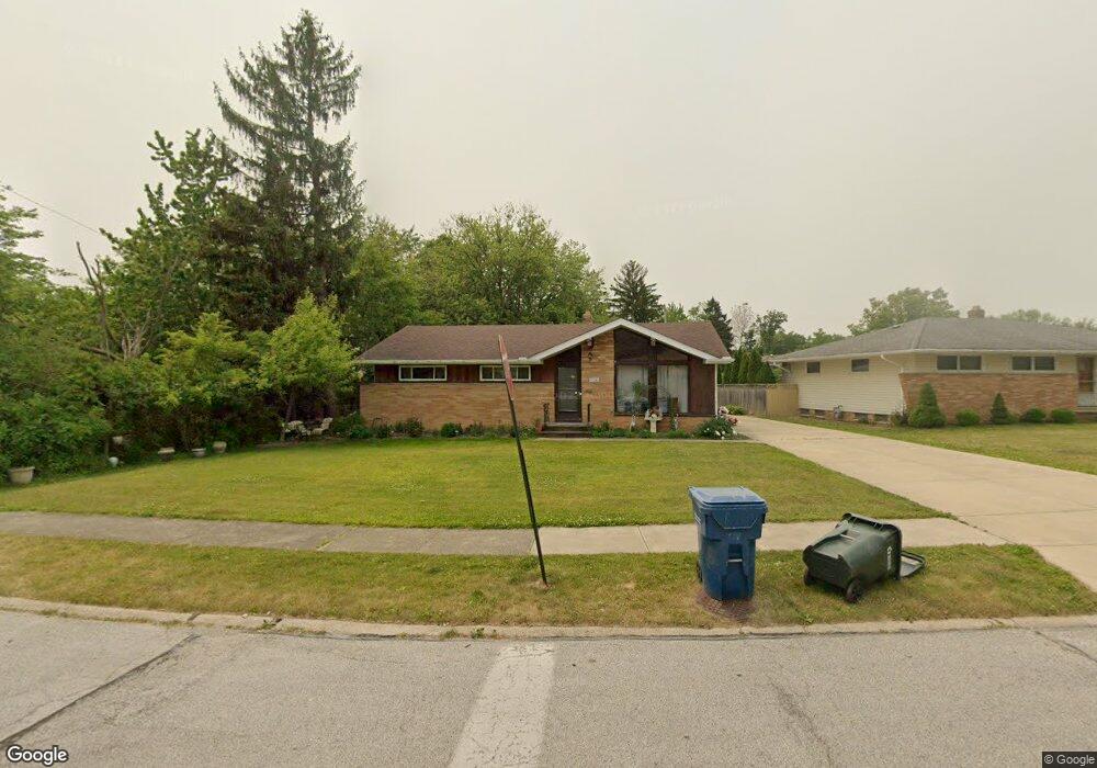
21761 Briarwood Dr Cleveland, OH 44126
Estimated Value: $265,000 - $307,000
3
Beds
2
Baths
1,232
Sq Ft
$227/Sq Ft
Est. Value
About This Home
This home is located at 21761 Briarwood Dr, Cleveland, OH 44126 and is currently estimated at $280,258, approximately $227 per square foot. 21761 Briarwood Dr is a home located in Cuyahoga County with nearby schools including Gilles-Sweet Elementary School, Lewis F Mayer Middle School, and Fairview High School.
Ownership History
Date
Name
Owned For
Owner Type
Purchase Details
Closed on
Jul 26, 2024
Sold by
Arkoush Maha E and Trunkett Maha E
Bought by
Arkoush Rogy
Current Estimated Value
Purchase Details
Closed on
Sep 28, 2010
Sold by
Kerber Anthony W
Bought by
Arkoush Maha E
Home Financials for this Owner
Home Financials are based on the most recent Mortgage that was taken out on this home.
Original Mortgage
$105,317
Interest Rate
4.5%
Mortgage Type
FHA
Purchase Details
Closed on
Apr 8, 2010
Sold by
Thompson Brian
Bought by
Daniels James R
Purchase Details
Closed on
Aug 18, 1983
Sold by
Hovanetz William R and Hovanetz Mary L
Bought by
Komer Frank S
Purchase Details
Closed on
Jan 1, 1975
Bought by
Hovanetz William R and Hovanetz Mary L
Create a Home Valuation Report for This Property
The Home Valuation Report is an in-depth analysis detailing your home's value as well as a comparison with similar homes in the area
Home Values in the Area
Average Home Value in this Area
Purchase History
| Date | Buyer | Sale Price | Title Company |
|---|---|---|---|
| Arkoush Rogy | $162,700 | None Listed On Document | |
| Arkoush Maha E | $108,000 | Ohio Title Corp | |
| Daniels James R | $120,000 | Attorney | |
| Komer Frank S | $68,000 | -- | |
| Hovanetz William R | -- | -- |
Source: Public Records
Mortgage History
| Date | Status | Borrower | Loan Amount |
|---|---|---|---|
| Previous Owner | Arkoush Maha E | $105,317 |
Source: Public Records
Tax History Compared to Growth
Tax History
| Year | Tax Paid | Tax Assessment Tax Assessment Total Assessment is a certain percentage of the fair market value that is determined by local assessors to be the total taxable value of land and additions on the property. | Land | Improvement |
|---|---|---|---|---|
| 2024 | $5,934 | $86,345 | $21,175 | $65,170 |
| 2023 | $4,605 | $56,950 | $18,620 | $38,330 |
| 2022 | $4,491 | $56,945 | $18,620 | $38,325 |
| 2021 | $4,581 | $56,950 | $18,620 | $38,330 |
| 2020 | $4,216 | $45,920 | $15,020 | $30,910 |
| 2019 | $3,750 | $131,200 | $42,900 | $88,300 |
| 2018 | $3,753 | $45,920 | $15,020 | $30,910 |
| 2017 | $3,316 | $37,390 | $12,290 | $25,100 |
| 2016 | $3,293 | $37,390 | $12,290 | $25,100 |
| 2015 | $3,174 | $37,390 | $12,290 | $25,100 |
| 2014 | $3,174 | $36,300 | $11,940 | $24,360 |
Source: Public Records
Map
Nearby Homes
- 20930 Mastick Rd
- 22534 Bard Ave
- 22506 Sharon Ln
- 22503 Sandy Ln
- 5951 Rockport Ln
- 22045 Morton Ave
- 22247 Mastick Rd
- 4464 W 224th St
- 4627 W 223rd St
- 21763 Hillsdale Ave
- 21437 Hillsdale Ave
- 22934 Mastick Rd Unit 102
- 4514 Orchard Rd
- 4309 W 222nd St
- 4710 Grayton Rd
- 4720 Grayton Rd
- 22968 Maple Ridge Rd Unit 103
- 22976 Maple Ridge Rd Unit B 105
- 4401 Fairview Park
- 22895 Mastick Rd
- 21781 Briarwood Dr
- 5280 Sherwood Dr
- 21801 Briarwood Dr
- 5294 Sherwood Dr
- 21780 Briarwood Dr
- 21840 Marian Cir
- 21760 Briarwood Dr
- 21821 Briarwood Dr
- 21800 Briarwood Dr
- 21841 Marian Cir
- 5261 Sherwood Dr
- 5281 Sherwood Dr
- 5301 Sherwood Dr
- 21820 Briarwood Dr
- 21841 Briarwood Dr
- 5321 Sherwood Dr
- 5320 Sherwood Dr
- 5341 Sherwood Dr
- 21781 Overlook Dr
- 21840 Briarwood Dr