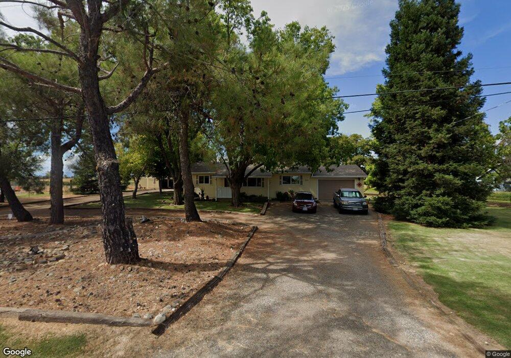
21766 Lone Tree Rd Anderson, CA 96007
Estimated Value: $249,648 - $317,000
About This Home
This home is located at 21766 Lone Tree Rd, Anderson, CA 96007 and is currently estimated at $294,412, approximately $272 per square foot. 21766 Lone Tree Rd is a home located in Shasta County with nearby schools including North Cottonwood, West Cottonwood Junior High School, and Cottonwood Creek Charter School.
Ownership History
We collect this data history from publicly available records. To have your information removed, we recommend requesting removal directly through your county’s website.
Purchase Details
Home Financials for this Owner
Home Financials are based on the most recent Mortgage that was taken out on this home.Purchase Details
Home Financials for this Owner
Home Financials are based on the most recent Mortgage that was taken out on this home.Purchase History
We collect this data history from publicly available records. To have your information removed, we recommend requesting removal directly through your county’s website.
| Date | Buyer | Sale Price | Title Company |
|---|---|---|---|
| -- | Placer Title Company | ||
| -- | Fidelity National Title Co |
Mortgage History
We collect this data history from publicly available records. To have your information removed, we recommend requesting removal directly through your county’s website.
| Date | Status | Borrower | Loan Amount |
|---|---|---|---|
| Closed | $82,300 | ||
| Closed | $81,000 |
Tax History
We collect this data history from publicly available records. To have your information removed, we recommend requesting removal directly through your county’s website.
| Year | Tax Paid | Tax Assessment Tax Assessment Total Assessment is a certain percentage of the fair market value that is determined by local assessors to be the total taxable value of land and additions on the property. | Land | Improvement |
|---|---|---|---|---|
| 2025 | $1,385 | $128,198 | $34,433 | $93,765 |
| 2024 | $1,356 | $125,685 | $33,758 | $91,927 |
| 2023 | $1,356 | $123,222 | $33,097 | $90,125 |
| 2022 | $1,324 | $120,807 | $32,449 | $88,358 |
| 2021 | $1,315 | $118,439 | $31,813 | $86,626 |
| 2020 | $1,283 | $117,225 | $31,487 | $85,738 |
| 2019 | $1,266 | $114,927 | $30,870 | $84,057 |
| 2018 | $1,241 | $112,674 | $30,265 | $82,409 |
| 2017 | $1,241 | $110,466 | $29,672 | $80,794 |
| 2016 | $1,138 | $108,301 | $29,091 | $79,210 |
| 2015 | $1,142 | $106,676 | $28,655 | $78,021 |
| 2014 | $1,114 | $104,587 | $28,094 | $76,493 |
Map
- 4072 Balls Ferry Rd
- 22148 Lone Tree Rd
- 4208 Balls Ferry Rd
- 4832 Balls Ferry Rd
- 4910 Balls Ferry Rd
- 0 Jim Dandy Rd
- 21221 Kimberly Rd
- 22405 Venzke Rd
- 5227 Hopson Rd
- 4750 Pheasant Dr
- 21357 Trefoil Ln
- 000 Vantage Dr
- 5340 Balls Ferry Rd
- 0000 Balls Ferry Rd
- 21941 Reading Dr
- 3760 Locust Rd
- 0 Deschutes Unit 26-2427
- 000 Riverland Dr
- 22011 Reading Dr
- 3850 Main St
- 21748 Lone Tree Rd
- 21789 Lone Tree Rd
- 21710 Lone Tree Rd
- 21719 Lone Tree Rd
- 21692 Lone Tree Rd
- 21846 Lone Tree Rd
- 4443 Hereford Way
- 21848 Lone Tree Rd
- 21688 Lone Tree Rd
- 21690 Lone Tree Rd
- 21855 Lone Tree Rd
- 4431 Hereford Way
- 4301 Panorama Point Rd
- 21686 Lone Tree Rd
- 4354 Hereford Way
- 2235 Lone Tree Rd
- 4241 Panorama Point Rd
- 21904 Lone Tree Rd
- 21932 Lone Tree Rd
- 4395 Hereford Way
Ask me questions while you tour the home.