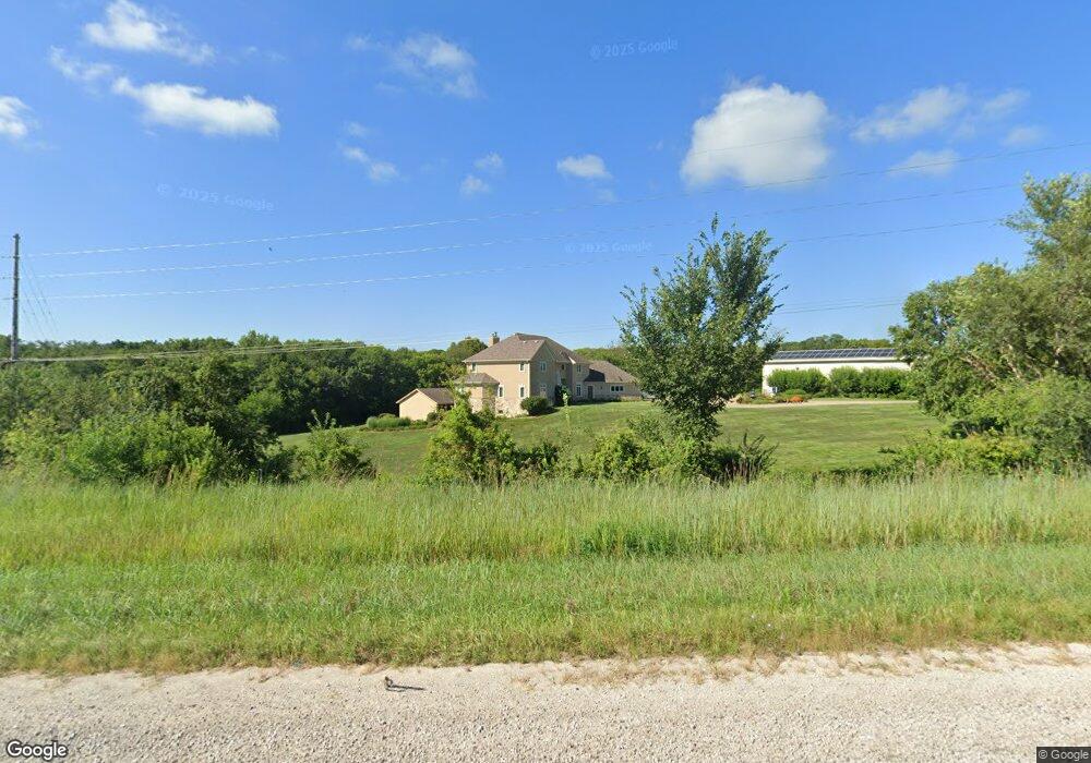
21790 Highway 5 Hartford, IA 50118
Warren County NeighborhoodEstimated Value: $553,000 - $995,413
6
Beds
10
Baths
4,127
Sq Ft
$171/Sq Ft
Est. Value
About This Home
This home is located at 21790 Highway 5, Hartford, IA 50118 and is currently estimated at $703,804, approximately $170 per square foot. 21790 Highway 5 is a home located in Warren County with nearby schools including Carlisle Elementary School, Hartford Upper Elementary School, and Carlisle Middle School.
Ownership History
Date
Name
Owned For
Owner Type
Purchase Details
Closed on
Nov 21, 2024
Sold by
Christopher Douglas Mccormick Revocable and Dixie Marie Mccormick Revocable Trust
Bought by
Timothy Charles Mccoy Trust and Kathleen Sue Mccormick Mccoy Trust
Current Estimated Value
Purchase Details
Closed on
Jul 19, 2024
Sold by
Mccoy Timothy Charles and Mccoy Kathleen Sue
Bought by
Timothy Charles Mccoy Trust and Kathleen Sue Mccormick Mccoy Trust
Create a Home Valuation Report for This Property
The Home Valuation Report is an in-depth analysis detailing your home's value as well as a comparison with similar homes in the area
Home Values in the Area
Average Home Value in this Area
Purchase History
| Date | Buyer | Sale Price | Title Company |
|---|---|---|---|
| Timothy Charles Mccoy Trust | -- | None Listed On Document | |
| Timothy Charles Mccoy Trust | -- | None Listed On Document | |
| Timothy Charles Mccoy Trust | -- | None Listed On Document |
Source: Public Records
Tax History Compared to Growth
Tax History
| Year | Tax Paid | Tax Assessment Tax Assessment Total Assessment is a certain percentage of the fair market value that is determined by local assessors to be the total taxable value of land and additions on the property. | Land | Improvement |
|---|---|---|---|---|
| 2024 | $17,136 | $1,011,800 | $86,000 | $925,800 |
| 2023 | $16,326 | $1,011,800 | $86,000 | $925,800 |
| 2022 | $15,562 | $803,100 | $84,300 | $718,800 |
| 2021 | $16,664 | $803,100 | $84,300 | $718,800 |
| 2020 | $16,664 | $788,000 | $84,300 | $703,700 |
| 2019 | $15,120 | $788,000 | $84,300 | $703,700 |
| 2018 | $15,044 | $743,300 | $0 | $0 |
| 2017 | $15,044 | $743,300 | $0 | $0 |
| 2016 | $13,986 | $714,500 | $0 | $0 |
| 2015 | $13,986 | $714,500 | $0 | $0 |
| 2014 | $12,468 | $632,700 | $0 | $0 |
Source: Public Records
Map
Nearby Homes
- 3333 220th Ave
- 00 Highway 5
- 5825 G24 Hwy
- 22955 Buchanan Trail
- 5101 S23 Hwy
- 19573 G24 Hwy
- 5198 S23 Hwy
- 01 S23 Hwy
- 24479 Elthon Place
- 18670 Delaware Place
- 118 Dubuque St
- 203 Brown St
- 502 Brown St
- Parcel FD 18000 BLK Fulton St
- Parcel FC 18000 BLK Fulton St
- 12028 SE 64th Ave
- 21438 Hayes St
- 415 Jefferson St
- 16211 Drake Trail
- 1270 Hardin Dr