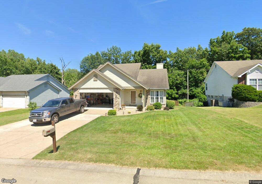
218 Birmingham Dr O Fallon, MO 63366
Estimated Value: $309,000 - $348,000
3
Beds
2
Baths
1,572
Sq Ft
$208/Sq Ft
Est. Value
About This Home
This home is located at 218 Birmingham Dr, O Fallon, MO 63366 and is currently estimated at $327,621, approximately $208 per square foot. 218 Birmingham Dr is a home located in St. Charles County with nearby schools including Joseph L. Mudd Elementary School, Forest Park Elementary School, and Fort Zumwalt North Middle School.
Ownership History
Date
Name
Owned For
Owner Type
Purchase Details
Closed on
Mar 25, 1999
Sold by
Cody Properties Llc
Bought by
Collins Patrick and Collins Angie
Current Estimated Value
Home Financials for this Owner
Home Financials are based on the most recent Mortgage that was taken out on this home.
Original Mortgage
$108,750
Outstanding Balance
$26,477
Interest Rate
6.82%
Estimated Equity
$301,144
Purchase Details
Closed on
Feb 19, 1999
Sold by
Fels Kenneth C
Bought by
Cody Properties Llc
Home Financials for this Owner
Home Financials are based on the most recent Mortgage that was taken out on this home.
Original Mortgage
$108,750
Outstanding Balance
$26,477
Interest Rate
6.82%
Estimated Equity
$301,144
Create a Home Valuation Report for This Property
The Home Valuation Report is an in-depth analysis detailing your home's value as well as a comparison with similar homes in the area
Home Values in the Area
Average Home Value in this Area
Purchase History
| Date | Buyer | Sale Price | Title Company |
|---|---|---|---|
| Collins Patrick | $114,500 | -- | |
| Cody Properties Llc | $96,000 | -- |
Source: Public Records
Mortgage History
| Date | Status | Borrower | Loan Amount |
|---|---|---|---|
| Open | Collins Patrick | $108,750 |
Source: Public Records
Tax History Compared to Growth
Tax History
| Year | Tax Paid | Tax Assessment Tax Assessment Total Assessment is a certain percentage of the fair market value that is determined by local assessors to be the total taxable value of land and additions on the property. | Land | Improvement |
|---|---|---|---|---|
| 2025 | $2,935 | $48,304 | -- | -- |
| 2023 | $2,937 | $44,215 | $0 | $0 |
| 2022 | $2,659 | $37,211 | $0 | $0 |
| 2021 | $2,661 | $37,211 | $0 | $0 |
| 2020 | $2,475 | $33,545 | $0 | $0 |
| 2019 | $2,480 | $33,545 | $0 | $0 |
| 2018 | $2,297 | $29,637 | $0 | $0 |
| 2017 | $2,262 | $29,637 | $0 | $0 |
| 2016 | $2,369 | $30,930 | $0 | $0 |
| 2015 | $2,202 | $30,930 | $0 | $0 |
| 2014 | $2,168 | $29,942 | $0 | $0 |
Source: Public Records
Map
Nearby Homes
- 21 Limerick Ln
- 403 Montbrook Dr
- 3 Limerick Ln Unit 19A
- 326 Westridge Dr
- 6 Autumn Grove Ct
- 731 Cordes St
- 609 Peace Dr
- 423 Woodlawn Ave
- 303 Church St
- 735 Sunset Ln
- 207 Cordes St
- 323 Linda Ln
- 863 Emge Rd
- 35 Chip Dr
- 205 E Elm St
- 38 Downing St
- 206 Saint Leo Dr
- 151 N Wellington St
- 147 S Wellington
- 16 Fort Zumwalt Dr
- 214 Birmingham Dr
- 222 Birmingham Dr
- 210 Birmingham Dr
- 226 Birmingham Dr
- 219 Birmingham Dr
- 215 Birmingham Dr
- 223 Birmingham Dr
- 206 Birmingham Dr
- 230 Birmingham Dr
- 211 Birmingham Dr
- 227 Birmingham Dr
- 207 Birmingham Dr
- 234 Birmingham Dr
- 231 Birmingham Dr
- 218 Surrey Ct
- 214 Surrey Ct
- 202 Birmingham Dr
- 222 Surrey Ct
- 210 Surrey Ct
- 203 Birmingham Dr