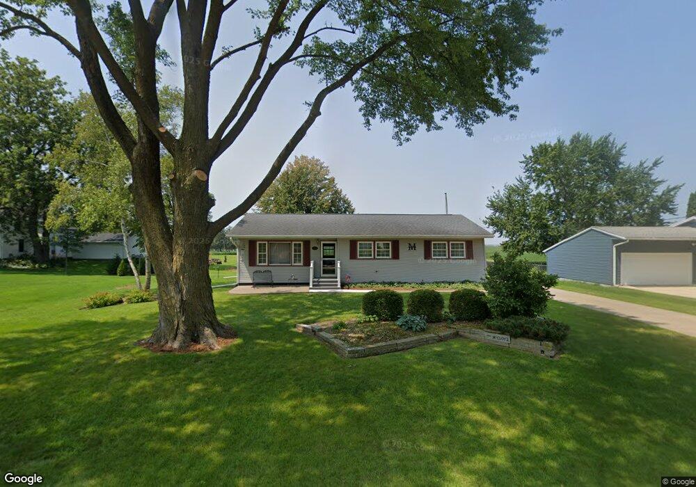
218 Bloomfield Ave Delmar, IA 52037
Estimated Value: $136,000 - $164,000
3
Beds
1
Bath
1,224
Sq Ft
$123/Sq Ft
Est. Value
About This Home
This home is located at 218 Bloomfield Ave, Delmar, IA 52037 and is currently estimated at $150,461, approximately $122 per square foot. 218 Bloomfield Ave is a home located in Clinton County with nearby schools including Delwood Elementary School.
Ownership History
Date
Name
Owned For
Owner Type
Purchase Details
Closed on
Sep 1, 2015
Sold by
The Estate Of Madonna M Mccloy
Bought by
Mccloy Marlene M
Current Estimated Value
Home Financials for this Owner
Home Financials are based on the most recent Mortgage that was taken out on this home.
Original Mortgage
$60,000
Outstanding Balance
$46,883
Interest Rate
3.84%
Mortgage Type
Future Advance Clause Open End Mortgage
Estimated Equity
$103,578
Create a Home Valuation Report for This Property
The Home Valuation Report is an in-depth analysis detailing your home's value as well as a comparison with similar homes in the area
Home Values in the Area
Average Home Value in this Area
Purchase History
| Date | Buyer | Sale Price | Title Company |
|---|---|---|---|
| Mccloy Marlene M | $75,000 | None Available |
Source: Public Records
Mortgage History
| Date | Status | Borrower | Loan Amount |
|---|---|---|---|
| Open | Mccloy Marlene M | $60,000 |
Source: Public Records
Tax History Compared to Growth
Tax History
| Year | Tax Paid | Tax Assessment Tax Assessment Total Assessment is a certain percentage of the fair market value that is determined by local assessors to be the total taxable value of land and additions on the property. | Land | Improvement |
|---|---|---|---|---|
| 2025 | $2,086 | $135,470 | $17,390 | $118,080 |
| 2024 | $2,086 | $142,920 | $17,390 | $125,530 |
| 2023 | $2,050 | $142,920 | $17,390 | $125,530 |
| 2022 | $1,784 | $133,860 | $17,390 | $116,470 |
| 2021 | $1,418 | $110,070 | $19,870 | $90,200 |
| 2020 | $1,418 | $94,150 | $19,870 | $74,280 |
| 2019 | $1,300 | $88,840 | $0 | $0 |
| 2018 | $1,266 | $88,840 | $0 | $0 |
| 2017 | $1,266 | $88,840 | $0 | $0 |
| 2016 | $1,062 | $76,010 | $0 | $0 |
| 2015 | $1,062 | $76,010 | $0 | $0 |
| 2014 | $1,060 | $76,010 | $0 | $0 |
| 2013 | $1,010 | $0 | $0 | $0 |
Source: Public Records
Map
Nearby Homes
- 105 Richland St
- 2541 130th St
- 1389 260th Ave
- Lot 2 Timber Dr
- Lot 3 Timber Dr
- Lot 1 Timber Dr
- 2812 145th St
- 0 Nairn Dr Unit 153479
- 1374 290th Ave
- 108 W Monroe St
- 712 S 2nd St
- 407 S Niagara St
- 302 E Maple St
- 313 S 4th St
- 210 S 2nd St
- 706 Myatt Dr Unit A & B
- 124 E Platt St
- 310 N Dearborn St
- 911 Lisa Dr
- 2120 174th Ave
- 118 Market St
- 216 Bloomfield Ave
- 206 Market St
- 114 Market St
- 202 Market St
- 217 Bloomfield Ave
- 119 Market St
- 215 Bloomfield Ave
- 303 Bloomfield Ave
- 117 Market St
- 214 Ridge Ave
- 212 Ridge Ave
- 304 Bloomfield Ave
- 115 Market St
- 305 Bloomfield Ave
- 302 Ridge Ave
- 104 Short St
- 304 Market St
- 0000 Ridge
- 309 Bloomfield Ave