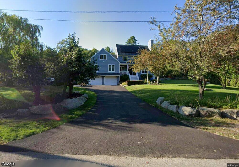
218 Bray St Gloucester, MA 01930
West Gloucester NeighborhoodEstimated Value: $1,084,000 - $1,592,000
4
Beds
3
Baths
3,170
Sq Ft
$418/Sq Ft
Est. Value
About This Home
This home is located at 218 Bray St, Gloucester, MA 01930 and is currently estimated at $1,324,728, approximately $417 per square foot. 218 Bray St is a home located in Essex County with nearby schools including West Parish, Ralph B O'maley Middle School, and Gloucester High School.
Ownership History
Date
Name
Owned For
Owner Type
Purchase Details
Closed on
Aug 29, 2024
Sold by
Pratt Jonathan J and Pratt Marilyn H
Bought by
Pratt
Current Estimated Value
Purchase Details
Closed on
Dec 14, 1992
Sold by
First City Dev Corp
Bought by
Pratt Jonathan J and Pratt Marilyn H
Create a Home Valuation Report for This Property
The Home Valuation Report is an in-depth analysis detailing your home's value as well as a comparison with similar homes in the area
Home Values in the Area
Average Home Value in this Area
Purchase History
| Date | Buyer | Sale Price | Title Company |
|---|---|---|---|
| Pratt | -- | None Available | |
| Pratt | -- | None Available | |
| Pratt Jonathan J | $65,000 | -- | |
| Pratt Jonathan J | $65,000 | -- |
Source: Public Records
Mortgage History
| Date | Status | Borrower | Loan Amount |
|---|---|---|---|
| Previous Owner | Pratt Jonathan J | $377,000 | |
| Previous Owner | Pratt Jonathan J | $393,000 |
Source: Public Records
Tax History
| Year | Tax Paid | Tax Assessment Tax Assessment Total Assessment is a certain percentage of the fair market value that is determined by local assessors to be the total taxable value of land and additions on the property. | Land | Improvement |
|---|---|---|---|---|
| 2025 | $10,825 | $1,113,700 | $297,700 | $816,000 |
| 2024 | $10,698 | $1,099,500 | $283,500 | $816,000 |
| 2023 | $11,543 | $1,090,000 | $253,100 | $836,900 |
| 2022 | $10,225 | $871,700 | $215,100 | $656,600 |
| 2021 | $9,896 | $795,500 | $195,700 | $599,800 |
| 2020 | $9,388 | $761,400 | $195,700 | $565,700 |
| 2019 | $8,750 | $689,500 | $195,700 | $493,800 |
| 2018 | $8,310 | $642,700 | $195,700 | $447,000 |
| 2017 | $9,267 | $702,600 | $286,600 | $416,000 |
| 2016 | $8,765 | $644,000 | $274,100 | $369,900 |
| 2015 | $8,550 | $626,400 | $267,900 | $358,500 |
Source: Public Records
Map
Nearby Homes
- 167 Atlantic St
- 178 Atlantic St
- 226 Atlantic St
- 2 Breezy Point Rd
- 13 Honeysuckle Rd
- 672 Washington St
- 3 Deacon Farm Ln
- 7 Leaman Dr
- 31 Echo Ave
- 5 Samoset Rd Unit B
- 368 Essex Ave
- 24 Cobblestone Ln Unit 603
- 5 Lepage Ln
- 145 Essex Ave Unit 402
- 6 Monroe Ct
- 13 Mystic Ave
- 8 Mystic Ave
- 587 Essex Ave
- 98 Maplewood Ave
- 15 Harvard St
Your Personal Tour Guide
Ask me questions while you tour the home.