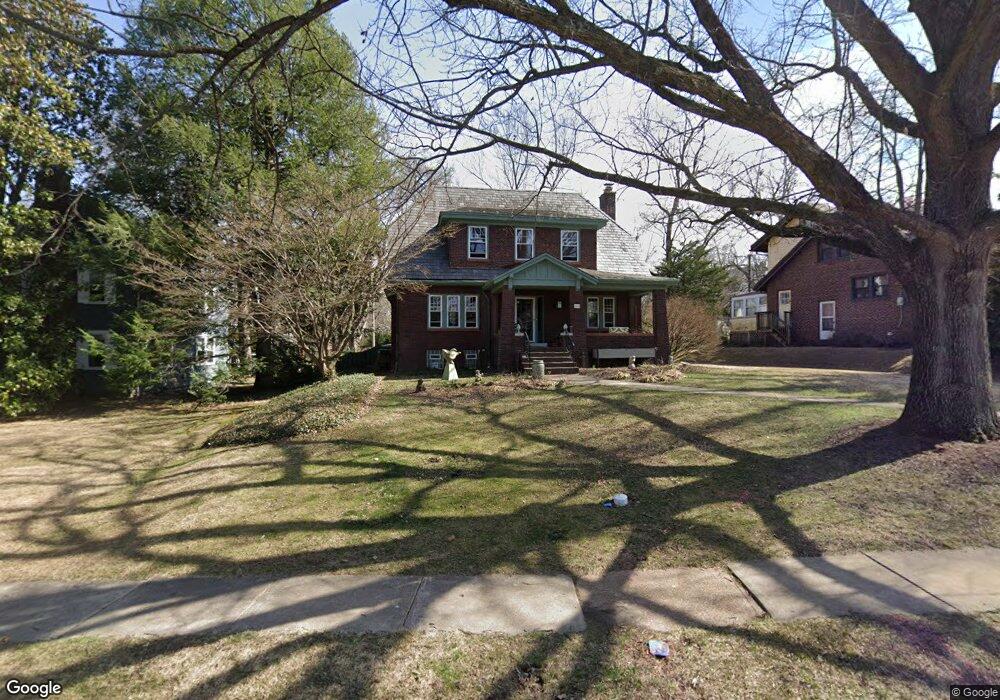
218 Glen Rd Saint Louis, MO 63119
Estimated Value: $698,000 - $821,000
3
Beds
2
Baths
1,924
Sq Ft
$383/Sq Ft
Est. Value
About This Home
This home is located at 218 Glen Rd, Saint Louis, MO 63119 and is currently estimated at $737,706, approximately $383 per square foot. 218 Glen Rd is a home located in St. Louis County with nearby schools including Avery Elementary School, Hixson Middle School, and Webster Groves High School.
Ownership History
Date
Name
Owned For
Owner Type
Purchase Details
Closed on
Apr 24, 2013
Sold by
Bozarth Vernon L and Bozarth Renau
Bought by
Bozarth Vernon L and Bozarth Renau
Current Estimated Value
Purchase Details
Closed on
Aug 17, 2012
Sold by
Arbogast William Daniel and Arbogast Ellen Marie
Bought by
Bozarth Vernon L and Bozarth Renau
Home Financials for this Owner
Home Financials are based on the most recent Mortgage that was taken out on this home.
Original Mortgage
$248,500
Outstanding Balance
$171,338
Interest Rate
3.57%
Mortgage Type
New Conventional
Estimated Equity
$566,368
Purchase Details
Closed on
Dec 6, 2002
Sold by
Arbogast William D and Arbogast Ellen Marie
Bought by
Arbogast William Daniel and Arbogast Ellen Marie
Home Financials for this Owner
Home Financials are based on the most recent Mortgage that was taken out on this home.
Original Mortgage
$180,000
Interest Rate
5.96%
Create a Home Valuation Report for This Property
The Home Valuation Report is an in-depth analysis detailing your home's value as well as a comparison with similar homes in the area
Home Values in the Area
Average Home Value in this Area
Purchase History
| Date | Buyer | Sale Price | Title Company |
|---|---|---|---|
| Bozarth Vernon L | -- | None Available | |
| Bozarth Vernon L | $355,000 | Title Partners Agency Llc | |
| Arbogast William Daniel | -- | -- |
Source: Public Records
Mortgage History
| Date | Status | Borrower | Loan Amount |
|---|---|---|---|
| Open | Bozarth Vernon L | $248,500 | |
| Previous Owner | Arbogast William Daniel | $180,000 |
Source: Public Records
Tax History Compared to Growth
Tax History
| Year | Tax Paid | Tax Assessment Tax Assessment Total Assessment is a certain percentage of the fair market value that is determined by local assessors to be the total taxable value of land and additions on the property. | Land | Improvement |
|---|---|---|---|---|
| 2025 | $7,579 | $116,060 | $95,820 | $20,240 |
| 2024 | $7,579 | $109,220 | $64,660 | $44,560 |
| 2023 | $7,542 | $109,220 | $64,660 | $44,560 |
| 2022 | $8,158 | $109,790 | $64,660 | $45,130 |
| 2021 | $8,130 | $109,790 | $64,660 | $45,130 |
| 2020 | $7,514 | $94,490 | $57,480 | $37,010 |
| 2019 | $7,461 | $94,490 | $57,480 | $37,010 |
| 2018 | $7,262 | $81,680 | $47,610 | $34,070 |
| 2017 | $7,213 | $81,680 | $47,610 | $34,070 |
| 2016 | $5,274 | $57,020 | $32,320 | $24,700 |
| 2015 | $5,299 | $57,020 | $32,320 | $24,700 |
| 2014 | -- | $61,820 | $28,230 | $33,590 |
Source: Public Records
Map
Nearby Homes
- 112 Oakwood Ave
- 441 Park Rd
- 546 Holland Ave
- 450 E Lockwood Ave Unit 303
- 610 Cornelia Ave
- 617 N Elm Ave
- 136 N Gore Ave
- 814 Holland Ave
- 619 N Bompart Ave
- 218 Euclid Ave
- 400 Marion Ave
- 827 Cornell Ave
- 8361 Big Bend Blvd
- 234 Plant Ave
- 156 Gray Ave
- 404 W Kirkham Ave
- 336 Madison Ave
- 716 Clark Ave
- 544 Summit Ave
- 901 Ennis Ave