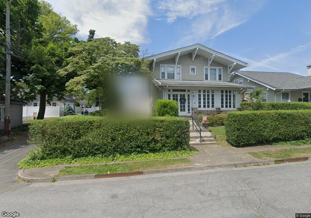
218 S 22nd St Unit 222 Allentown, PA 18104
West End Allentown NeighborhoodEstimated Value: $353,000 - $357,000
4
Beds
3
Baths
1,764
Sq Ft
$202/Sq Ft
Est. Value
About This Home
This home is located at 218 S 22nd St Unit 222, Allentown, PA 18104 and is currently estimated at $355,760, approximately $201 per square foot. 218 S 22nd St Unit 222 is a home located in Lehigh County with nearby schools including Huntington Elementary School, Cleveland School, and Union Terrace Elementary School.
Ownership History
Date
Name
Owned For
Owner Type
Purchase Details
Closed on
Dec 27, 2024
Sold by
Hoin Lori L and Reiss Lori L
Bought by
613 Court St Llc
Current Estimated Value
Home Financials for this Owner
Home Financials are based on the most recent Mortgage that was taken out on this home.
Original Mortgage
$258,750
Outstanding Balance
$256,943
Interest Rate
6.78%
Mortgage Type
New Conventional
Estimated Equity
$98,817
Purchase Details
Closed on
Mar 10, 1997
Sold by
Reiss Ronald W and Reiss Lori L
Bought by
Reiss Lori L
Purchase Details
Closed on
Oct 24, 1988
Sold by
Hoin Terry C
Bought by
Reiss Ronald W and Reiss Lori L
Purchase Details
Closed on
May 29, 1984
Sold by
Hoin Terry C and Hoin Judith A
Bought by
Hoin Terry C
Purchase Details
Closed on
Jul 6, 1979
Bought by
Hoin Terry C and Hoin Judith A
Create a Home Valuation Report for This Property
The Home Valuation Report is an in-depth analysis detailing your home's value as well as a comparison with similar homes in the area
Home Values in the Area
Average Home Value in this Area
Purchase History
| Date | Buyer | Sale Price | Title Company |
|---|---|---|---|
| 613 Court St Llc | $345,000 | First United Land Transfer | |
| 613 Court St Llc | $345,000 | First United Land Transfer | |
| Reiss Lori L | -- | -- | |
| Reiss Ronald W | -- | -- | |
| Hoin Terry C | -- | -- | |
| Hoin Terry C | $63,500 | -- |
Source: Public Records
Mortgage History
| Date | Status | Borrower | Loan Amount |
|---|---|---|---|
| Open | 613 Court St Llc | $258,750 | |
| Closed | 613 Court St Llc | $258,750 |
Source: Public Records
Tax History Compared to Growth
Tax History
| Year | Tax Paid | Tax Assessment Tax Assessment Total Assessment is a certain percentage of the fair market value that is determined by local assessors to be the total taxable value of land and additions on the property. | Land | Improvement |
|---|---|---|---|---|
| 2025 | $5,636 | $166,600 | $25,800 | $140,800 |
| 2024 | $5,636 | $166,600 | $25,800 | $140,800 |
| 2023 | $5,636 | $166,600 | $25,800 | $140,800 |
| 2022 | $5,446 | $166,600 | $140,800 | $25,800 |
| 2021 | $5,342 | $166,600 | $25,800 | $140,800 |
| 2020 | $5,208 | $166,600 | $25,800 | $140,800 |
| 2019 | $5,128 | $166,600 | $25,800 | $140,800 |
| 2018 | $4,754 | $166,600 | $25,800 | $140,800 |
| 2017 | $4,638 | $166,600 | $25,800 | $140,800 |
| 2016 | -- | $166,600 | $25,800 | $140,800 |
| 2015 | -- | $166,600 | $25,800 | $140,800 |
| 2014 | -- | $166,600 | $25,800 | $140,800 |
Source: Public Records
Map
Nearby Homes
- 215 S 23rd St
- 320 S 22nd St
- 2317-2319 Elm St
- 403 S 24th St
- 2411 Union St
- 419 S Ott St
- 2270 Bishop Rd
- 871 Robin Hood Dr
- 303 College Dr
- 129 S Saint Cloud St
- 1840 W Turner St
- 2823 Hamilton Blvd
- 2140 W Gordon St
- 406 S 17th St
- 215 N 19th St
- 2133 W Gordon St Unit 2135
- 39 S 17th St
- 1852 W Chew St
- 128 S West St
- 2895 Hamilton Blvd Unit 104
- 214 S 22nd St Unit 216
- 2201 W Fairview St Unit 2205
- 2207 W Fairview St Unit 2215
- 2203 W Fairview
- 213 S Leh St Unit 221
- 2206 W Union St Unit 2208
- 2202 W Union St Unit 2204
- 2210 W Union St Unit 2214
- 219 S Leh St
- 2215 W Fairview St Unit 2219
- 213 S 22nd St Unit 221
- 2216 W Union St Unit 2220
- 2151 W Fairview St
- 2221 W Fairview St Unit 2225
- 2218 Union St
- 2218 W Union St Unit 2220
- 0 S 22nd St
- 2146 W Union St Unit 2152
- 2143 W Fairview St
- 2140 W Union St Unit 2146