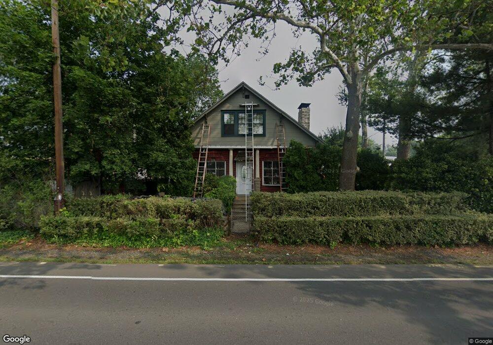
2180 State Rd Bensalem, PA 19020
Estimated Value: $388,375 - $463,000
4
Beds
1
Bath
1,992
Sq Ft
$218/Sq Ft
Est. Value
About This Home
This home is located at 2180 State Rd, Bensalem, PA 19020 and is currently estimated at $433,344, approximately $217 per square foot. 2180 State Rd is a home located in Bucks County with nearby schools including Robert K. Shafer Middle School, School Lane Charter School, and St Charles Borromeo School.
Ownership History
Date
Name
Owned For
Owner Type
Purchase Details
Closed on
Feb 17, 2005
Sold by
Cook Brian and Cook David
Bought by
Cook Brian and Cook Jennifer Anne
Current Estimated Value
Home Financials for this Owner
Home Financials are based on the most recent Mortgage that was taken out on this home.
Original Mortgage
$70,000
Interest Rate
7.5%
Mortgage Type
Adjustable Rate Mortgage/ARM
Purchase Details
Closed on
Jul 10, 1967
Bought by
Cook Clarence J and Cook Marilyn D
Create a Home Valuation Report for This Property
The Home Valuation Report is an in-depth analysis detailing your home's value as well as a comparison with similar homes in the area
Home Values in the Area
Average Home Value in this Area
Purchase History
| Date | Buyer | Sale Price | Title Company |
|---|---|---|---|
| Cook Brian | -- | -- | |
| Cook Brian | -- | -- | |
| Cook Clarence J | -- | -- |
Source: Public Records
Mortgage History
| Date | Status | Borrower | Loan Amount |
|---|---|---|---|
| Open | Cook Brian | $70,000 | |
| Closed | Cook Brian | $70,000 |
Source: Public Records
Tax History Compared to Growth
Tax History
| Year | Tax Paid | Tax Assessment Tax Assessment Total Assessment is a certain percentage of the fair market value that is determined by local assessors to be the total taxable value of land and additions on the property. | Land | Improvement |
|---|---|---|---|---|
| 2025 | $3,318 | $15,200 | $3,440 | $11,760 |
| 2024 | $3,318 | $15,200 | $3,440 | $11,760 |
| 2023 | $3,225 | $15,200 | $3,440 | $11,760 |
| 2022 | $3,206 | $15,200 | $3,440 | $11,760 |
| 2021 | $3,206 | $15,200 | $3,440 | $11,760 |
| 2020 | $3,174 | $15,200 | $3,440 | $11,760 |
| 2019 | $3,103 | $15,200 | $3,440 | $11,760 |
| 2018 | $3,031 | $15,200 | $3,440 | $11,760 |
| 2017 | $3,012 | $15,200 | $3,440 | $11,760 |
| 2016 | $3,012 | $15,200 | $3,440 | $11,760 |
| 2015 | -- | $15,200 | $3,440 | $11,760 |
| 2014 | -- | $15,200 | $3,440 | $11,760 |
Source: Public Records
Map
Nearby Homes
- 128 Federal St
- 106 Dock St
- 129 Prince George St
- 2025 State Rd
- 106A Prince George St Unit A
- 117B Prince George St
- 120B Dock St
- 136b Alexandria St
- 116B King St
- 116A King St
- 114B King St
- 104B King St
- 204A Dock St
- 119B Annapolis St
- 7 Fox Ct Unit EE7
- 943 Cornwells Ave
- 44 River Ln Unit HH44
- 12 Fawn Ct Unit Z12
- 2498 Ogden Ave
- 1156 Regina Ave
- 2176 State Rd
- 426 Birch Ave
- 425 Birch Ave
- 423 Wallace Ave
- 442 Birch Ave
- 415 Birch Ave
- 139 Equestrian Row A
- 428 Wicker Ave
- 429 Wallace Ave
- 335 Wallace Ave
- 441 Birch Ave
- 436 Wicker Ave
- 450 Birch Ave
- 139B Equestrian Row Unit C172
- 139B Equestrian Row
- 139 Equestrian Row Unit C172
- 139 Equestrian Row
- 137B Equestrian Row Unit C162B
- 137B Equestrian Row
- 137 Equestrian Row