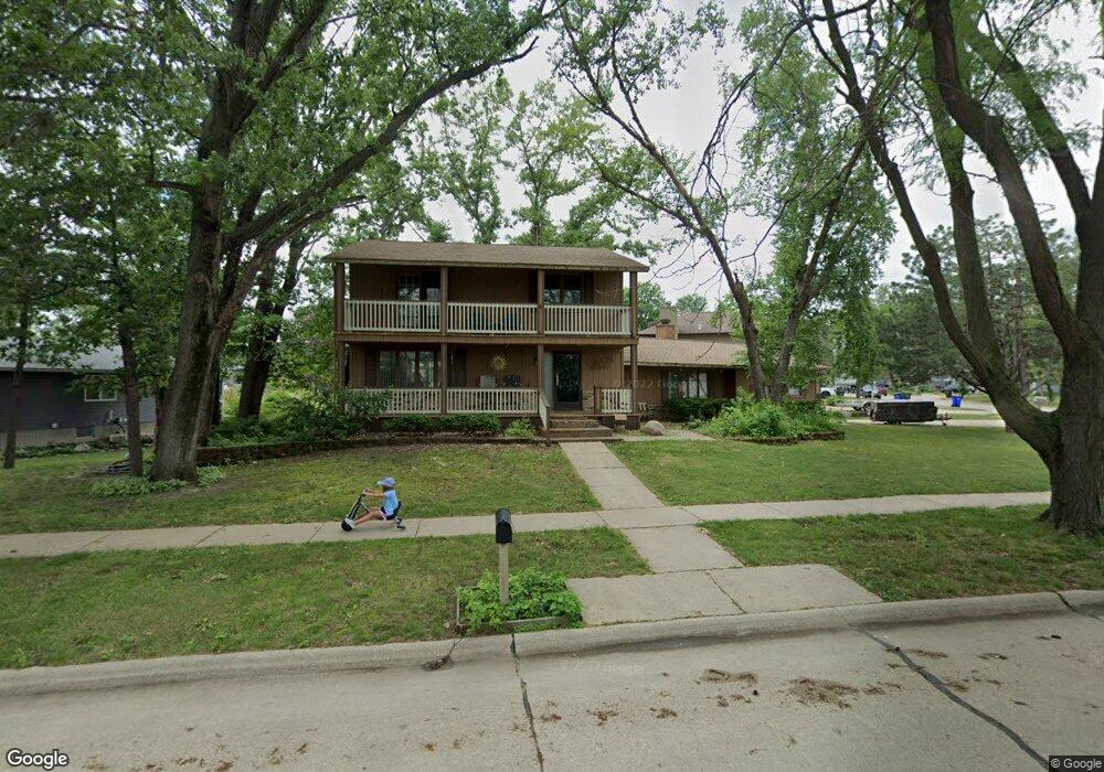
2183 David Ct NE Cedar Rapids, IA 52402
Estimated Value: $272,933 - $292,000
4
Beds
3
Baths
2,144
Sq Ft
$132/Sq Ft
Est. Value
About This Home
This home is located at 2183 David Ct NE, Cedar Rapids, IA 52402 and is currently estimated at $283,983, approximately $132 per square foot. 2183 David Ct NE is a home located in Linn County with nearby schools including Pierce Elementary School, Franklin Middle School, and John F. Kennedy High School.
Ownership History
Date
Name
Owned For
Owner Type
Purchase Details
Closed on
Nov 3, 1998
Sold by
Murchison Shannon M and Murchison Wanda K
Bought by
Bading Mark F and Bading Lynette J
Current Estimated Value
Home Financials for this Owner
Home Financials are based on the most recent Mortgage that was taken out on this home.
Original Mortgage
$105,000
Outstanding Balance
$20,892
Interest Rate
6.68%
Estimated Equity
$263,091
Create a Home Valuation Report for This Property
The Home Valuation Report is an in-depth analysis detailing your home's value as well as a comparison with similar homes in the area
Purchase History
| Date | Buyer | Sale Price | Title Company |
|---|---|---|---|
| Bading Mark F | $144,500 | -- |
Source: Public Records
Mortgage History
| Date | Status | Borrower | Loan Amount |
|---|---|---|---|
| Open | Bading Mark F | $105,000 |
Source: Public Records
Tax History
| Year | Tax Paid | Tax Assessment Tax Assessment Total Assessment is a certain percentage of the fair market value that is determined by local assessors to be the total taxable value of land and additions on the property. | Land | Improvement |
|---|---|---|---|---|
| 2025 | $4,006 | $259,500 | $52,600 | $206,900 |
| 2024 | $4,392 | $244,900 | $52,600 | $192,300 |
| 2023 | $4,392 | $236,800 | $48,500 | $188,300 |
| 2022 | $3,936 | $217,100 | $48,500 | $168,600 |
| 2021 | $4,122 | $199,000 | $40,400 | $158,600 |
| 2020 | $4,122 | $195,400 | $40,400 | $155,000 |
| 2019 | $3,710 | $180,600 | $38,400 | $142,200 |
| 2018 | $3,602 | $180,600 | $38,400 | $142,200 |
| 2017 | $3,734 | $180,000 | $38,400 | $141,600 |
| 2016 | $3,709 | $174,500 | $38,400 | $136,100 |
| 2015 | $4,081 | $191,836 | $32,340 | $159,496 |
| 2014 | $3,896 | $191,836 | $32,340 | $159,496 |
| 2013 | $3,808 | $191,836 | $32,340 | $159,496 |
Source: Public Records
Map
Nearby Homes
- 4656 Northwood Dr NE
- 4642 Aspen Ln NE
- 2106 42nd St NE
- 2058 42nd St NE
- 4700 Wenig Rd NE
- 2602 Towne House Dr NE
- 3800 Redbud Rd NE
- 4460 Westchester Dr NE Unit C
- 4610 Westchester Dr NE Unit D
- 1006 Messina Dr NE
- 1138 Messina Dr NE
- 4761 Westchester Dr NE Unit C
- 4545 Westchester Dr NE Unit D
- 4436 Rushmore Dr NE
- 2603 Falcon Dr NE
- 5455 Blairs Ferry Rd NE
- 4509 Benton St NE
- 3538 Elmwood Ct NE
- 1639 Miami Dr NE
- 302 6th Ave
- 2189 David Ct NE
- 4515 Lorcardo Dr NE
- 2195 David Ct NE
- 4509 Lorcardo Dr NE
- 4512 Fairlane Ct NE
- 2180 David Ct NE
- 2184 David Ct NE
- 4506 Fairlane Ct NE
- 4620 Janet Place NE
- 2201 David Ct NE
- 4503 Lorcardo Dr NE
- 4518 Fairlane Ct NE
- 4500 Lorcardo Dr NE
- 4630 Janet Place NE
- 4815 Fairlane Ct NE
- 2211 David Ct NE
- 2202 David Ct NE
- 4417 Lorcardo Dr NE
- 4502 Fairlane Dr NE
- 4500 Fairlane Dr NE
Your Personal Tour Guide
Ask me questions while you tour the home.