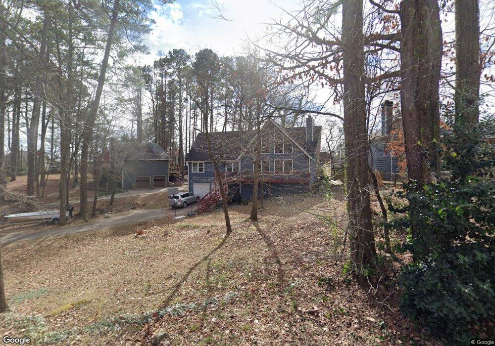
2185 Forest Dr Unit IV Cumming, GA 30041
Estimated Value: $398,000 - $436,000
3
Beds
2
Baths
1,566
Sq Ft
$264/Sq Ft
Est. Value
About This Home
This home is located at 2185 Forest Dr Unit IV, Cumming, GA 30041 and is currently estimated at $413,303, approximately $263 per square foot. 2185 Forest Dr Unit IV is a home located in Forsyth County with nearby schools including Mashburn Elementary School, Lakeside Middle School, and Forsyth Central High School.
Ownership History
Date
Name
Owned For
Owner Type
Purchase Details
Closed on
Jun 21, 2019
Sold by
Ward Michael D
Bought by
Colcord Jacob
Current Estimated Value
Home Financials for this Owner
Home Financials are based on the most recent Mortgage that was taken out on this home.
Original Mortgage
$226,816
Outstanding Balance
$201,954
Interest Rate
4.75%
Mortgage Type
FHA
Estimated Equity
$211,349
Purchase Details
Closed on
Dec 31, 1996
Sold by
Smith Marty Debra
Bought by
Ward Michael Fern
Create a Home Valuation Report for This Property
The Home Valuation Report is an in-depth analysis detailing your home's value as well as a comparison with similar homes in the area
Home Values in the Area
Average Home Value in this Area
Purchase History
| Date | Buyer | Sale Price | Title Company |
|---|---|---|---|
| Colcord Jacob | $231,000 | -- | |
| Ward Michael Fern | $115,000 | -- |
Source: Public Records
Mortgage History
| Date | Status | Borrower | Loan Amount |
|---|---|---|---|
| Open | Colcord Jacob | $226,816 | |
| Closed | Ward Michael Fern | $0 |
Source: Public Records
Tax History Compared to Growth
Tax History
| Year | Tax Paid | Tax Assessment Tax Assessment Total Assessment is a certain percentage of the fair market value that is determined by local assessors to be the total taxable value of land and additions on the property. | Land | Improvement |
|---|---|---|---|---|
| 2025 | $3,956 | $158,688 | $58,000 | $100,688 |
| 2024 | $3,956 | $161,324 | $54,000 | $107,324 |
| 2023 | $3,680 | $149,516 | $40,000 | $109,516 |
| 2022 | $3,072 | $102,160 | $24,000 | $78,160 |
| 2021 | $2,821 | $102,160 | $24,000 | $78,160 |
| 2020 | $2,413 | $87,380 | $16,000 | $71,380 |
| 2019 | $2,030 | $82,316 | $18,000 | $64,316 |
| 2018 | $1,773 | $69,616 | $18,000 | $51,616 |
| 2017 | $1,663 | $59,916 | $18,000 | $41,916 |
| 2016 | $1,607 | $57,916 | $16,000 | $41,916 |
| 2015 | $1,499 | $53,916 | $12,000 | $41,916 |
| 2014 | $1,337 | $50,496 | $0 | $0 |
Source: Public Records
Map
Nearby Homes
- 2205 Forest Dr
- LOT 51 Brook Valley Dr
- LOT 50 Brook Valley Dr
- LOT 48 Brook Valley Dr
- LOT 52 Brook Valley Dr
- LOT 47 Brook Valley Dr
- LOT 54 Brook Valley Dr
- 2765 Port Bow Ln
- 2420 Wanda Woods Rd
- 2650 Merry Rd
- 1950 Buford Dam Rd Unit 202
- 1950 Buford Dam Rd Unit 801
- 1820 Ridge Rd
- 2840 Waverly Walk Point
- 3235 Southshore Ct
- 2575 Maple Park Place
- 2935 Hamilton Rd Unit IV
- 2340 Manor Pointe Dr
- 2215 Manor Pointe Dr
- 2300 Habersham Marina Rd Unit 103
- 2155 Forest Dr
- 2135 Forest Dr
- 4615 Forest Dr
- 0 Forest Dr Unit 7099455
- 0 Forest Dr Unit 7431171
- 0 Forest Dr Unit 8758998
- 0 Forest Dr Unit 8058644
- 0 Forest Dr Unit 8610309
- 2215 Forest Dr
- 2065 Buford Dam Rd
- 2180 Forest Dr
- 2055 Buford Dam Rd
- 2170 Forest Dr
- 2210 Forest Dr
- 2200 Forest Dr
- 2225 Forest Dr Unit Gaa037
- 2225 Forest Dr
- 2225 Forest Dr Unit GAA0376
- 2160 Forest Dr
- 2045 Buford Dam Rd