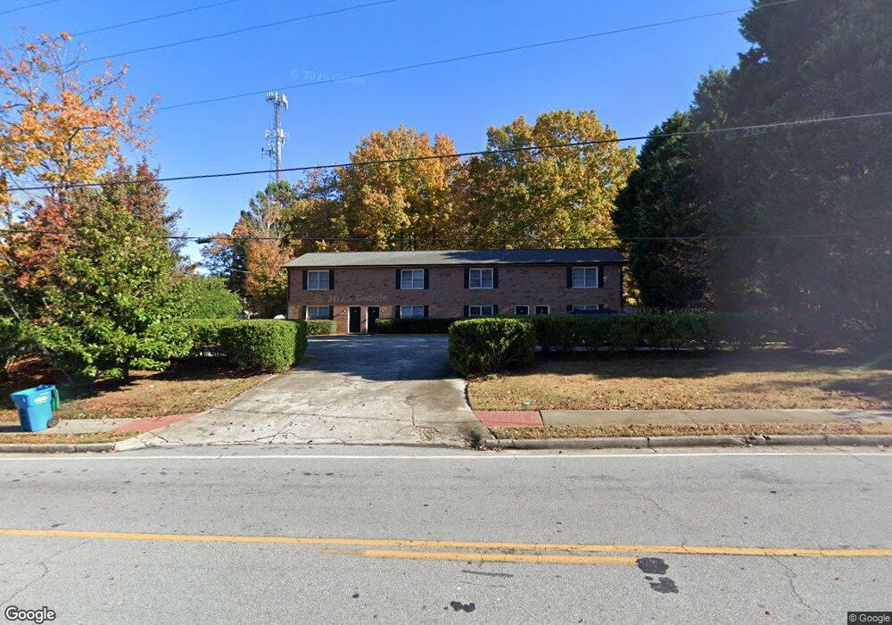
2186 Highpoint Rd Snellville, GA 30078
Estimated Value: $404,607 - $847,000
8
Beds
6
Baths
4,960
Sq Ft
$141/Sq Ft
Est. Value
About This Home
This home is located at 2186 Highpoint Rd, Snellville, GA 30078 and is currently estimated at $698,402, approximately $140 per square foot. 2186 Highpoint Rd is a home located in Gwinnett County with nearby schools including Norton Elementary School, Snellville Middle School, and South Gwinnett High School.
Ownership History
Date
Name
Owned For
Owner Type
Purchase Details
Closed on
Apr 27, 2020
Sold by
Machczynski Patricia V
Bought by
2186 Highpoint Llc
Current Estimated Value
Home Financials for this Owner
Home Financials are based on the most recent Mortgage that was taken out on this home.
Original Mortgage
$217,500
Interest Rate
3.5%
Mortgage Type
Commercial
Purchase Details
Closed on
Nov 14, 2019
Sold by
Machcznski William Henry Estate
Bought by
Machczynski Patricia V
Create a Home Valuation Report for This Property
The Home Valuation Report is an in-depth analysis detailing your home's value as well as a comparison with similar homes in the area
Home Values in the Area
Average Home Value in this Area
Purchase History
| Date | Buyer | Sale Price | Title Company |
|---|---|---|---|
| 2186 Highpoint Llc | $250,000 | -- | |
| Machczynski Patricia V | -- | -- |
Source: Public Records
Mortgage History
| Date | Status | Borrower | Loan Amount |
|---|---|---|---|
| Closed | 2186 Highpoint Llc | $217,500 |
Source: Public Records
Tax History Compared to Growth
Tax History
| Year | Tax Paid | Tax Assessment Tax Assessment Total Assessment is a certain percentage of the fair market value that is determined by local assessors to be the total taxable value of land and additions on the property. | Land | Improvement |
|---|---|---|---|---|
| 2025 | $7,984 | $200,000 | $57,320 | $142,680 |
| 2024 | $7,668 | $222,080 | $57,320 | $164,760 |
| 2023 | $7,668 | $188,800 | $66,000 | $122,800 |
| 2022 | $3,140 | $188,800 | $66,000 | $122,800 |
| 2021 | $4,419 | $100,000 | $29,280 | $70,720 |
| 2020 | $4,515 | $141,040 | $29,280 | $111,760 |
| 2019 | $4,515 | $118,960 | $28,000 | $90,960 |
| 2018 | $4,515 | $118,960 | $28,000 | $90,960 |
| 2016 | $3,586 | $92,000 | $28,000 | $64,000 |
| 2015 | $3,629 | $92,000 | $28,000 | $64,000 |
| 2014 | $3,649 | $92,000 | $28,000 | $64,000 |
Source: Public Records
Map
Nearby Homes
- 2930 Spruce Cir
- 2325 Thackery Rd
- 2296 Thackery Rd
- 3487 Desoto Rd
- 2034 Britt Dr
- 2312 Westridge Dr
- 2500 Rosedale Rd Unit I
- 3265 Brownwood Dr
- 1916 Oakwood Grove Dr Unit 1
- 3430 Park Glenn Ln
- 2167 Foley Park St
- 2286 Foley Park St
- 0 Cambridge St Unit 7681233
- 2563 Creek Terrace
- 2292 Cambridge St
- 2101 Bankston Cir
- 1904 Britt Dr
- 2430 Bankston Cir
- 2404 Jacks View Ct Unit 2
- 2459 Jacks View Ct
- 2196 Highpoint Rd
- 3127 Sloping Terrace Unit 1
- 3137 Sloping Terrace
- 2202 Highpoint Rd
- 3181 Highpoint Ct
- 2206 Highpoint Rd
- 3117 Sloping Terrace
- 2175 Highpoint Rd Unit B
- 2175 Highpoint Rd Unit A
- 2175 Highpoint Rd
- 3157 Sloping Terrace
- 3192 Highpoint Ct
- 3125 Sloping Terrace Unit 3125
- 3195 Highpoint Ct
- 3174 Sloping Terrace
- 3191 Highpoint Ct
- 3177 Sloping Terrace
- 2231 Highpoint Rd
- 2211 Highpoint Rd
- 3159 Highpoint Ct