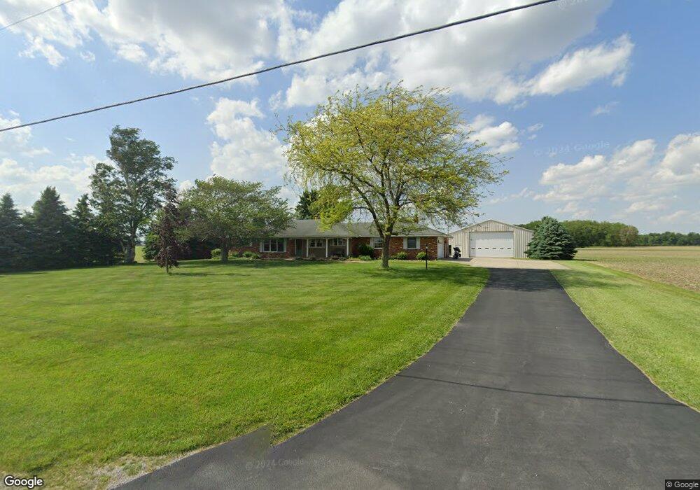
2186 W McGormley Rd Fremont, OH 43420
Estimated Value: $348,686 - $403,000
4
Beds
3
Baths
2,340
Sq Ft
$159/Sq Ft
Est. Value
About This Home
This home is located at 2186 W McGormley Rd, Fremont, OH 43420 and is currently estimated at $372,672, approximately $159 per square foot. 2186 W McGormley Rd is a home located in Sandusky County with nearby schools including Fremont Ross High School.
Ownership History
Date
Name
Owned For
Owner Type
Purchase Details
Closed on
Jan 23, 2008
Sold by
Shifflette Jacqueline L
Bought by
Pfeiffer Russell E and The Pfeiffer Family Trust
Current Estimated Value
Home Financials for this Owner
Home Financials are based on the most recent Mortgage that was taken out on this home.
Original Mortgage
$514,724
Interest Rate
6.2%
Mortgage Type
Purchase Money Mortgage
Purchase Details
Closed on
Jul 10, 2003
Sold by
Pfeiffer Russell E and Pfeiffer Susan S
Bought by
Pfeiffer Russell E and Pfeiffer Susan S
Purchase Details
Closed on
Aug 30, 2000
Sold by
Burmeister Mary J
Bought by
Pfeiffer Susan S and Pfeiffer Russell E
Home Financials for this Owner
Home Financials are based on the most recent Mortgage that was taken out on this home.
Original Mortgage
$25,000
Interest Rate
11.5%
Mortgage Type
New Conventional
Create a Home Valuation Report for This Property
The Home Valuation Report is an in-depth analysis detailing your home's value as well as a comparison with similar homes in the area
Home Values in the Area
Average Home Value in this Area
Purchase History
| Date | Buyer | Sale Price | Title Company |
|---|---|---|---|
| Pfeiffer Russell E | $82,500 | None Available | |
| Pfeiffer Russell E | -- | -- | |
| Pfeiffer Susan S | $222,500 | -- |
Source: Public Records
Mortgage History
| Date | Status | Borrower | Loan Amount |
|---|---|---|---|
| Closed | Pfeiffer Russell E | $514,724 | |
| Previous Owner | Pfeiffer Susan S | $25,000 |
Source: Public Records
Tax History Compared to Growth
Tax History
| Year | Tax Paid | Tax Assessment Tax Assessment Total Assessment is a certain percentage of the fair market value that is determined by local assessors to be the total taxable value of land and additions on the property. | Land | Improvement |
|---|---|---|---|---|
| 2024 | $4,176 | $106,930 | $14,210 | $92,720 |
| 2023 | $4,176 | $86,940 | $11,550 | $75,390 |
| 2022 | $3,627 | $86,940 | $11,550 | $75,390 |
| 2021 | $3,736 | $86,940 | $11,550 | $75,390 |
| 2020 | $3,532 | $80,540 | $11,170 | $69,370 |
| 2019 | $3,529 | $80,540 | $11,170 | $69,370 |
| 2018 | $3,434 | $80,540 | $11,170 | $69,370 |
| 2017 | $3,258 | $75,990 | $11,170 | $64,820 |
| 2016 | $2,857 | $75,990 | $11,170 | $64,820 |
| 2015 | $2,812 | $75,990 | $11,170 | $64,820 |
| 2014 | $2,800 | $72,660 | $10,570 | $62,090 |
| 2013 | $2,741 | $72,660 | $10,570 | $62,090 |
Source: Public Records
Map
Nearby Homes
- 855 Rambo Ln
- 43 Sun Valley Dr Unit 43
- 350 Conner Dr
- 1970 Morrison Rd
- 1818 Finley Dr
- 41 Brookview Dr
- 1832 Myrtle St
- 2484 Buckland Ave
- 10 Meadowbrook Dr
- 10 Meadowbrook Ln
- 1826 Morrison Rd
- 135 Briarwood Cir
- 64 River Run Dr Unit J
- 64 River Run Dr
- 18 Katlyn Dr
- 933 E Cole Rd
- 1719 Buckland Ave
- 822 Upton Rd
- 2020 Elm Dr
- 1485 Autumn Woods Dr
- 2735 Baker Rd
- 2920 Morrison Rd
- 1803 W McGormley Rd
- 2975 Morrison Rd
- 2630 Baker Rd
- 2829 Darr Rd
- 2827 Morrison Rd
- 3085 Darr Rd
- 2916 Darr Rd
- 2994 Darr Rd
- 2972 Darr Rd
- 3119 Darr Rd
- 2508 Baker Rd
- 3064 Darr Rd
- 2444 Baker Rd
- 1527 W McGormley Rd
- 1516 W McGormley Rd
- 1521 W McGormley Rd
- 0 County Road 214 Unit 401308
- 2440 Baker Rd