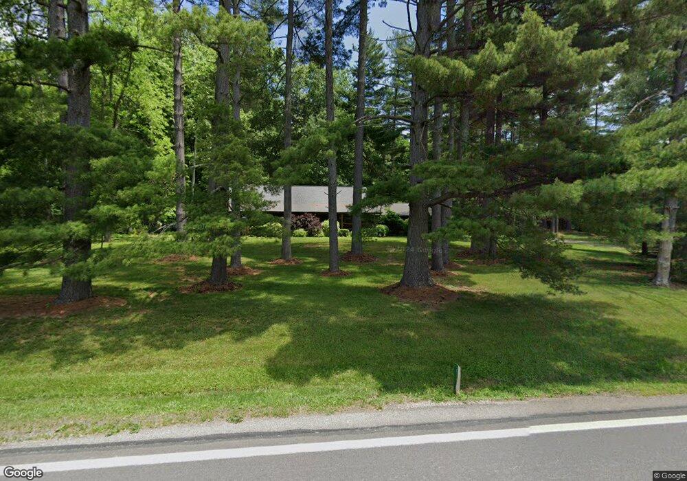
2188 State Route 41 Bainbridge, OH 45612
Estimated Value: $197,000 - $404,079
3
Beds
1
Bath
1,728
Sq Ft
$155/Sq Ft
Est. Value
About This Home
This home is located at 2188 State Route 41, Bainbridge, OH 45612 and is currently estimated at $268,693, approximately $155 per square foot. 2188 State Route 41 is a home located in Ross County with nearby schools including Paint Valley Elementary School, Paint Valley Middle School, and Paint Valley High School.
Ownership History
Date
Name
Owned For
Owner Type
Purchase Details
Closed on
Oct 12, 2021
Sold by
Ione Powell Kathleen
Bought by
Powell Dean A
Current Estimated Value
Purchase Details
Closed on
May 17, 2006
Sold by
Free John O
Bought by
Powell Dean A and Powell Kathleen I
Home Financials for this Owner
Home Financials are based on the most recent Mortgage that was taken out on this home.
Original Mortgage
$160,000
Interest Rate
6.54%
Mortgage Type
Purchase Money Mortgage
Create a Home Valuation Report for This Property
The Home Valuation Report is an in-depth analysis detailing your home's value as well as a comparison with similar homes in the area
Home Values in the Area
Average Home Value in this Area
Purchase History
| Date | Buyer | Sale Price | Title Company |
|---|---|---|---|
| Powell Dean A | -- | -- | |
| Powell Dean A | $200,000 | Title First |
Source: Public Records
Mortgage History
| Date | Status | Borrower | Loan Amount |
|---|---|---|---|
| Previous Owner | Powell Dean A | $160,000 |
Source: Public Records
Tax History Compared to Growth
Tax History
| Year | Tax Paid | Tax Assessment Tax Assessment Total Assessment is a certain percentage of the fair market value that is determined by local assessors to be the total taxable value of land and additions on the property. | Land | Improvement |
|---|---|---|---|---|
| 2024 | $3,198 | $90,040 | $11,770 | $78,270 |
| 2023 | $3,198 | $88,770 | $10,780 | $77,990 |
| 2022 | $3,216 | $88,770 | $10,780 | $77,990 |
| 2021 | $3,043 | $77,870 | $10,330 | $67,540 |
| 2020 | $3,042 | $77,870 | $10,330 | $67,540 |
| 2019 | $3,098 | $77,870 | $10,330 | $67,540 |
| 2018 | $2,777 | $67,550 | $10,220 | $57,330 |
| 2017 | $2,783 | $67,550 | $10,220 | $57,330 |
| 2016 | $2,717 | $67,550 | $10,220 | $57,330 |
| 2015 | $2,656 | $67,550 | $10,220 | $57,330 |
| 2014 | $2,510 | $67,550 | $10,220 | $57,330 |
| 2013 | $2,552 | $77,410 | $10,220 | $67,190 |
Source: Public Records
Map
Nearby Homes
- 316 S Maple St
- 201 N Maple St
- 301 N Maple St
- 2780 Potts Hill Rd
- 2780 Potts Hill Rd Unit (Tract 4 at Potts Hi
- 213 S Benner Hill Rd
- 0 Schmidt Rd
- 1540 Cove Run Rd
- 942 N Benner Hill Rd
- 2470 Tong Hollow Rd
- 4999 Auerville Rd
- 4511 Potts Hill Rd
- 7724 Cave Rd
- 14703 Brier Rd
- 0 Potts Hill Rd Unit 225030231
- 2466 Pike Lake Rd
- 4945 Upper Twin Rd
- 0 Upper Twin Rd Unit 5159777
- 0 Upper Twin Rd Unit 225036418
- 0 Green Ridge Rd Unit 198065
- 579 Sr 41 Hwy
- 2156 State Route 41 S
- 2090 State Route 41 S
- 2313 State Route 41
- 2053 State Route 41 S
- 2053 State Route 41 S
- 2011 State Route 41
- 2001 State Route 41 S
- 2000 State Route 41 S
- 2730 State Route 41 S
- 2758 St Rt 41
- 3504 Us Rt 50
- 3504 U S 50
- 2758 U S 50
- 3590 U S 50
- 3656 Us Highway 50 W
- 5889 Jester Hill Rd
- 3714 Us Highway 50 W
- 11.39ac Jester Hill Rd
- 6043 Jester Hill Rd