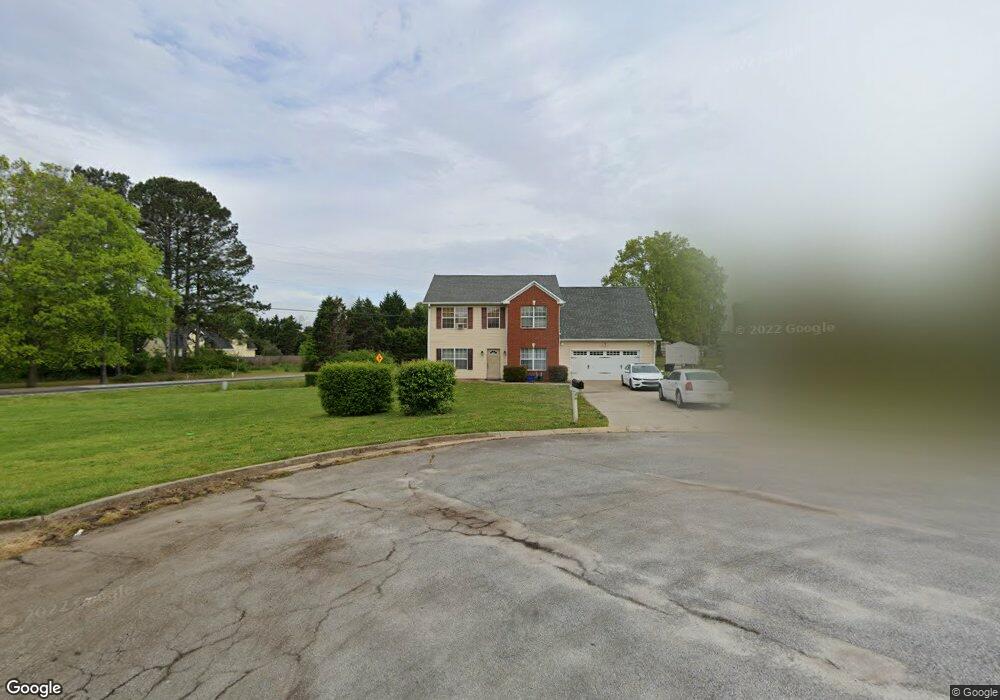
219 Angie Way Unit 2 Bethlehem, GA 30620
Estimated Value: $334,283 - $407,000
3
Beds
3
Baths
2,364
Sq Ft
$160/Sq Ft
Est. Value
About This Home
This home is located at 219 Angie Way Unit 2, Bethlehem, GA 30620 and is currently estimated at $378,571, approximately $160 per square foot. 219 Angie Way Unit 2 is a home located in Barrow County with nearby schools including Yargo Elementary School, Haymon-Morris Middle School, and Apalachee High School.
Ownership History
Date
Name
Owned For
Owner Type
Purchase Details
Closed on
Oct 29, 1998
Sold by
D C M Builders Inc
Bought by
Walker-Cook Donnette and Walker-Cook Terr
Current Estimated Value
Home Financials for this Owner
Home Financials are based on the most recent Mortgage that was taken out on this home.
Original Mortgage
$118,047
Outstanding Balance
$25,812
Interest Rate
6.61%
Mortgage Type
FHA
Estimated Equity
$352,759
Purchase Details
Closed on
Mar 19, 1998
Sold by
C G S Development In
Bought by
D C M Builders Inc
Purchase Details
Closed on
Jul 9, 1996
Bought by
C G S Development In
Create a Home Valuation Report for This Property
The Home Valuation Report is an in-depth analysis detailing your home's value as well as a comparison with similar homes in the area
Home Values in the Area
Average Home Value in this Area
Purchase History
| Date | Buyer | Sale Price | Title Company |
|---|---|---|---|
| Walker-Cook Donnette | $121,000 | -- | |
| D C M Builders Inc | $190,000 | -- | |
| C G S Development In | -- | -- |
Source: Public Records
Mortgage History
| Date | Status | Borrower | Loan Amount |
|---|---|---|---|
| Open | Walker-Cook Donnette | $118,047 |
Source: Public Records
Tax History Compared to Growth
Tax History
| Year | Tax Paid | Tax Assessment Tax Assessment Total Assessment is a certain percentage of the fair market value that is determined by local assessors to be the total taxable value of land and additions on the property. | Land | Improvement |
|---|---|---|---|---|
| 2024 | $2,774 | $113,641 | $26,800 | $86,841 |
| 2023 | $3,187 | $114,041 | $26,800 | $87,241 |
| 2022 | $2,769 | $98,608 | $22,400 | $76,208 |
| 2021 | $2,733 | $92,208 | $16,000 | $76,208 |
| 2020 | $2,190 | $73,910 | $16,000 | $57,910 |
| 2019 | $2,227 | $73,910 | $16,000 | $57,910 |
| 2018 | $2,116 | $71,110 | $13,200 | $57,910 |
| 2017 | $1,813 | $62,276 | $13,200 | $49,076 |
| 2016 | $1,515 | $52,425 | $13,200 | $39,225 |
| 2015 | $1,536 | $52,881 | $13,200 | $39,681 |
| 2014 | $1,361 | $46,606 | $6,468 | $40,138 |
| 2013 | -- | $43,678 | $6,468 | $37,210 |
Source: Public Records
Map
Nearby Homes
- 209 Angie Way
- 303 Ron Dr
- 1111 Otis Dr
- 1129 Loganville Hwy
- 1024 Lyndhurst Ln
- 1164 Otis Dr
- 758 Clarence Edwards Rd
- 738 Worth Ct
- 720 Westbury Ct
- 0 Jb Owens Unit 7552902
- 0 Jb Owens Unit 7552891
- 0 Jb Owens Unit LOT 2 - 2.09 ACRES
- 0 Jb Owens Unit LOT 3 - 2.01 ACRES
- 724 Westbury Dr
- 704 Newnham Walk
- The Barnes Plan at River Meadows
- The Paisley Plan at River Meadows
- The Rose II Plan at River Meadows
- The Logan Plan at River Meadows
- 190 Lokeys Ln
- 217 Angie Way
- 217 Angie Way Unit 1
- 218 Angie Way Unit 2
- 215 Angie Way
- 776 Bethel Bower Rd
- 216 Angie Way Unit 2
- 216 Angie Way
- 1102 Loganville Hwy
- 214 Angie Way
- 157 Cole Cir Unit 1
- 213 Angie Way Unit 2
- 0 Hwy 81 and Bethel Church Rd Unit 7526920
- 0 Bethel Church Rd and Hwy 81 Unit 7207569
- 212 Angie Way
- 319 Ron Dr
- 317 Ron Dr Unit 2
- 211 Angie Way Unit 2
- 152 Cole Cir
- 315 Ron Dr Unit 2