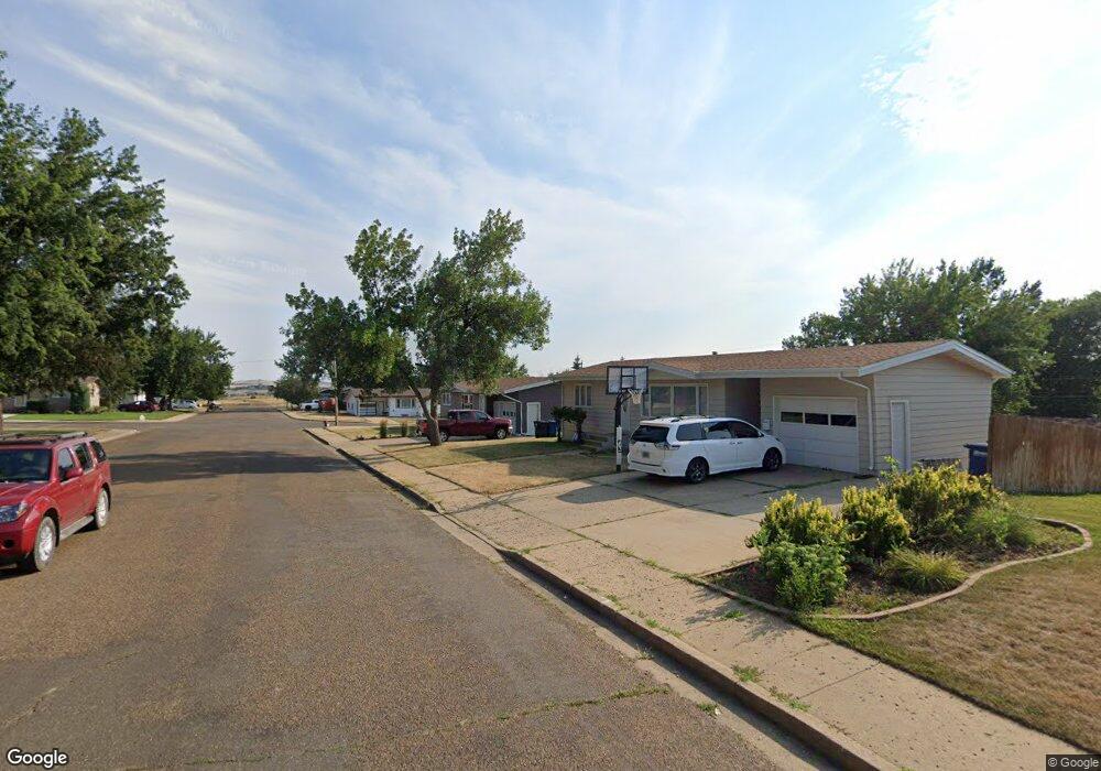
219 Baker Ave Dickinson, ND 58601
Estimated Value: $216,718 - $298,000
3
Beds
2
Baths
864
Sq Ft
$280/Sq Ft
Est. Value
About This Home
This home is located at 219 Baker Ave, Dickinson, ND 58601 and is currently estimated at $242,180, approximately $280 per square foot. 219 Baker Ave is a home located in Stark County with nearby schools including Trinity Elementary School West, Trinity Elementary School East, and St. Joseph School.
Ownership History
Date
Name
Owned For
Owner Type
Purchase Details
Closed on
Jun 1, 2021
Sold by
Murphy Cathy and Estate Of Caroline Connell
Bought by
Venture Commercial Llc
Current Estimated Value
Home Financials for this Owner
Home Financials are based on the most recent Mortgage that was taken out on this home.
Original Mortgage
$120,000
Outstanding Balance
$8,552
Interest Rate
2.9%
Mortgage Type
Commercial
Estimated Equity
$233,628
Create a Home Valuation Report for This Property
The Home Valuation Report is an in-depth analysis detailing your home's value as well as a comparison with similar homes in the area
Home Values in the Area
Average Home Value in this Area
Purchase History
| Date | Buyer | Sale Price | Title Company |
|---|---|---|---|
| Venture Commercial Llc | $155,000 | North Dakota Guaranty & Ttl |
Source: Public Records
Mortgage History
| Date | Status | Borrower | Loan Amount |
|---|---|---|---|
| Open | Venture Commercial Llc | $120,000 |
Source: Public Records
Tax History
| Year | Tax Paid | Tax Assessment Tax Assessment Total Assessment is a certain percentage of the fair market value that is determined by local assessors to be the total taxable value of land and additions on the property. | Land | Improvement |
|---|---|---|---|---|
| 2025 | $2,022 | $163,900 | $24,600 | $139,300 |
| 2024 | $1,987 | $163,900 | $24,600 | $139,300 |
| 2023 | $1,617 | $163,900 | $24,600 | $139,300 |
| 2022 | $1,530 | $76,900 | $0 | $0 |
| 2021 | $474 | $146,100 | $24,600 | $121,500 |
| 2020 | $220 | $146,100 | $24,600 | $121,500 |
| 2019 | $221 | $146,100 | $24,600 | $121,500 |
| 2017 | $1,131 | $152,700 | $24,600 | $128,100 |
| 2015 | $1,131 | $169,200 | $23,300 | $145,900 |
| 2014 | $1,577 | $166,800 | $23,300 | $143,500 |
| 2013 | -- | $161,000 | $23,300 | $137,700 |
Source: Public Records
Map
Nearby Homes
- 1163 Lincoln St
- 390 Baker Ave
- 209 15th Ave E
- 1161 6th St E
- 618 16th Ave E
- 1377 8th St E
- 0 14th Ave E Unit 25-201
- 0 14th Ave E Unit 24-492
- 0 9th St E
- 0 7th Ave E
- 881 Mustang Ave
- 759 8th Ave E
- 0 17 65 Acres
- 930 Shinagle Dr
- 858 Elm Ave
- 302 6th Ave E
- 625 8th St E
- 986 Mustang Ave
- 541 2nd St E
- 977 Shinagle Dr
- 230 Baker Ave
- 1149 Carroll St
- 243 Baker Ave
- 1128 Carroll St
- 1115 Carroll St
- 242 Baker Ave
- 1150 Carroll St
- 230 Adams Ave
- 240 Adams Ave
- 1101 Carroll St
- 255 Baker Ave
- 197 Baker Ave
- 254 Baker Ave
- 1106 Carroll St
- 250 Adams Ave
- 261 Suncrest Ave
- 198 Baker Ave
- 1086 Carroll St
- 1096 Carroll St
- 1169 Carroll St
Your Personal Tour Guide
Ask me questions while you tour the home.