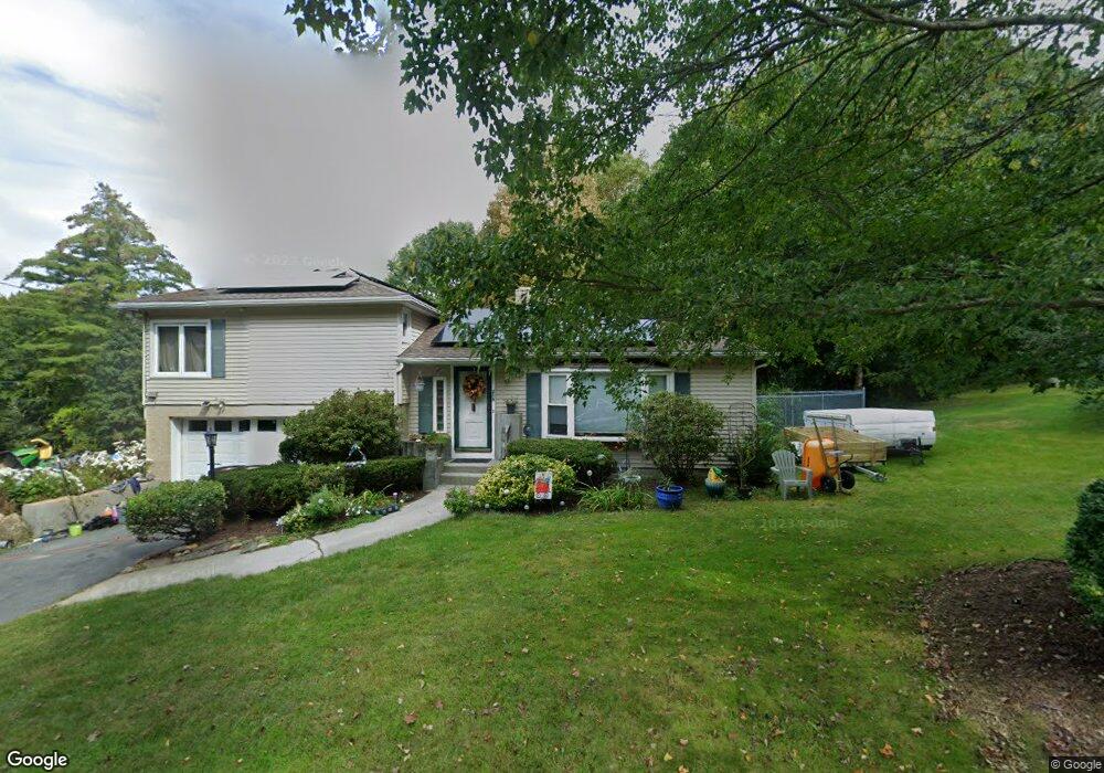
219 East Rd West Brookfield, MA 01585
Estimated Value: $302,000 - $362,000
2
Beds
1
Bath
1,600
Sq Ft
$201/Sq Ft
Est. Value
About This Home
This home is located at 219 East Rd, West Brookfield, MA 01585 and is currently estimated at $321,030, approximately $200 per square foot. 219 East Rd is a home with nearby schools including Quaboag Regional High School.
Ownership History
Date
Name
Owned For
Owner Type
Purchase Details
Closed on
Mar 10, 2020
Sold by
Thompson Joyce A
Bought by
Dube Jonathan E
Current Estimated Value
Home Financials for this Owner
Home Financials are based on the most recent Mortgage that was taken out on this home.
Original Mortgage
$10,350
Outstanding Balance
$7,116
Interest Rate
3.2%
Mortgage Type
Second Mortgage Made To Cover Down Payment
Estimated Equity
$313,914
Purchase Details
Closed on
Oct 24, 1974
Bought by
Thompson Walter E and Thompson Joyce
Create a Home Valuation Report for This Property
The Home Valuation Report is an in-depth analysis detailing your home's value as well as a comparison with similar homes in the area
Home Values in the Area
Average Home Value in this Area
Purchase History
| Date | Buyer | Sale Price | Title Company |
|---|---|---|---|
| Dube Jonathan E | $207,000 | None Available | |
| Thompson Walter E | -- | -- |
Source: Public Records
Mortgage History
| Date | Status | Borrower | Loan Amount |
|---|---|---|---|
| Open | Dube Jonathan E | $10,350 | |
| Previous Owner | Thompson Walter E | $25,000 |
Source: Public Records
Tax History Compared to Growth
Tax History
| Year | Tax Paid | Tax Assessment Tax Assessment Total Assessment is a certain percentage of the fair market value that is determined by local assessors to be the total taxable value of land and additions on the property. | Land | Improvement |
|---|---|---|---|---|
| 2025 | $3,445 | $232,600 | $54,500 | $178,100 |
| 2024 | $3,505 | $232,600 | $54,500 | $178,100 |
| 2023 | $3,444 | $218,000 | $54,500 | $163,500 |
| 2022 | $2,846 | $182,900 | $44,800 | $138,100 |
| 2021 | $2,791 | $174,900 | $42,400 | $132,500 |
| 2020 | $2,646 | $154,200 | $42,400 | $111,800 |
| 2019 | $2,668 | $147,000 | $42,400 | $104,600 |
| 2018 | $2,427 | $140,100 | $42,400 | $97,700 |
| 2017 | $2,528 | $136,200 | $44,000 | $92,200 |
| 2016 | $2,589 | $130,500 | $42,000 | $88,500 |
| 2015 | $2,348 | $125,200 | $42,000 | $83,200 |
| 2014 | $2,431 | $127,300 | $42,000 | $85,300 |
Source: Public Records
Map
Nearby Homes
- 152 Southbridge Rd Unit 3D
- 29 Liberty St
- 124 Southbridge Rd
- Lot 8 Southbridge Rd
- LOT 7 Southbridge Rd
- 58 Nelson St
- 366 Southbridge Rd
- 82 Comins Pond Rd
- Lot 4 Brimfield Rd
- 35 Bacon St
- 72 Maple St
- 17 Otis St
- 59 High St
- 170 Bridge St
- Lot 5 Brimfield Rd
- Lot 3 Brimfield Rd
- Lot 4 Reed St
- Lot 7 Reed St
- 0 Town Farm Rd
- 940 Old West Brookfield Rd