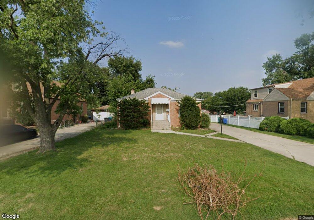
219 High Ridge Rd Hillside, IL 60162
Estimated Value: $251,000 - $284,000
2
Beds
1
Bath
863
Sq Ft
$311/Sq Ft
Est. Value
About This Home
This home is located at 219 High Ridge Rd, Hillside, IL 60162 and is currently estimated at $268,605, approximately $311 per square foot. 219 High Ridge Rd is a home located in Cook County with nearby schools including Hillside Elementary School and Proviso West High School.
Ownership History
Date
Name
Owned For
Owner Type
Purchase Details
Closed on
Jun 23, 2022
Sold by
Singh Gurpiar
Bought by
Singh Gurpiar
Current Estimated Value
Purchase Details
Closed on
Nov 18, 2005
Sold by
Larosa Marlene
Bought by
Singh Gurpiar and Singh Alka
Home Financials for this Owner
Home Financials are based on the most recent Mortgage that was taken out on this home.
Original Mortgage
$160,000
Interest Rate
6.17%
Mortgage Type
Fannie Mae Freddie Mac
Create a Home Valuation Report for This Property
The Home Valuation Report is an in-depth analysis detailing your home's value as well as a comparison with similar homes in the area
Home Values in the Area
Average Home Value in this Area
Purchase History
| Date | Buyer | Sale Price | Title Company |
|---|---|---|---|
| Singh Gurpiar | -- | None Listed On Document | |
| Singh Gurpiar | $200,000 | Greater Illinois Title |
Source: Public Records
Mortgage History
| Date | Status | Borrower | Loan Amount |
|---|---|---|---|
| Previous Owner | Singh Gurpiar | $160,000 |
Source: Public Records
Tax History
| Year | Tax Paid | Tax Assessment Tax Assessment Total Assessment is a certain percentage of the fair market value that is determined by local assessors to be the total taxable value of land and additions on the property. | Land | Improvement |
|---|---|---|---|---|
| 2025 | $6,036 | $20,165 | $4,484 | $15,681 |
| 2024 | $6,036 | $20,165 | $4,484 | $15,681 |
| 2023 | $4,984 | $20,165 | $4,484 | $15,681 |
| 2022 | $4,984 | $16,054 | $3,057 | $12,997 |
| 2021 | $4,914 | $16,054 | $3,057 | $12,997 |
| 2020 | $5,570 | $17,946 | $3,057 | $14,889 |
| 2019 | $2,901 | $10,663 | $2,853 | $7,810 |
| 2018 | $2,816 | $10,663 | $2,853 | $7,810 |
| 2017 | $3,730 | $13,337 | $2,853 | $10,484 |
| 2016 | $3,078 | $10,545 | $2,649 | $7,896 |
| 2015 | $2,932 | $10,545 | $2,649 | $7,896 |
| 2014 | $2,877 | $10,545 | $2,649 | $7,896 |
| 2013 | $3,220 | $12,392 | $2,649 | $9,743 |
Source: Public Records
Map
Nearby Homes
- 311 Buckthorn Ln
- 326 N Forest Ave
- 70 N Laverne Ave
- 500 N Laverne Ave
- 226 N Lind Ave
- 605 N Wolf Rd Unit B9
- 4353 Butterfield Rd
- 250 N Irving Ave
- 512 50th Ave
- 504 N Irving Ave
- 540 47th Ave
- 768 N Rohde Ave
- 4904 W Hawthorne Ave
- 4938 W Randolph St
- 4929 W Randolph St
- 429 Geneva Ave
- 443 Granville Ave
- 11011 W Roosevelt Rd
- 1529 N Hillside Ave
- 1426 N Rohde Ave
- 223 High Ridge Rd
- 4655 N Jackson Blvd
- 227 High Ridge Rd
- 230 Clayton Ave
- 234 Clayton Ave
- 226 Clayton Ave
- 238 Clayton Ave
- 233 High Ridge Rd
- 242 Clayton Ave
- 237 High Ridge Rd
- 218 High Ridge Rd
- 222 High Ridge Rd
- 214 High Ridge Rd
- 246 Clayton Ave
- 246 Clayton Rd
- 226 High Ridge Rd
- 4701 N Jackson Blvd
- 230 High Ridge Rd
- 241 High Ridge Rd
- 250 Clayton Ave
Your Personal Tour Guide
Ask me questions while you tour the home.