Estimated Value: $604,000 - $708,326
4
Beds
3
Baths
2,192
Sq Ft
$297/Sq Ft
Est. Value
About This Home
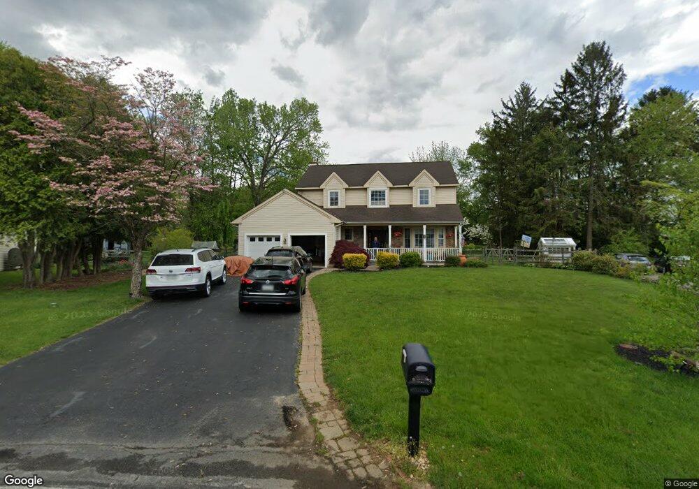
This home is located at 219 Locust Ln, Exton, PA 19341 and is currently estimated at $650,332, approximately $296 per square foot. 219 Locust Ln is a home located in Chester County with nearby schools including Exton Elementary School, J.R. Fugett Middle School, and West Chester East High School.
Ownership History
Date
Name
Owned For
Owner Type
Purchase Details
Closed on
Jul 15, 1997
Sold by
Ken Crest Centers
Bought by
Mazza Enrico A and Mazza Katherine A
Current Estimated Value
Home Financials for this Owner
Home Financials are based on the most recent Mortgage that was taken out on this home.
Original Mortgage
$149,200
Outstanding Balance
$21,932
Interest Rate
7.79%
Estimated Equity
$628,400
Purchase Details
Closed on
May 15, 1984
Sold by
Moorhead Robert M and Moorhead Janice L
Bought by
Ken Crest Centers
Create a Home Valuation Report for This Property
The Home Valuation Report is an in-depth analysis detailing your home's value as well as a comparison with similar homes in the area
Home Values in the Area
Average Home Value in this Area
Purchase History
| Date | Buyer | Sale Price | Title Company |
|---|---|---|---|
| Mazza Enrico A | $43,500 | -- | |
| Ken Crest Centers | $73,500 | -- |
Source: Public Records
Mortgage History
| Date | Status | Borrower | Loan Amount |
|---|---|---|---|
| Open | Mazza Enrico A | $149,200 |
Source: Public Records
Tax History
| Year | Tax Paid | Tax Assessment Tax Assessment Total Assessment is a certain percentage of the fair market value that is determined by local assessors to be the total taxable value of land and additions on the property. | Land | Improvement |
|---|---|---|---|---|
| 2025 | $6,030 | $208,010 | $44,560 | $163,450 |
| 2024 | $6,030 | $208,010 | $44,560 | $163,450 |
| 2023 | $5,762 | $208,010 | $44,560 | $163,450 |
| 2022 | $5,684 | $208,010 | $44,560 | $163,450 |
| 2021 | $5,601 | $208,010 | $44,560 | $163,450 |
| 2020 | $5,563 | $208,010 | $44,560 | $163,450 |
| 2019 | $5,483 | $208,010 | $44,560 | $163,450 |
| 2018 | $5,361 | $208,010 | $44,560 | $163,450 |
| 2017 | $5,239 | $208,010 | $44,560 | $163,450 |
| 2016 | $4,505 | $208,010 | $44,560 | $163,450 |
| 2015 | $4,505 | $208,010 | $44,560 | $163,450 |
| 2014 | $4,505 | $208,010 | $44,560 | $163,450 |
Source: Public Records
Map
Nearby Homes
- 300 Bell Ct
- 167 Brazier Ln
- 226 Red Leaf Ln
- 218 Hendricks Ave
- 377 Lynetree Dr Unit 5A
- 108 Mountain View Dr
- 608 Brainerd Place
- 596 Coach Hill Ct Unit C
- 603 Coach Hill Ct Unit B
- 431 Lynetree Dr
- 1 Timber Mill Ln Unit SARTO
- 1406 Timber Mill Ln
- 5 Timber Mill Ln Unit BISCOTTO
- 3 Timber Mill Ln Unit SILENZIO
- 2 Timber Mill Ln Unit SERENO
- 261 Watch Hill Rd
- 521 Astor Square Unit 45
- 839 Durant Ct Unit 21
- 431 Carmarthen Ct
- 143 Birchwood Dr
- 217 Locust Ln
- 221 Locust Ln
- 516 E Swedesford Rd
- 514 E Swedesford Rd
- 518 E Swedesford Rd
- 512 E Swedesford Rd
- 215 Locust Ln
- 223 Locust Ln
- 216 Locust Ln
- 225 Locust Ln
- 600 E Swedesford Rd
- 516 Brookview Rd
- 213 Locust Ln
- 521 Heather Rd
- 222 Locust Ln
- 224 Locust Ln
- 514 Brookview Rd
- 519 Heather Rd
- 211 Locust Ln
- 510 E Swedesford Rd
Your Personal Tour Guide
Ask me questions while you tour the home.