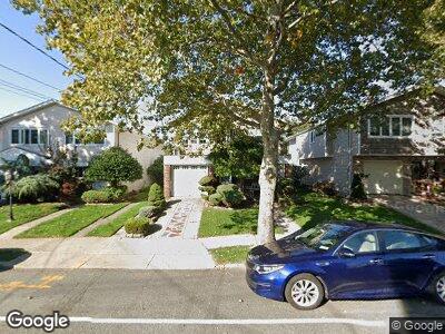
219 Merrill Ave Staten Island, NY 10314
Bulls Head NeighborhoodEstimated Value: $848,602 - $946,000
--
Bed
--
Bath
1,996
Sq Ft
$448/Sq Ft
Est. Value
About This Home
This home is located at 219 Merrill Ave, Staten Island, NY 10314 and is currently estimated at $893,401, approximately $447 per square foot. 219 Merrill Ave is a home located in Richmond County with nearby schools including P.S. 060 Alice Austen School, Is 72 Rocco Laurie, and Port Richmond High School.
Ownership History
Date
Name
Owned For
Owner Type
Purchase Details
Closed on
Aug 16, 2017
Sold by
Birnbaum Murray and Birnbaum Florence
Bought by
Mangnotti Susan and Theodorou Donna
Current Estimated Value
Purchase Details
Closed on
Jun 6, 2015
Sold by
Birnbaum Florence
Bought by
Birnbaum Murray and Birnbaum Florence
Purchase Details
Closed on
Mar 3, 2005
Sold by
Birnbaum Murray and Birnbaum Florence
Bought by
Birnbaum Florence
Create a Home Valuation Report for This Property
The Home Valuation Report is an in-depth analysis detailing your home's value as well as a comparison with similar homes in the area
Home Values in the Area
Average Home Value in this Area
Purchase History
| Date | Buyer | Sale Price | Title Company |
|---|---|---|---|
| Mangnotti Susan | -- | None Available | |
| Birnbaum Murray | -- | Safe Harbor Title | |
| Birnbaum Florence | -- | Lawyers Title Ins |
Source: Public Records
Mortgage History
| Date | Status | Borrower | Loan Amount |
|---|---|---|---|
| Previous Owner | Birnbaum Florence | $75,000 |
Source: Public Records
Tax History Compared to Growth
Tax History
| Year | Tax Paid | Tax Assessment Tax Assessment Total Assessment is a certain percentage of the fair market value that is determined by local assessors to be the total taxable value of land and additions on the property. | Land | Improvement |
|---|---|---|---|---|
| 2024 | $3,430 | $52,320 | $11,398 | $40,922 |
| 2023 | $7,286 | $42,001 | $10,664 | $31,337 |
| 2022 | $6,912 | $54,360 | $13,680 | $40,680 |
| 2021 | $7,047 | $46,260 | $13,680 | $32,580 |
| 2020 | $5,001 | $45,300 | $13,680 | $31,620 |
| 2019 | $4,500 | $44,340 | $13,680 | $30,660 |
| 2018 | $5,889 | $35,001 | $11,616 | $23,385 |
| 2017 | $5,925 | $34,006 | $13,508 | $20,498 |
| 2016 | $6,271 | $33,120 | $13,680 | $19,440 |
| 2015 | $4,873 | $31,920 | $11,400 | $20,520 |
| 2014 | $4,873 | $30,273 | $10,812 | $19,461 |
Source: Public Records
Map
Nearby Homes
- 219 Merrill Ave
- 215 Merrill Ave
- 223 Merrill Ave
- 211 Merrill Ave
- 227 Merrill Ave
- 79 Commerce St
- 83 Commerce St
- 75 Commerce St
- 87 Commerce St
- 231 Merrill Ave
- 207 Merrill Ave
- 71 Commerce St
- 91 Commerce St
- 95 Commerce St
- 203 Merrill Ave
- 235 Merrill Ave
- 69 Commerce St
- 216 Merrill Ave
- 220 Merrill Ave
- 99 Commerce St