Estimated Value: $291,124 - $347,000
3
Beds
3
Baths
2,141
Sq Ft
$143/Sq Ft
Est. Value
About This Home
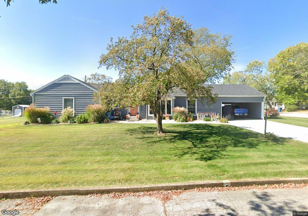
This home is located at 219 N Locust St, Eldon, MI 65026 and is currently estimated at $307,031, approximately $143 per square foot. 219 N Locust St is a home located in Miller County with nearby schools including South Elementary School, Eldon Upper Elementary School, and Eldon Middle School.
Ownership History
Date
Name
Owned For
Owner Type
Purchase Details
Closed on
Apr 15, 2020
Sold by
Renken Jill A
Bought by
Allen Jason S and Allen Stacy D
Current Estimated Value
Home Financials for this Owner
Home Financials are based on the most recent Mortgage that was taken out on this home.
Original Mortgage
$199,750
Outstanding Balance
$175,885
Interest Rate
3.2%
Mortgage Type
New Conventional
Estimated Equity
$131,146
Purchase Details
Closed on
Apr 16, 2014
Sold by
Baucom Jeanne
Bought by
Renken David K and Renken Jill A
Home Financials for this Owner
Home Financials are based on the most recent Mortgage that was taken out on this home.
Original Mortgage
$89,165
Interest Rate
4.34%
Mortgage Type
Future Advance Clause Open End Mortgage
Create a Home Valuation Report for This Property
The Home Valuation Report is an in-depth analysis detailing your home's value as well as a comparison with similar homes in the area
Home Values in the Area
Average Home Value in this Area
Purchase History
| Date | Buyer | Sale Price | Title Company |
|---|---|---|---|
| Allen Jason S | -- | None Available | |
| Renken David K | -- | None Available |
Source: Public Records
Mortgage History
| Date | Status | Borrower | Loan Amount |
|---|---|---|---|
| Open | Allen Jason S | $199,750 | |
| Previous Owner | Renken David K | $89,165 |
Source: Public Records
Tax History
| Year | Tax Paid | Tax Assessment Tax Assessment Total Assessment is a certain percentage of the fair market value that is determined by local assessors to be the total taxable value of land and additions on the property. | Land | Improvement |
|---|---|---|---|---|
| 2025 | $1,239 | $28,600 | $3,100 | $25,500 |
| 2024 | $1,138 | $25,050 | $2,800 | $22,250 |
| 2023 | $1,137 | $25,050 | $2,800 | $22,250 |
| 2022 | $1,138 | $25,050 | $2,800 | $22,250 |
| 2021 | $1,138 | $25,050 | $2,800 | $22,250 |
| 2020 | $1,059 | $23,080 | $2,800 | $20,280 |
| 2019 | $775 | $16,860 | $2,800 | $14,060 |
| 2018 | $806 | $16,860 | $2,800 | $14,060 |
| 2017 | $787 | $17,830 | $2,640 | $15,190 |
| 2016 | $794 | $17,830 | $0 | $0 |
| 2015 | -- | $17,830 | $0 | $0 |
| 2012 | -- | $17,440 | $0 | $0 |
Source: Public Records
Map
Nearby Homes
- 110 W Autry St
- 502 N Vernon Dr
- 130 S Grand Ave
- 509 Sunset Strip
- Lot 5 W Bourbon St
- Lot 7 W Bourbon St
- Lot 9 W Bourbon St
- Lot 6 W Bourbon St
- Lot 10 W Bourbon St
- 406 N Mill St
- 406 S Godfrey Ave
- 207 Franklin Ave
- 508 E Harrison St
- 204 W Jemphrey Rd
- 414 W 6th St
- 502 W 6th St
- 807 Rollotrend Ln
- 807 W Rollotrend Ln
- 612 E High St
- 405 S Dunstan Dr
- 219 N Locust St
- 209 N Locust St
- 208 N Grand Ave
- 222 N Locust St
- 222 N Locust St
- 204 N Grand Ave
- 307 W Newton St
- 208 N Locust St
- 309 W Newton St
- 305 W Newton St
- 309 W Newton St
- 311 W Newton St
- 317 W High St
- 307 W High St
- 319 W High St
- 211 Olive St
- 207 N Grand Ave
- 312 Shelton St
- 310 Shelton St
- 205 N Grand Ave
Your Personal Tour Guide
Ask me questions while you tour the home.