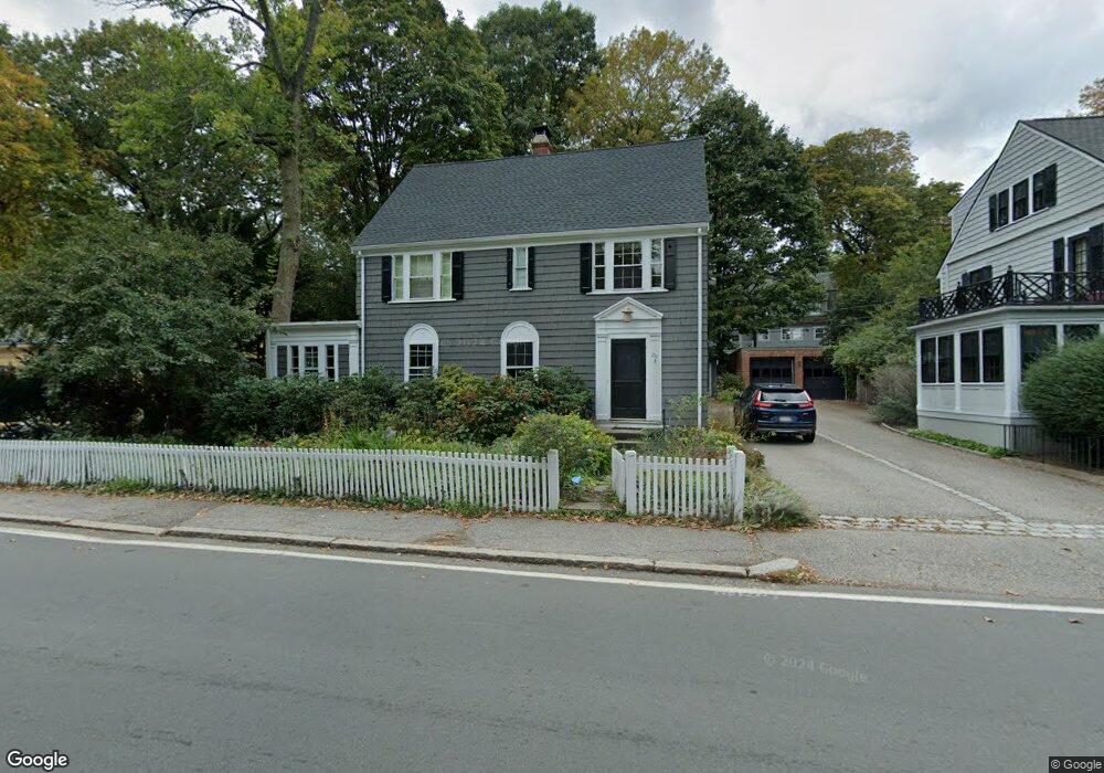
219 Pond Ave Brookline, MA 02445
Brookline Village NeighborhoodEstimated Value: $2,221,177 - $2,645,000
5
Beds
4
Baths
2,277
Sq Ft
$1,084/Sq Ft
Est. Value
About This Home
This home is located at 219 Pond Ave, Brookline, MA 02445 and is currently estimated at $2,468,294, approximately $1,084 per square foot. 219 Pond Ave is a home located in Norfolk County with nearby schools including William H. Lincoln School, St. Mary of the Assumption Elementary School, and Maimonides School.
Ownership History
Date
Name
Owned For
Owner Type
Purchase Details
Closed on
Feb 29, 2024
Sold by
Deangelo Edward J and Conrad Miriam
Bought by
James Deangelo Lt and Deangelo
Current Estimated Value
Purchase Details
Closed on
Sep 12, 2000
Sold by
Schechter Ruth E
Bought by
Deangelo Edward J
Home Financials for this Owner
Home Financials are based on the most recent Mortgage that was taken out on this home.
Original Mortgage
$360,000
Interest Rate
8.1%
Mortgage Type
Purchase Money Mortgage
Purchase Details
Closed on
May 19, 1993
Sold by
Mcardle Ann
Bought by
Rubinow Ruth S
Create a Home Valuation Report for This Property
The Home Valuation Report is an in-depth analysis detailing your home's value as well as a comparison with similar homes in the area
Home Values in the Area
Average Home Value in this Area
Purchase History
| Date | Buyer | Sale Price | Title Company |
|---|---|---|---|
| James Deangelo Lt | -- | None Available | |
| Deangelo Edward J | $658,000 | -- | |
| Rubinow Ruth S | $347,500 | -- |
Source: Public Records
Mortgage History
| Date | Status | Borrower | Loan Amount |
|---|---|---|---|
| Previous Owner | Rubinow Ruth S | $305,000 | |
| Previous Owner | Rubinow Ruth S | $360,000 | |
| Previous Owner | Rubinow Ruth S | $170,000 | |
| Previous Owner | Rubinow Ruth S | $10,000 |
Source: Public Records
Tax History Compared to Growth
Tax History
| Year | Tax Paid | Tax Assessment Tax Assessment Total Assessment is a certain percentage of the fair market value that is determined by local assessors to be the total taxable value of land and additions on the property. | Land | Improvement |
|---|---|---|---|---|
| 2025 | $19,831 | $2,009,200 | $1,415,100 | $594,100 |
| 2024 | $18,888 | $1,933,300 | $1,360,700 | $572,600 |
| 2023 | $16,521 | $1,657,100 | $1,055,200 | $601,900 |
| 2022 | $16,080 | $1,578,000 | $1,004,800 | $573,200 |
| 2021 | $14,870 | $1,517,300 | $966,200 | $551,100 |
| 2020 | $13,434 | $1,421,600 | $878,400 | $543,200 |
| 2019 | $12,686 | $1,353,900 | $836,600 | $517,300 |
| 2018 | $11,939 | $1,262,000 | $753,500 | $508,500 |
| 2017 | $11,764 | $1,190,700 | $711,000 | $479,700 |
| 2016 | $11,494 | $1,103,100 | $664,500 | $438,600 |
| 2015 | $11,010 | $1,030,900 | $621,000 | $409,900 |
| 2014 | $10,869 | $954,300 | $564,500 | $389,800 |
Source: Public Records
Map
Nearby Homes
- 99 Pond Ave Unit 608
- 81 Glen Rd Unit S2
- 60 Glen Rd Unit 101
- 36 Allerton St
- 77 Pond Ave Unit 1103
- 77 Pond Ave Unit 1506
- 33 Pond Ave Unit 422
- 33 Pond Ave Unit 709
- 33 Pond Ave Unit 523
- 33 Pond Ave Unit 919
- 47 Highland Rd
- 6 Juniper St Unit 16
- 44 Washington St Unit 501
- 70 Jamaicaway Unit 16
- 50 Jamaicaway Unit 1
- 90 Bynner St Unit 7
- 20 Rice St Unit 2
- 390 Riverway Unit 6
- 39 Kent St Unit B
- 105 Franklin St Unit 1