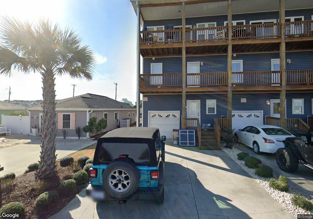
219 W Terminal Blvd Unit C Atlantic Beach, NC 28512
Estimated Value: $604,511 - $770,000
2
Beds
5
Baths
2,362
Sq Ft
$289/Sq Ft
Est. Value
About This Home
This home is located at 219 W Terminal Blvd Unit C, Atlantic Beach, NC 28512 and is currently estimated at $682,628, approximately $289 per square foot. 219 W Terminal Blvd Unit C is a home located in Carteret County with nearby schools including Morehead City Primary School, Morehead Elementary School at Camp Glenn, and Morehead City Middle School.
Ownership History
Date
Name
Owned For
Owner Type
Purchase Details
Closed on
Feb 26, 2010
Sold by
Tyson James M and Tyson Susan B
Bought by
Mcintosh Thomas C and Mcintosh Melonie R
Current Estimated Value
Home Financials for this Owner
Home Financials are based on the most recent Mortgage that was taken out on this home.
Original Mortgage
$338,320
Outstanding Balance
$224,455
Interest Rate
5%
Mortgage Type
New Conventional
Estimated Equity
$458,173
Create a Home Valuation Report for This Property
The Home Valuation Report is an in-depth analysis detailing your home's value as well as a comparison with similar homes in the area
Home Values in the Area
Average Home Value in this Area
Purchase History
| Date | Buyer | Sale Price | Title Company |
|---|---|---|---|
| Mcintosh Thomas C | $423,000 | None Available |
Source: Public Records
Mortgage History
| Date | Status | Borrower | Loan Amount |
|---|---|---|---|
| Open | Mcintosh Thomas C | $338,320 |
Source: Public Records
Tax History Compared to Growth
Tax History
| Year | Tax Paid | Tax Assessment Tax Assessment Total Assessment is a certain percentage of the fair market value that is determined by local assessors to be the total taxable value of land and additions on the property. | Land | Improvement |
|---|---|---|---|---|
| 2025 | $1,489 | $618,020 | $0 | $618,020 |
| 2024 | $1,220 | $330,000 | $0 | $330,000 |
| 2023 | $1,137 | $330,000 | $0 | $330,000 |
| 2022 | $1,104 | $330,000 | $0 | $330,000 |
| 2021 | $1,104 | $330,000 | $0 | $330,000 |
| 2020 | $1,104 | $330,000 | $0 | $330,000 |
| 2019 | $1,037 | $329,600 | $0 | $329,600 |
| 2017 | $1,037 | $329,600 | $0 | $329,600 |
| 2016 | $1,037 | $329,600 | $0 | $329,600 |
| 2015 | $1,004 | $329,600 | $0 | $329,600 |
| 2014 | $1,236 | $412,000 | $0 | $412,000 |
Source: Public Records
Map
Nearby Homes
- 209 W Terminal Blvd
- 108 N Kinston Ave
- 111 E Terminal Blvd
- 503 W Bogue Blvd
- 104 Atlantic Beach Causeway
- 208 Beaufort Ave Unit 1
- 121 Sound Dr
- 115 Bowen St
- 217 W Atlantic Blvd
- 119 Center Dr Unit 1
- 119 Center Dr Unit 3
- 602 Ft MacOn Rd W Unit 231
- 602 W Fort MacOn Rd Unit 109
- 602 Ft MacOn Rd W Unit 249
- 602 Fort MacOn Rd
- 602 W Fort MacOn Rd Unit 242
- 602 Ft MacOn Rd W Unit 148
- 602 Ft MacOn Rd W Unit 132
- 602 W Fort MacOn Rd Unit 135
- 602 W Fort MacOn Rd Unit 118
- 219 W Terminal Blvd Unit A
- 219 W Terminal Blvd Unit B
- 219 W Terminal Blvd
- 215 W Terminal Blvd
- 213 W Terminal Blvd
- 300 S Raleigh Ave
- 212-214 Atlantic W
- 218 W Terminal Blvd
- 302 S Raleigh Ave
- 220 W Atlantic Blvd Unit A
- 220 W Atlantic Blvd Unit B
- 220 W Atlantic Blvd Unit B
- 220 W Atlantic Blvd Unit C
- 220 W Atlantic Blvd Unit A
- 220 W Atlantic Blvd
- 220 W Atlantic Blvd Unit C
- 214 W Terminal Blvd
- 218 W Atlantic Blvd
- 300 W Terminal Blvd
- 216 W Atlantic Blvd