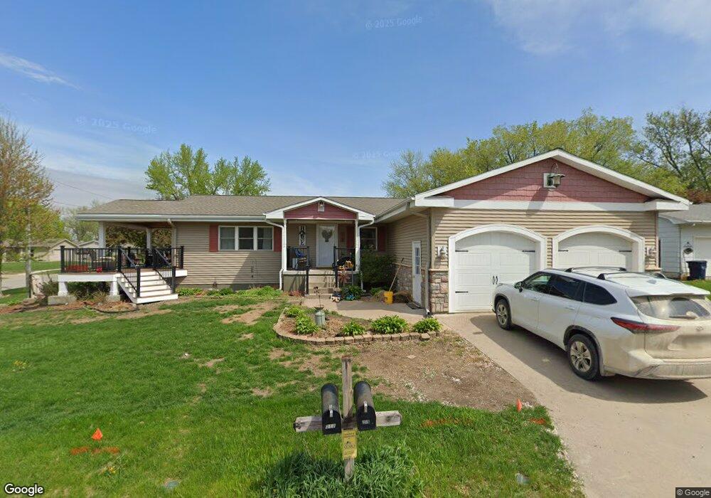
219 W Wate St Wilton, IA 52778
Estimated Value: $245,000 - $270,000
5
Beds
3
Baths
1,400
Sq Ft
$185/Sq Ft
Est. Value
About This Home
This home is located at 219 W Wate St, Wilton, IA 52778 and is currently estimated at $258,963, approximately $184 per square foot. 219 W Wate St is a home located in Muscatine County with nearby schools including Wilton Elementary School and Wilton Junior/Senior High School.
Ownership History
Date
Name
Owned For
Owner Type
Purchase Details
Closed on
Feb 7, 2014
Sold by
Howell Jolene R and Rice Jason D
Bought by
Rice Jason D and Rice Kerianne
Current Estimated Value
Home Financials for this Owner
Home Financials are based on the most recent Mortgage that was taken out on this home.
Original Mortgage
$130,400
Interest Rate
4.55%
Mortgage Type
New Conventional
Create a Home Valuation Report for This Property
The Home Valuation Report is an in-depth analysis detailing your home's value as well as a comparison with similar homes in the area
Home Values in the Area
Average Home Value in this Area
Purchase History
| Date | Buyer | Sale Price | Title Company |
|---|---|---|---|
| Rice Jason D | -- | None Available |
Source: Public Records
Mortgage History
| Date | Status | Borrower | Loan Amount |
|---|---|---|---|
| Closed | Rice Jason D | $130,400 |
Source: Public Records
Tax History Compared to Growth
Tax History
| Year | Tax Paid | Tax Assessment Tax Assessment Total Assessment is a certain percentage of the fair market value that is determined by local assessors to be the total taxable value of land and additions on the property. | Land | Improvement |
|---|---|---|---|---|
| 2025 | $4,440 | $260,860 | $29,790 | $231,070 |
| 2024 | $4,440 | $256,910 | $29,790 | $227,120 |
| 2023 | $4,256 | $258,216 | $29,807 | $228,409 |
| 2022 | $4,038 | $223,660 | $28,120 | $195,540 |
| 2021 | $4,038 | $205,060 | $28,120 | $176,940 |
| 2020 | $4,006 | $200,530 | $28,120 | $172,410 |
| 2019 | $3,992 | $183,140 | $0 | $0 |
| 2018 | $3,668 | $174,750 | $0 | $0 |
| 2017 | $3,668 | $174,720 | $0 | $0 |
| 2016 | $3,734 | $174,720 | $0 | $0 |
| 2015 | $3,734 | $169,570 | $0 | $0 |
| 2014 | $3,638 | $169,570 | $0 | $0 |
Source: Public Records
Map
Nearby Homes