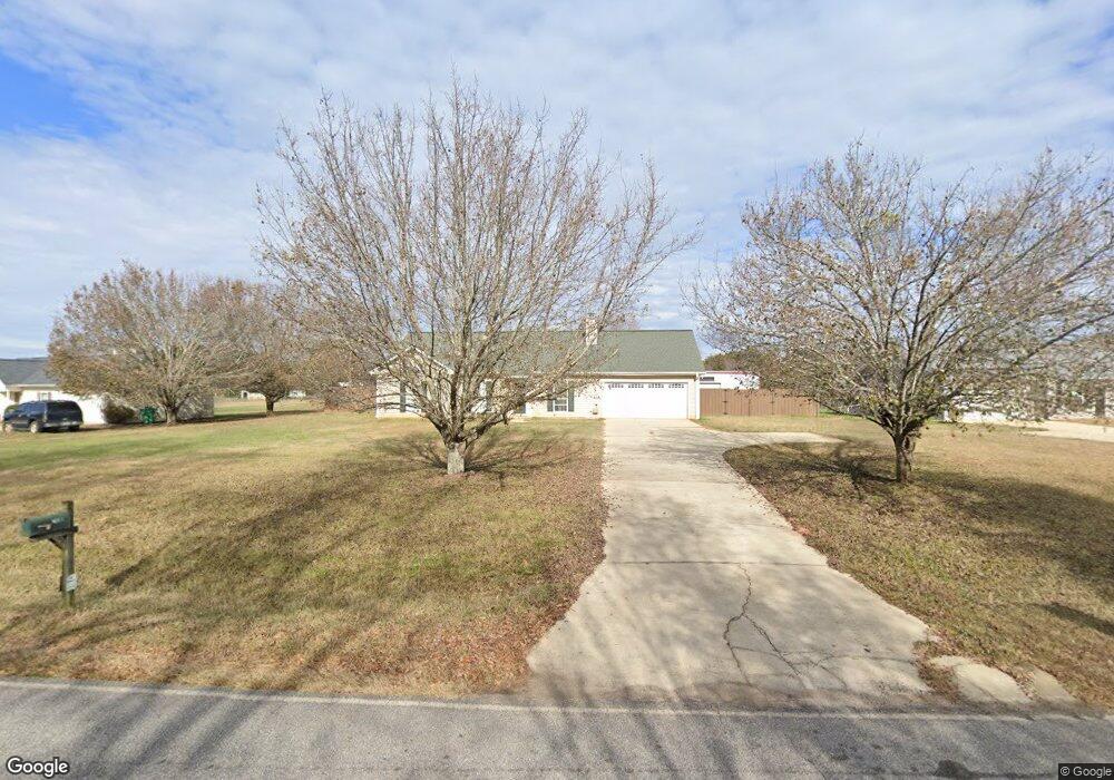
2190 Broad St Unit 1 Statham, GA 30666
Estimated Value: $296,000 - $316,000
--
Bed
2
Baths
1,500
Sq Ft
$205/Sq Ft
Est. Value
About This Home
This home is located at 2190 Broad St Unit 1, Statham, GA 30666 and is currently estimated at $307,451, approximately $204 per square foot. 2190 Broad St Unit 1 is a home located in Barrow County with nearby schools including Statham Elementary School, Bear Creek Middle School, and Winder-Barrow High School.
Ownership History
Date
Name
Owned For
Owner Type
Purchase Details
Closed on
Aug 26, 1997
Sold by
Hollifield J Eric and Smith William Scott
Bought by
Haynes Marion S
Current Estimated Value
Home Financials for this Owner
Home Financials are based on the most recent Mortgage that was taken out on this home.
Original Mortgage
$83,640
Outstanding Balance
$13,019
Interest Rate
7.52%
Mortgage Type
VA
Estimated Equity
$294,432
Purchase Details
Closed on
Feb 23, 1996
Bought by
W T'S Drywall Compan
Create a Home Valuation Report for This Property
The Home Valuation Report is an in-depth analysis detailing your home's value as well as a comparison with similar homes in the area
Home Values in the Area
Average Home Value in this Area
Purchase History
| Date | Buyer | Sale Price | Title Company |
|---|---|---|---|
| Haynes Marion S | $82,000 | -- | |
| W T'S Drywall Compan | -- | -- |
Source: Public Records
Mortgage History
| Date | Status | Borrower | Loan Amount |
|---|---|---|---|
| Open | Haynes Marion S | $83,640 |
Source: Public Records
Tax History Compared to Growth
Tax History
| Year | Tax Paid | Tax Assessment Tax Assessment Total Assessment is a certain percentage of the fair market value that is determined by local assessors to be the total taxable value of land and additions on the property. | Land | Improvement |
|---|---|---|---|---|
| 2024 | $2,424 | $96,191 | $22,000 | $74,191 |
| 2023 | $1,593 | $96,191 | $22,000 | $74,191 |
| 2022 | $1,883 | $76,092 | $18,600 | $57,492 |
| 2021 | $1,736 | $65,492 | $8,000 | $57,492 |
| 2020 | $1,147 | $40,118 | $8,000 | $32,118 |
| 2019 | $1,163 | $40,118 | $8,000 | $32,118 |
| 2018 | $1,156 | $40,118 | $8,000 | $32,118 |
| 2017 | $1,220 | $34,968 | $8,000 | $26,968 |
| 2016 | $988 | $35,292 | $8,000 | $27,292 |
| 2015 | $1,011 | $35,940 | $8,000 | $27,940 |
| 2014 | $893 | $33,752 | $5,488 | $28,264 |
| 2013 | -- | $32,404 | $5,488 | $26,916 |
Source: Public Records
Map
Nearby Homes
- 97 Defilippe Dr
- 163 Annie Ln
- 129 Purackal Ln
- 67 Defilippe Dr
- 227 Dove Field Dr Unit 84
- 247 Dove Field Dr Unit 83
- 267 Dove Field Dr Unit 82
- 287 Dove Field Dr Unit 81
- 305 Dove Field Dr Unit 80
- 1880 Oakley Trail
- 2540 Oakley Trail
- 2665 Oakley Trail
- 2671 Oakley Trail
- 2661 Oakley Trail
- 2641 Oakley Trail
- 50 Defilippe Dr
- 2194 Broad St
- 2186 Broad St
- 2198 Broad St
- 2182 Broad St Unit 1
- 531 Reynolds Ct
- 0 Reynolds Ct Unit 3187590
- 0 Reynolds Ct Unit 3141353
- 0 Reynolds Ct
- 529 Reynolds Ct
- 529 Reynolds Ct Unit 18
- 2204 Broad St
- 2176 Broad St Unit 1
- 527 Reynolds Ct Unit 2
- 2230 Glenn Jackson Rd Unit 1
- 2170 Broad St Unit 1
- 2170 Broad St
- 2213 Glenn Jackson Rd
- 2217 Glenn Jackson Rd
- 530 Reynolds Ct
- 2234 Glenn Jackson Rd